Tocht Stappen Eaux-Bonnes - La montagne verte - Aas - Photo
 tracegps
tracegps

Gebruiker

© OpenStreetMap contributors
Lengte
Lengte
11,4 km
Max. hoogte
Max. hoogte
1194 m
Positief hoogteverschil
595 m
Km-Effort
Km-Effort  
19,3 km
Min. hoogte
Min. hoogte
610 m
Negatief hoogteverschil
596 m
Boucle
Boucle
Ja
Datum van aanmaak :
2014-12-10 00:00:00.0
Laatste wijziging :
2014-12-10 00:00:00.0

(0 Bericht)

Stappen
Stappen
4h00
Moeilijkheid : Medium

Scan deze QR-code om de tocht te openen in de SityTrail-applicatie

Gratisgps-wandelapplicatie

Logo SityTrail SityTrail

IGN / Geografische instituten

SityTrail uit de App Store downloaden SityTrail uit Google Play downloaden

Logo SityTrail SityTrail World

De wereld gaat voor u open

SityTrail uit de App Store downloaden SityTrail uit Google Play downloaden SityTrail op Huawei AppGallery downloaden

Over ons

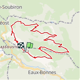
Tocht Stappen van 11,4 km beschikbaar op Nieuw-Aquitanië, Pyrénées-Atlantiques, Eaux-Bonnes. Deze tocht wordt voorgesteld door tracegps.

Beschrijving

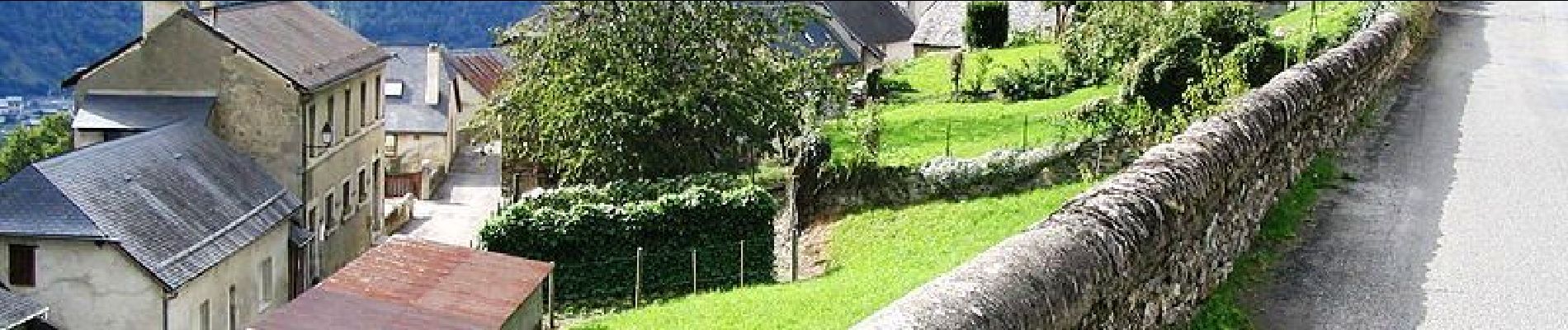
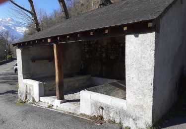
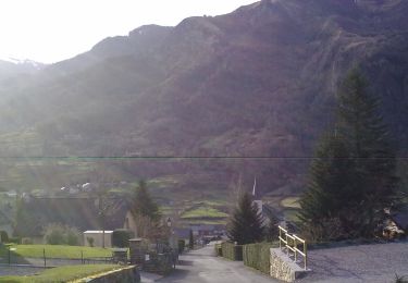
Cette superbe promenade vous offrira de larges panoramas sur les deux versants de la montagne verte (vallée du Valentin d´un côté, vallon du Canceigt de l´autre) et les massifs d´altitude. Vous traverserez les villages d´Aas et Bagès à l´architecture bien conservée, typique de la Vallée d´Ossau. Retrouvez d’autres informations et la fiche descriptive sur le site Pays Basque et Béarn.

Hoogteprofiel

Foto's

Plaatsbepaling

Land:
France
Regio :
Nieuw-Aquitanië
Departement/Provincie :
Pyrénées-Atlantiques
Gemeente :
Eaux-Bonnes
Locatie:
Unknown
Vertrek:(Dec)
Vertrek:(UTM)
711833 ; 4761973 (30T) N.

Wandeltochten in de omgeving

Tocht Stappen Béost - Behost - Photo
Stappen
swp648

Stappen

Gemakkelijk
(1)
Béost, Nieuw-Aquitanië, Pyrénées-Atlantiques, France
6 km | 9,9 km-effort
2h 59min
Ja
Tocht Stappen Laruns - LARUNS le tour du valentin G3
Stappen
GUIDE
marmotte65

Stappen

Moeilijk
Laruns, Nieuw-Aquitanië, Pyrénées-Atlantiques, France
9,1 km | 14,7 km-effort
3h 20min
Ja
Tocht Te voet Eaux-Bonnes - La promenade horizontale - Photo
Te voet
GUIDE+

Te voet

Gemakkelijk
Eaux-Bonnes, Nieuw-Aquitanië, Pyrénées-Atlantiques, France
3,5 km | 5,3 km-effort
1h 12min
Ja
Tocht Te voet Eaux-Bonnes - Les thermes - Photo
Te voet
GUIDE+

Te voet

Gemakkelijk
Eaux-Bonnes, Nieuw-Aquitanië, Pyrénées-Atlantiques, France
3,6 km | 5,9 km-effort
1h 20min
Ja
Tocht Te voet Laruns - L'eau - Photo
Te voet
GUIDE+

Te voet

Gemakkelijk
Laruns, Nieuw-Aquitanië, Pyrénées-Atlantiques, France
4,8 km | 5,9 km-effort
1h 20min
Ja
Tocht Te voet Eaux-Bonnes - La montagne verte - Photo
Te voet
GUIDE+

Te voet

Gemakkelijk
Eaux-Bonnes, Nieuw-Aquitanië, Pyrénées-Atlantiques, France
10,4 km | 17,8 km-effort
4h 2min
Ja
Tocht Te voet Louvie-Soubiron - Les carrières - Photo
Te voet
GUIDE+

Te voet

Gemakkelijk
Louvie-Soubiron, Nieuw-Aquitanië, Pyrénées-Atlantiques, France
3,4 km | 7 km-effort
1h 35min
Ja
Tocht Te voet Béost - La promenade des trois villages - Photo
Te voet
GUIDE+

Te voet

Gemakkelijk
Béost, Nieuw-Aquitanië, Pyrénées-Atlantiques, France
5,1 km | 8,6 km-effort
1h 56min
Ja
Tocht Te voet Gère-Bélesten - La fontaine d'Esteret - Photo
Te voet
GUIDE+

Te voet

Gemakkelijk
Gère-Bélesten, Nieuw-Aquitanië, Pyrénées-Atlantiques, France
3,7 km | 7,6 km-effort
1h 43min
Ja


Sluiten
Mijn abonnementen