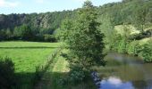

Boucle de Mesnil - Raoult

tracegps
Gebruiker

Lengte
9,1 km

Max. hoogte
95 m

Positief hoogteverschil
148 m

Km-Effort
11,1 km

Min. hoogte
23 m

Negatief hoogteverschil
148 m
Boucle
Ja
Datum van aanmaak :
2014-12-10 00:00:00.0
Laatste wijziging :
2014-12-10 00:00:00.0
1h00
Moeilijkheid : Medium

Gratisgps-wandelapplicatie
Over ons
Tocht Mountainbike van 9,1 km beschikbaar op Normandië, Manche, Condé-sur-Vire. Deze tocht wordt voorgesteld door tracegps.
Beschrijving
Circuit proposé par la Communauté de Communes de Tessy sur Vire. Départ de l’église de Le Mesnil-Raoult. Retrouvez le descriptif et les commentaires du circuit sur le site de la Communauté de Communes de Tessy sur Vire.
Plaatsbepaling
Land:
France
Regio :
Normandië
Departement/Provincie :
Manche
Gemeente :
Condé-sur-Vire
Locatie:
Le Mesnil-Raoult
Vertrek:(Dec)
Vertrek:(UTM)
641825 ; 5433177 (30U) N.
Opmerkingen
Wandeltochten in de omgeving
Le rocher de Ham


Stappen
Gemakkelijk
(1)
Condé-sur-Vire,
Normandië,
Manche,
France

10,9 km | 13,4 km-effort
2h 24min
Ja
Roches de ham


Stappen
Gemakkelijk
(1)
Condé-sur-Vire,
Normandië,
Manche,
France

11,1 km | 13,5 km-effort
2h 58min
Ja
Au coeur de la vallée de la Vire


Mountainbike
Moeilijk
(2)
Domjean,
Normandië,
Manche,
France

32 km | 39 km-effort
4h 0min
Ja

CondéSurVire


sport
Heel gemakkelijk
(1)
Condé-sur-Vire,
Normandië,
Manche,
France

19,7 km | 23 km-effort
Onbekend
Ja

Le Mesnil-Opac C12-II


Mountainbike
Gemakkelijk
Moyon-Villages,
Normandië,
Manche,
France

7,2 km | 8,4 km-effort
45min
Ja

Le Mesnil-Opac C12-II


Stappen
Gemakkelijk
Moyon-Villages,
Normandië,
Manche,
France

7,2 km | 8,4 km-effort
1h 49min
Ja

Le Mesnil-Opac C12-I


Mountainbike
Gemakkelijk
Moyon-Villages,
Normandië,
Manche,
France

7,9 km | 9,2 km-effort
45min
Ja

Le Mesnil-Opac C12-I


Stappen
Gemakkelijk
Moyon-Villages,
Normandië,
Manche,
France

7,9 km | 9,2 km-effort
2h 0min
Ja

Circuit de Fervaches - C10 II


Stappen
Gemakkelijk
Tessy-Bocage,
Normandië,
Manche,
France

6,7 km | 8 km-effort
1h 45min
Ja


 SityTrail


