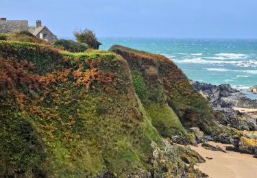
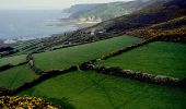
Tocht Paard La Hague - Le Cap de la Hague à cheval - Photo

Le Cap de la Hague à cheval

 tracegps
tracegps

Gebruiker

© OpenStreetMap contributors
Lengte
Lengte
41 km
Max. hoogte
Max. hoogte
179 m
Positief hoogteverschil
939 m
Km-Effort
Km-Effort  
53 km
Min. hoogte
Min. hoogte
15 m
Negatief hoogteverschil
936 m
Boucle
Boucle
Ja
Datum van aanmaak :
2014-12-10 00:00:00.0
Laatste wijziging :
2014-12-10 00:00:00.0

(0 Bericht)

Paard
Paard
9h00
Moeilijkheid : Moeilijk

Scan deze QR-code om de tocht te openen in de SityTrail-applicatie

Gratisgps-wandelapplicatie

Logo SityTrail SityTrail

IGN / Geografische instituten

SityTrail uit de App Store downloaden SityTrail uit Google Play downloaden

Logo SityTrail SityTrail World

De wereld gaat voor u open

SityTrail uit de App Store downloaden SityTrail uit Google Play downloaden SityTrail op Huawei AppGallery downloaden

Over ons

Tocht Paard van 41 km beschikbaar op Normandië, Manche, La Hague. Deze tocht wordt voorgesteld door tracegps.

Beschrijving

Partez sur les traces du chevalier de la lande, qui hante la campagne de la Hague les nuits de tempête. Ce long circuit peut se pratiquer en vélo. Jalonné de nombreux sites intéressants, il vous livre les différents visages de la Hague : sauvage ou industrielle, poète ou préhistorique… Plus de détails sur le circuit (balisage, difficulté…), les points remarquables à proximité et téléchargements sur Manche Tourisme – Loisirs Randonnée GPS.

Hoogteprofiel

Foto's

POI's

POI La Hague - 01_DEPART_STE-CROIX - Photo
tracegps
POI La Hague - 02_DEPART_GRUCHY - Photo
tracegps
POI La Hague - 03_ECULLEVILLE - Photo
tracegps
LA HAGUE 
POI La Hague - 04_PREVERT - Photo
tracegps
LA HAGUE 
POI La Hague - 05_USINE - Photo
tracegps
LA HAGUE 
POI La Hague - 06_CONTREBANDE - Photo
tracegps
LA HAGUE 
POI La Hague - 07_POUQUELEES - Photo
tracegps
LA HAGUE 

Plaatsbepaling

Land:
France
Regio :
Normandië
Departement/Provincie :
Manche
Gemeente :
La Hague
Locatie:
Sainte-Croix-Hague
Vertrek:(Dec)
Vertrek:(UTM)
588473 ; 5499001 (30U) N.

Wandeltochten in de omgeving

Tocht Fiets La Hague - La Haguarde Bitumeuse 2011 - Gréville Hague - Photo
Fiets
tracegps

Fiets

Medium
(1)
La Hague, Normandië, Manche, France
61 km | 72 km-effort
2h 0min
Ja
Tocht Stappen La Hague - Séjour Cotentin Etape 4 Biville - Les Pieux - Photo
Stappen
GUIDE
chessyca

Stappen

Moeilijk
La Hague, Normandië, Manche, France
29 km | 35 km-effort
6h 55min
Neen
Tocht Te voet La Hague - Séjour Cotentin Etape 1 Hurville Nacqueville à Jobourg - Photo
Te voet
GUIDE
chessyca

Te voet

Medium
La Hague, Normandië, Manche, France
19,6 km | 24 km-effort
5h 33min
Neen
Tocht Stappen La Hague - landemer / goury - Photo
Stappen
mimisouge72

Stappen

Heel gemakkelijk
(1)
La Hague, Normandië, Manche, France
19,7 km | 22 km-effort
5h 12min
Neen
Tocht Stappen La Hague - ioupi biville 01 - Photo
Stappen
black2boy

Stappen

Gemakkelijk
(1)
La Hague, Normandië, Manche, France
9,5 km | 11,3 km-effort
2h 11min
Ja
Tocht Stappen La Hague - Normandie  étape 5 - Photo
Stappen
mdeclemy

Stappen

Medium
(1)
La Hague, Normandië, Manche, France
24 km | 28 km-effort
6h 2min
Neen
Tocht Stappen La Hague - Tonneville - Photo
Stappen
PatRando

Stappen

Medium
La Hague, Normandië, Manche, France
8,5 km | 10 km-effort
1h 54min
Ja
Tocht Lopen La Hague - Run and Bike Haguard 2013 - Sainte Croix Hague - Photo
Lopen
tracegps

Lopen

Moeilijk
La Hague, Normandië, Manche, France
21 km | 27 km-effort
2h 30min
Ja
Tocht Mountainbike La Hague - Run and Bike Haguard 2013 - Sainte Croix Hague - Photo
Mountainbike
tracegps

Mountainbike

Medium
La Hague, Normandië, Manche, France
21 km | 27 km-effort
1h 30min
Ja


Sluiten
Mijn abonnementen