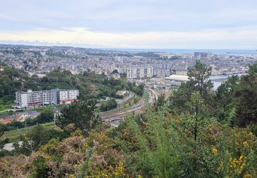
Tocht Mountainbike Cherbourg-en-Cotentin - Bocage et collines de Tourlaville  - Photo

Bocage et collines de Tourlaville

 tracegps
tracegps

Gebruiker

© OpenStreetMap contributors
Lengte
Lengte
14,7 km
Max. hoogte
Max. hoogte
174 m
Positief hoogteverschil
356 m
Km-Effort
Km-Effort  
19,4 km
Min. hoogte
Min. hoogte
22 m
Negatief hoogteverschil
362 m
Boucle
Boucle
Ja
Datum van aanmaak :
2014-12-10 00:00:00.0
Laatste wijziging :
2014-12-10 00:00:00.0

(0 Bericht)

Mountainbike
Mountainbike
2h15
Moeilijkheid : Medium

Scan deze QR-code om de tocht te openen in de SityTrail-applicatie

Gratisgps-wandelapplicatie

Logo SityTrail SityTrail

IGN / Geografische instituten

SityTrail uit de App Store downloaden SityTrail uit Google Play downloaden

Logo SityTrail SityTrail World

De wereld gaat voor u open

SityTrail uit de App Store downloaden SityTrail uit Google Play downloaden SityTrail op Huawei AppGallery downloaden

Over ons

Tocht Mountainbike van 14,7 km beschikbaar op Normandië, Manche, Cherbourg-en-Cotentin. Deze tocht wordt voorgesteld door tracegps.

Beschrijving

Des toponymes parlant !! « Thorlakr Villa » était le nom d’un hardi viking de l’an mil ! Il aurait laissé son nom à Tourlaville qui accueille le beau château Renaissance autour duquel tourne ce circuit. Autre toponyme parlant : la commune de la Glacerie qui a accueilli une manufacture de… glaces. N’oublions pas d’évoquer les lieux-dits La Ménagerie, Le Fourchu ou la Roche aux chats qui auraient sans doute de belles histoires à nous chuchoter. Plus de détails sur le circuit (balisage, difficulté…), les points remarquables à proximité et téléchargements sur Manche Tourisme – Loisirs Randonnée GPS.

Hoogteprofiel

Foto's

POI's

POI Cherbourg-en-Cotentin - 01_DEPART_ - Photo
tracegps
CHERBOURG-EN-COTENTIN 
POI Cherbourg-en-Cotentin - 02_ROCHES - Photo
tracegps
CHERBOURG-EN-COTENTIN 
POI Cherbourg-en-Cotentin - 03_MUSEE_ - Photo
tracegps
CHERBOURG-EN-COTENTIN 
POI Cherbourg-en-Cotentin - 04_EGLISE - Photo
tracegps
CHERBOURG-EN-COTENTIN 
POI Cherbourg-en-Cotentin - 05_COSTILS - Photo
tracegps
CHERBOURG-EN-COTENTIN 
POI Cherbourg-en-Cotentin - 06_CHATEAU - Photo
tracegps
CHERBOURG-EN-COTENTIN 

Plaatsbepaling

Land:
France
Regio :
Normandië
Departement/Provincie :
Manche
Gemeente :
Cherbourg-en-Cotentin
Locatie:
Tourlaville
Vertrek:(Dec)
Vertrek:(UTM)
603505 ; 5498317 (30U) N.

Wandeltochten in de omgeving

Tocht Te voet Cherbourg-en-Cotentin - Séjour Cotentin Etape 7 Boucle Cherbourg avant départ - Photo
Te voet
GUIDE
chessyca

Te voet

Gemakkelijk
Cherbourg-en-Cotentin, Normandië, Manche, France
12,2 km | 14,9 km-effort
3h 22min
Neen
Tocht Stappen Cherbourg-en-Cotentin - La Glacerie  - Photo
Stappen
PatRando

Stappen

Gemakkelijk
Cherbourg-en-Cotentin, Normandië, Manche, France
6,6 km | 8,7 km-effort
1h 26min
Ja
Tocht Stappen Bretteville - Bretteville Pointe de la Bricq - Photo
Stappen
FOUCAULT

Stappen

Bretteville, Normandië, Manche, France
7,3 km | 8,3 km-effort
2h 19min
Ja
Tocht Wegfiets Cherbourg-en-Cotentin - Autour de Cherbourg en vélo  - Photo
Wegfiets
FOUCAULT

Wegfiets

Heel gemakkelijk
Cherbourg-en-Cotentin, Normandië, Manche, France
24 km | 26 km-effort
2h 12min
Ja
Tocht Stappen Cherbourg-en-Cotentin - Tourlaville : 22 octobre 2017 - Photo
Stappen
PatRando

Stappen

Gemakkelijk
Cherbourg-en-Cotentin, Normandië, Manche, France
6,2 km | 7,5 km-effort
1h 2min
Ja
Tocht Mountainbike Cherbourg-en-Cotentin - Relais des 4 châteaux 2013 - Tourlaville  - Photo
Mountainbike
tracegps

Mountainbike

Moeilijk
Cherbourg-en-Cotentin, Normandië, Manche, France
30 km | 38 km-effort
3h 0min
Ja
Tocht Stappen Cherbourg-en-Cotentin - Le colignon - Photo
Stappen
yoyodutheil

Stappen

Heel gemakkelijk
(1)
Cherbourg-en-Cotentin, Normandië, Manche, France
5,8 km | 7,2 km-effort
1h 34min
Ja
Tocht Stappen Cherbourg-en-Cotentin - Les chemins de Saint- Michel - Cherbourg - Lessay - Photo
Stappen
tracegps

Stappen

Medium
Cherbourg-en-Cotentin, Normandië, Manche, France
91 km | 103 km-effort
Onbekend
Neen
Tocht Stappen Cherbourg-en-Cotentin - GR 223 - de Cherbourg à Flamanville - Photo
Stappen
tracegps

Stappen

Medium
(1)
Cherbourg-en-Cotentin, Normandië, Manche, France
70 km | 87 km-effort
16h 0min
Neen


Sluiten
Mijn abonnementen