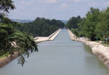
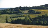
Tocht Stappen Villeneuve-sur-Lot - Villeneuve-sur-Lot / Courbiac, les Bastides en point de mire - Pays de la vallée du Lot - Photo

Villeneuve-sur-Lot / Courbiac, les Bastides en point de mire - Pays de la vallée du Lot

 tracegps
tracegps

Gebruiker

© OpenStreetMap contributors
Lengte
Lengte
6,8 km
Max. hoogte
Max. hoogte
191 m
Positief hoogteverschil
207 m
Km-Effort
Km-Effort  
9,6 km
Min. hoogte
Min. hoogte
89 m
Negatief hoogteverschil
204 m
Boucle
Boucle
Ja
Datum van aanmaak :
2014-12-10 00:00:00.0
Laatste wijziging :
2014-12-10 00:00:00.0

(0 Bericht)

Stappen
Stappen
2h00
Moeilijkheid : Medium

Scan deze QR-code om de tocht te openen in de SityTrail-applicatie

Gratisgps-wandelapplicatie

Logo SityTrail SityTrail

IGN / Geografische instituten

SityTrail uit de App Store downloaden SityTrail uit Google Play downloaden

Logo SityTrail SityTrail World

De wereld gaat voor u open

SityTrail uit de App Store downloaden SityTrail uit Google Play downloaden SityTrail op Huawei AppGallery downloaden

Over ons

Tocht Stappen van 6,8 km beschikbaar op Nieuw-Aquitanië, Lot-et-Garonne, Villeneuve-sur-Lot. Deze tocht wordt voorgesteld door tracegps.

Beschrijving

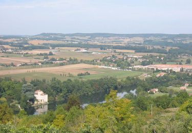
Villeneuve sur Lot / Courbiac Communauté de Communes du Villeneuvois. Chevaux et poneys habitent cet itinéraire, situé non loin de la bastide de Villeneuve-sur-Lot. Une succession d’ouvertures s’offre au regard sur les places fortes et les bastides des environs, Saint-Pastour, Castelnaud-de-Gratecambe, Monflanquin, le château de Biron, Penne-d’Agenais… Téléchargez la fiche de cette randonnée sur le site du Tourisme du Lot et Garonne.

Hoogteprofiel

Foto's

Plaatsbepaling

Land:
France
Regio :
Nieuw-Aquitanië
Departement/Provincie :
Lot-et-Garonne
Gemeente :
Villeneuve-sur-Lot
Locatie:
Unknown
Vertrek:(Dec)
Vertrek:(UTM)
321787 ; 4920421 (31T) N.

Wandeltochten in de omgeving

Tocht Stappen Penne-d'Agenais - Penne-d'Agenais, vers le château de Noaillac - Pays de la vallée du Lot - Photo
Stappen
tracegps

Stappen

Moeilijk
(2)
Penne-d'Agenais, Nieuw-Aquitanië, Lot-et-Garonne, France
13 km | 17,8 km-effort
3h 30min
Ja
Tocht Mountainbike Penne-d'Agenais - Penne-d'Agenais, sur le plateau Saint-Michel - Pays de la vallée du Lot - Photo
Mountainbike
tracegps

Mountainbike

Moeilijk
(1)
Penne-d'Agenais, Nieuw-Aquitanië, Lot-et-Garonne, France
10,5 km | 14,5 km-effort
1h 19min
Ja
Tocht Te voet Penne-d'Agenais - Penne-d’Agenais, vers le château de Noaillac - 13,2km - Photo
Te voet
GUIDE+

Te voet

Gemakkelijk
Penne-d'Agenais, Nieuw-Aquitanië, Lot-et-Garonne, France
13,1 km | 17,8 km-effort
4h 2min
Ja
Tocht Te voet Penne-d'Agenais - Penne-d’Agenais, sur le plateau Saint-Michel -10,7km - Photo
Te voet
GUIDE+

Te voet

Gemakkelijk
Penne-d'Agenais, Nieuw-Aquitanië, Lot-et-Garonne, France
10 km | 13,9 km-effort
3h 8min
Ja
Tocht Stappen Penne-d'Agenais - La randonnée de Penne d'agenais- Lot et Garonne  - Photo
Stappen
alainjoseph6

Stappen

Medium
Penne-d'Agenais, Nieuw-Aquitanië, Lot-et-Garonne, France
7,2 km | 9,8 km-effort
2h 20min
Ja
Tocht Mountainbike Penne-d'Agenais - 8142359 track 1522706785 672 - Photo
Mountainbike
sebcar

Mountainbike

Medium
(1)
Penne-d'Agenais, Nieuw-Aquitanië, Lot-et-Garonne, France
36 km | 45 km-effort
Onbekend
Ja
Tocht Fiets Villeneuve-sur-Lot - de Villeneuve sur Lot à Moissac en passant par Aiguillon - Photo
Fiets
destras

Fiets

Medium
Villeneuve-sur-Lot, Nieuw-Aquitanië, Lot-et-Garonne, France
129 km | 143 km-effort
6h 0min
Neen
Tocht Te voet Villeneuve-sur-Lot - Saint-Germain, l’autre colline de Villeneuve-sur-Lot - 10,3km - Photo
Te voet
GUIDE+

Te voet

Gemakkelijk
Villeneuve-sur-Lot, Nieuw-Aquitanië, Lot-et-Garonne, France
10 km | 14,5 km-effort
3h 17min
Ja
Tocht Te voet Villeneuve-sur-Lot - Saint-Germain, aux portes de Villeneuve-sur-Lot - 4,2km - Photo
Te voet
GUIDE+

Te voet

Gemakkelijk
Villeneuve-sur-Lot, Nieuw-Aquitanië, Lot-et-Garonne, France
4 km | 5,7 km-effort
1h 17min
Ja


Sluiten
Mijn abonnementen