


7,8 km | 8,9 km-effort


Gebruiker


Gratisgps-wandelapplicatie
 SityTrail
IGN / Geografische instituten
SityTrail World
De wereld gaat voor u open
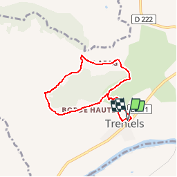
Tocht Stappen van 6,6 km beschikbaar op Nieuw-Aquitanië, Lot-et-Garonne, Trentels. Deze tocht wordt voorgesteld door tracegps.
Trentels Communauté de Communes Fumélois Lémance. Il faut monter pour mieux percevoir l’environnement accidenté des contreforts du Lot et chercher dans le paysage les richesses qui s’y cachent : bastides, pigeonniers, vergers, pechs boisés… Téléchargez la fiche de cette randonnée sur le site du Tourisme du Lot et Garonne.


Stappen
Elektrische fiets
Mountainbike
Stappen
Stappen
Stappen

Fietstoerisme
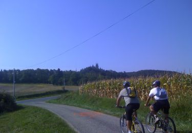
Bien juste un peu trop de route