Tocht Paard Clermont-Soubiran - Clermont-Soubiran, aux portes du Tarn-et-Garonne - Pays de l'Agenais - Photo

Clermont-Soubiran, aux portes du Tarn-et-Garonne - Pays de l'Agenais

 tracegps
tracegps

Gebruiker

© OpenStreetMap contributors
Lengte
Lengte
9,2 km
Max. hoogte
Max. hoogte
171 m
Positief hoogteverschil
185 m
Km-Effort
Km-Effort  
11,7 km
Min. hoogte
Min. hoogte
66 m
Negatief hoogteverschil
187 m
Boucle
Boucle
Ja
Datum van aanmaak :
2014-12-10 00:00:00.0
Laatste wijziging :
2014-12-10 00:00:00.0

(0 Bericht)

Paard
Paard
1h34
Moeilijkheid : Medium

Scan deze QR-code om de tocht te openen in de SityTrail-applicatie

Gratisgps-wandelapplicatie

Logo SityTrail SityTrail

IGN / Geografische instituten

SityTrail uit de App Store downloaden SityTrail uit Google Play downloaden

Logo SityTrail SityTrail World

De wereld gaat voor u open

SityTrail uit de App Store downloaden SityTrail uit Google Play downloaden SityTrail op Huawei AppGallery downloaden

Over ons

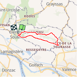
Tocht Paard van 9,2 km beschikbaar op Nieuw-Aquitanië, Lot-et-Garonne, Clermont-Soubiran. Deze tocht wordt voorgesteld door tracegps.

Beschrijving

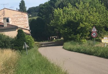
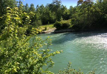
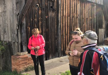
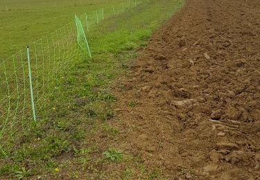
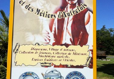
Clermont Soubiran Cté de Communes des Deux Séounes. A l’aller, le circuit utilise des routes et des chemins panoramiques dominant la vallée de la Garonne. Le retour s’effectue sur l’ancienne voie romaine tracée au pied du coteau, hors d’eau des crues du fleuve. Téléchargez la fiche de cette randonnée sur le site du Tourisme du Lot et Garonne.

Hoogteprofiel

Foto's

Plaatsbepaling

Land:
France
Regio :
Nieuw-Aquitanië
Departement/Provincie :
Lot-et-Garonne
Gemeente :
Clermont-Soubiran
Locatie:
Unknown
Vertrek:(Dec)
Vertrek:(UTM)
326591 ; 4889694 (31T) N.

Wandeltochten in de omgeving

Tocht sport Valence - 08/07/2024 - Photo
sport
cheepewa

sport

Heel gemakkelijk
Valence, Occitanië, Tarn-et-Garonne, France
7,8 km | 9,5 km-effort
Onbekend
Ja
Tocht sport Valence - 05/07/2024 - Photo
sport
cheepewa

sport

Heel gemakkelijk
Valence, Occitanië, Tarn-et-Garonne, France
11,7 km | 12,6 km-effort
Onbekend
Ja
Tocht sport Valence - Ballade 29/06/24 - Photo
sport
cheepewa

sport

Heel gemakkelijk
Valence, Occitanië, Tarn-et-Garonne, France
11,6 km | 13,6 km-effort
Onbekend
Ja
Tocht sport Valence - Lundi 22avril 2024 - Photo
sport
cheepewa

sport

Heel gemakkelijk
Valence, Occitanië, Tarn-et-Garonne, France
10,5 km | 12,7 km-effort
Onbekend
Ja
Tocht sport Valence - Les marcheurs du Pontus 18 avril 2024 - Photo
sport
cheepewa

sport

Heel gemakkelijk
Valence, Occitanië, Tarn-et-Garonne, France
10,8 km | 11,7 km-effort
Onbekend
Ja
Tocht Stappen Clermont-Soubiran - Coteaux depuis maison Roiatti  - Photo
Stappen
jlc12

Stappen

Medium
Clermont-Soubiran, Nieuw-Aquitanië, Lot-et-Garonne, France
4,1 km | 5,5 km-effort
1h 7min
Ja
Tocht Stappen Clermont-Soubiran - coupet autour de labro - Photo
Stappen
jlc12

Stappen

Medium
(2)
Clermont-Soubiran, Nieuw-Aquitanië, Lot-et-Garonne, France
11,5 km | 14,7 km-effort
3h 11min
Ja
Tocht Mountainbike Donzac - Les sentiers du Brulhois - Donzac - Photo
Mountainbike
tracegps

Mountainbike

Medium
Donzac, Occitanië, Tarn-et-Garonne, France
40 km | 48 km-effort
2h 45min
Ja
Tocht Mountainbike Saint-Romain-le-Noble - St Romain le Noble / St Pierre de Clairac / Puymirol - Photo
Mountainbike
tracegps

Mountainbike

Moeilijk
Saint-Romain-le-Noble, Nieuw-Aquitanië, Lot-et-Garonne, France
27 km | 36 km-effort
2h 0min
Ja


Sluiten
Mijn abonnementen