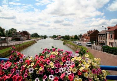
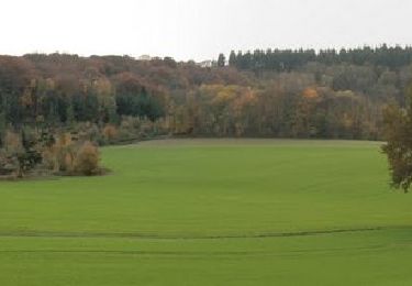
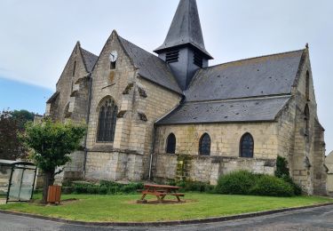
Tocht Stappen Bichancourt - Bichancourt - Le Canal Saint Lazare - Photo

Bichancourt - Le Canal Saint Lazare

 tracegps
tracegps

Gebruiker

© OpenStreetMap contributors
Lengte
Lengte
6,6 km
Max. hoogte
Max. hoogte
64 m
Positief hoogteverschil
42 m
Km-Effort
Km-Effort  
7,1 km
Min. hoogte
Min. hoogte
36 m
Negatief hoogteverschil
43 m
Boucle
Boucle
Ja
Datum van aanmaak :
2014-12-10 00:00:00.0
Laatste wijziging :
2014-12-10 00:00:00.0

(0 Bericht)

Stappen
Stappen
1h40
Moeilijkheid : Medium

Scan deze QR-code om de tocht te openen in de SityTrail-applicatie

Gratisgps-wandelapplicatie

Logo SityTrail SityTrail

IGN / Geografische instituten

SityTrail uit de App Store downloaden SityTrail uit Google Play downloaden

Logo SityTrail SityTrail World

De wereld gaat voor u open

SityTrail uit de App Store downloaden SityTrail uit Google Play downloaden SityTrail op Huawei AppGallery downloaden

Over ons

Tocht Stappen van 6,6 km beschikbaar op Hauts-de-France, Aisne, Bichancourt. Deze tocht wordt voorgesteld door tracegps.

Beschrijving

L'Oise et ses affluents s'écoulent au fond de vallées fréquemment inondées. Ce milieu où l'eau est omniprésente est un vivier pour de nombreuses espèces de faune et de flore. Ce petit circuit permet d'en apercevoir la richesse et la diversité. Retrouvez toutes les informations nécessaires ICI.

Hoogteprofiel

Foto's

Plaatsbepaling

Land:
France
Regio :
Hauts-de-France
Departement/Provincie :
Aisne
Gemeente :
Bichancourt
Locatie:
Unknown
Vertrek:(Dec)
Vertrek:(UTM)
515371 ; 5491950 (31U) N.

Wandeltochten in de omgeving

Tocht Fiets Chauny - Sur les versants de l'Oise - 55 km - Chauny - Photo
Fiets
tracegps

Fiets

Moeilijk
Chauny, Hauts-de-France, Aisne, France
55 km | 62 km-effort
5h 30min
Ja
Tocht Fiets Chauny - Sur les versants de l'Oise - 27 km - Chauny - Photo
Fiets
tracegps

Fiets

Medium
Chauny, Hauts-de-France, Aisne, France
25 km | 30 km-effort
2h 30min
Ja
Tocht Mountainbike Champs - parcours praast  - Photo
Mountainbike
alainwald

Mountainbike

Gemakkelijk
Champs, Hauts-de-France, Aisne, France
46 km | 52 km-effort
3h 48min
Ja
Tocht sport Quierzy - Rando 1 Vivi - Photo
sport
000114.9bbc9f4d6ceb4d0792ecf953a7cb56dd.1433

sport

Heel gemakkelijk
Quierzy, Hauts-de-France, Aisne, France
29 km | 31 km-effort
Onbekend
Neen
Tocht Mountainbike Sinceny - Sortie VTT - Photo
Mountainbike
patweb02

Mountainbike

Heel gemakkelijk
Sinceny, Hauts-de-France, Aisne, France
13,9 km | 14,9 km-effort
1h 0min
Ja
Tocht Andere activiteiten Chauny - Picardie - Ligne 234 - Anizy-Pinon - Chauny - Photo
Andere activiteiten
mich54

Andere activiteiten

Heel gemakkelijk
Chauny, Hauts-de-France, Aisne, France
25 km | 27 km-effort
5min
Neen
Tocht 4x4 Chauny - Rando 4L - Photo
4x4
jojo02

4x4

Gemakkelijk
Chauny, Hauts-de-France, Aisne, France
88 km | 102 km-effort
4h 16min
Ja
Tocht Mountainbike Chauny - la frette - Photo
Mountainbike
jojo02

Mountainbike

Gemakkelijk
Chauny, Hauts-de-France, Aisne, France
15,2 km | 16,3 km-effort
53min
Neen
Tocht Stappen Ognes - ognes 15 mai - Photo
Stappen
MarieDeBacker

Stappen

Gemakkelijk
Ognes, Hauts-de-France, Aisne, France
7,6 km | 8,7 km-effort
1h 54min
Ja


Sluiten
Mijn abonnementen