![](/images/other/stat-length.png)
![Tocht Fiets Crécy-en-Ponthieu - Au nord de la Baie de Somme - Circuit du Geai - Crécy en Ponthieu - Photo](https://media.geolcdn.com/t/1900/400/ext.pjpeg?maxdim=2&url=https%3A%2F%2Fservices.sitytrail.com%2FGeolivesWS%2FDownloadMedia.ashx%3FTrailID%3D109864%26Media%3D4851_1.jpg)
Au nord de la Baie de Somme - Circuit du Geai - Crécy en Ponthieu
tracegps
Gebruiker
![Lengte](/images/other/stat-length.png)
![Max. hoogte](https://static1.geolcdn.com/siteimages/upload/files/1508320355ic_sort_altitude_max_24dp.png)
![Positief hoogteverschil](https://static1.geolcdn.com/siteimages/upload/files/1508320355ic_sort_den_pos_24dp.png)
![Km-Effort](/images/other/stat-length.png)
![Min. hoogte](https://static1.geolcdn.com/siteimages/upload/files/1508320355ic_sort_altitude_min_24dp.png)
![Negatief hoogteverschil](https://static1.geolcdn.com/siteimages/upload/files/1508320355ic_sort_den_neg_24dp.png)
![Boucle](https://static1.geolcdn.com/siteimages/upload/files/16400158638029165_repeat_loop_refresh_sync_direction_icon.png)
![Fiets](https://static1.geolcdn.com/sitytour/trail-icons/200.png)
1h40
Moeilijkheid : Medium
![Scan deze QR-code om de tocht te openen in de SityTrail-applicatie](https://capi.geolives.com/qq0zvz2zws4bq2lad0pu/sitytour/trails/109864/qr.png?size=200)
Gratisgps-wandelapplicatie
Over ons
Tocht Fiets van 17,5 km beschikbaar op Hauts-de-France, Somme, Crécy-en-Ponthieu. Deze tocht wordt voorgesteld door tracegps.
Beschrijving
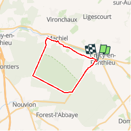
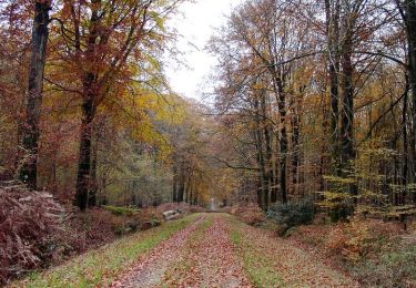
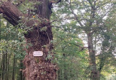
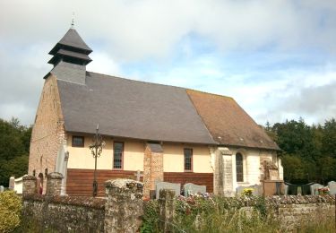
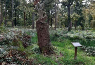
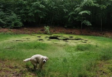
Au nord de la Baie de Somme - Circuit du Geai - Crécy en Ponthieu Découvrez la forêt de Crécy et ses arbres remarquables, mais aussi les marais et villages historiques du Ponthieu Marquenterre. Ce circuit est balisé par le Syndicat Mixte Baie de Somme Grand Littoral Picard. Au cours des parcours, vous emprunterez des pistes cyclables créées et entretenues par le Syndicat Mixte Baie de Somme Grand Littoral Picard. Vous partagez ces espaces avec d’autres usagers, respectez le code de la route, restez courtois et respectueux !
Plaatsbepaling
Opmerkingen
Wandeltochten in de omgeving
![Tocht Fiets Crécy-en-Ponthieu - Les Vieux Chênes - Crécy en Ponthieu - Photo](https://media.geolcdn.com/t/375/260/ext.jpg?maxdim=2&url=https%3A%2F%2Fservices.sitytrail.com%2FGeolivesWS%2FDownloadMedia.ashx%3FTrailID%3D109915%26Media%3D4931_1.jpg)
![Fiets Fiets](https://static1.geolcdn.com/sitytour/trail-icons/200.png)
Fiets
![](/images/other/stat-length.png)
![](https://static1.geolcdn.com/siteimages/upload/files/16400158638029165_repeat_loop_refresh_sync_direction_icon.png)
![Tocht Stappen Crécy-en-Ponthieu - Forêt de Crécy-en-Ponthieu - Photo](https://media.geolcdn.com/t/375/260/fd05b009-a0e0-48d9-b30d-737c848f8a0a.jpg&format=jpg&maxdim=2)
![Stappen Stappen](https://static1.geolcdn.com/sitytour/trail-icons/101.png)
Stappen
![](/images/other/stat-length.png)
![](https://static1.geolcdn.com/siteimages/upload/files/16400158638029165_repeat_loop_refresh_sync_direction_icon.png)
![Tocht Mountainbike Forest-l'Abbaye - Forest-l'Abbaye Cyclisme - Photo](https://media.geolcdn.com/t/375/260/9d218c20-19f9-4002-98b6-99eda2a32b95.png&format=jpg&maxdim=2)
![Mountainbike Mountainbike](https://static1.geolcdn.com/sitytour/trail-icons/202.png)
Mountainbike
![](/images/other/stat-length.png)
![](https://static1.geolcdn.com/siteimages/upload/files/16400158638029165_repeat_loop_refresh_sync_direction_icon.png)
![Tocht Stappen Forest-l'Abbaye - Forest l’Abbaye - Photo](https://media.geolcdn.com/t/375/260/23604bac-d1df-4fcb-bab6-ba45040d791e.jpg&format=jpg&maxdim=2)
![Stappen Stappen](https://static1.geolcdn.com/sitytour/trail-icons/101.png)
Stappen
![](/images/other/stat-length.png)
![](https://static1.geolcdn.com/siteimages/upload/files/16400158638029165_repeat_loop_refresh_sync_direction_icon.png)
![Tocht Stappen Forest-l'Abbaye - À la découverte d'arbres remarquables en Forêt de Crécy - Photo](https://media.geolcdn.com/t/375/260/8a9c9e06-a466-4037-92ca-f29b0b2e52d6.jpeg&format=jpg&maxdim=2)
![Stappen Stappen](https://static1.geolcdn.com/sitytour/trail-icons/101.png)
Stappen
![](/images/other/stat-length.png)
![](https://static1.geolcdn.com/siteimages/upload/files/16400158638029165_repeat_loop_refresh_sync_direction_icon.png)
![Tocht Stappen Crécy-en-Ponthieu - Forêt de Crécy - Photo](https://media.geolcdn.com/t/375/260/f1b387ad-8151-48dc-8a2f-cae702cbbcd3.jpeg&format=jpg&maxdim=2)
![Stappen Stappen](https://static1.geolcdn.com/sitytour/trail-icons/101.png)
Stappen
![](/images/other/stat-length.png)
![](https://static1.geolcdn.com/siteimages/upload/files/16400158638029165_repeat_loop_refresh_sync_direction_icon.png)
![Tocht Te voet Forest-l'Abbaye - Le Hallot - Photo](https://media.geolcdn.com/t/375/260/55088aac-3fac-47bc-a0c5-00e9894c90f2.jpeg&format=jpg&maxdim=2)
![Te voet Te voet](https://static1.geolcdn.com/sitytour/trail-icons/100.png)
Te voet
![](/images/other/stat-length.png)
![](https://static1.geolcdn.com/siteimages/upload/files/16400158638029165_repeat_loop_refresh_sync_direction_icon.png)
![Tocht Stappen Crécy-en-Ponthieu - LP80_Crecy Ponthieu_Scultures bois - Photo](https://media.geolcdn.com/t/375/260/85252c58-db6b-4eda-bb40-73441ade40b9.jpg&format=jpg&maxdim=2)
![Stappen Stappen](https://static1.geolcdn.com/sitytour/trail-icons/101.png)
Stappen
![](/images/other/stat-length.png)
![](https://static1.geolcdn.com/siteimages/upload/files/16400158638029165_repeat_loop_refresh_sync_direction_icon.png)
![Tocht Stappen Crécy-en-Ponthieu - forêt de Crecy - Photo](https://media.geolcdn.com/t/375/260/63501a4c-5e7d-4485-abe4-dbf7d7ae3149.jpg&format=jpg&maxdim=2)
![Stappen Stappen](https://static1.geolcdn.com/sitytour/trail-icons/101.png)
Stappen
![](/images/other/stat-length.png)
![](https://static1.geolcdn.com/siteimages/upload/files/16400158638029165_repeat_loop_refresh_sync_direction_icon.png)