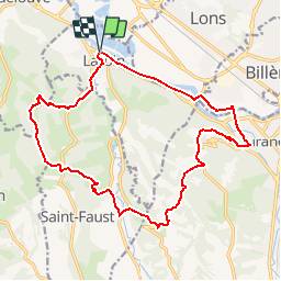
![](/images/other/stat-length.png)
![Tocht Stappen Laroin - Les vignes en terrasses des collines de Jurançon - Photo](https://media.geolcdn.com/t/1900/400/ext.pjpeg?maxdim=2&url=https%3A%2F%2Fservices.sitytrail.com%2FGeolivesWS%2FDownloadMedia.ashx%3FTrailID%3D109345%26Media%3D3626_1.jpg)
Les vignes en terrasses des collines de Jurançon
tracegps
Gebruiker
![Lengte](/images/other/stat-length.png)
![Max. hoogte](https://static1.geolcdn.com/siteimages/upload/files/1508320355ic_sort_altitude_max_24dp.png)
![Positief hoogteverschil](https://static1.geolcdn.com/siteimages/upload/files/1508320355ic_sort_den_pos_24dp.png)
![Km-Effort](/images/other/stat-length.png)
![Min. hoogte](https://static1.geolcdn.com/siteimages/upload/files/1508320355ic_sort_altitude_min_24dp.png)
![Negatief hoogteverschil](https://static1.geolcdn.com/siteimages/upload/files/1508320355ic_sort_den_neg_24dp.png)
![Boucle](https://static1.geolcdn.com/siteimages/upload/files/16400158638029165_repeat_loop_refresh_sync_direction_icon.png)
![Stappen](https://static1.geolcdn.com/sitytour/trail-icons/101.png)
5h00
Moeilijkheid : Moeilijk
![Scan deze QR-code om de tocht te openen in de SityTrail-applicatie](https://capi.geolives.com/qq0zvz2zws4bq2lad0pu/sitytour/trails/109345/qr.png?size=200)
Gratisgps-wandelapplicatie
Over ons
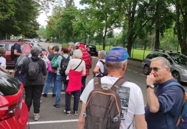
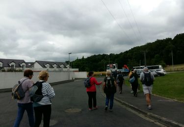
Tocht Stappen van 19,6 km beschikbaar op Nieuw-Aquitanië, Pyrénées-Atlantiques, Laroin. Deze tocht wordt voorgesteld door tracegps.
Beschrijving
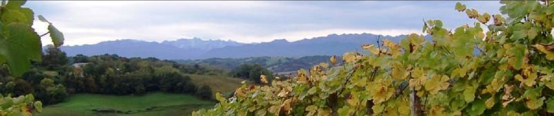
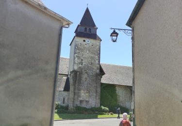
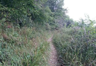
Les vignes en terrasses des collines de Jurançon Par les belles soirées, les collines du Jurançon prennent la teinte dorée du vin qu’elles produisent. Les collines, les terrasses rayées de ce rare vin qu’aimait tant « Nouste Henric », se parent de toute la douceur du pays. Les vignes, conduites en hautains, sont orientées au sud, face à la chaîne des Pyrénées.
Plaatsbepaling
Opmerkingen
Wandeltochten in de omgeving
![Tocht Te voet Lescar - Lescar du 2018-06-24 - Photo](https://media.geolcdn.com/t/375/260/ext.jpg?maxdim=2&url=https%3A%2F%2Fstatic1.geolcdn.com%2Fsiteimages%2Fupload%2Ffiles%2F1545311037marcheuse_200dpi.jpg)
![Te voet Te voet](https://static1.geolcdn.com/sitytour/trail-icons/100.png)
Te voet
![](/images/other/stat-length.png)
![](https://static1.geolcdn.com/siteimages/upload/files/16400158638029165_repeat_loop_refresh_sync_direction_icon.png)
![Tocht Stappen Siros - SIROS Le sentier du gave M2 3143980 - Photo](https://media.geolcdn.com/t/375/260/2adf7da9-eb05-4d5c-bb78-ec6153367b08.jpg&format=jpg&maxdim=2)
![Stappen Stappen](https://static1.geolcdn.com/sitytour/trail-icons/101.png)
Stappen
![](/images/other/stat-length.png)
![](https://static1.geolcdn.com/siteimages/upload/files/16400158638029165_repeat_loop_refresh_sync_direction_icon.png)
![Tocht Stappen Aubertin - AUBERTIN (PPT) de la hélère à la baïse fait (G3) 2641287 - Photo](https://media.geolcdn.com/t/375/260/48e70064-c312-4418-ae56-e61cd12d160d.jpg&format=jpg&maxdim=2)
![Stappen Stappen](https://static1.geolcdn.com/sitytour/trail-icons/101.png)
Stappen
![](/images/other/stat-length.png)
![](https://static1.geolcdn.com/siteimages/upload/files/16400158638029165_repeat_loop_refresh_sync_direction_icon.png)
![Tocht Stappen Billère - BILLÈRE RS Du golf au chateau de Pau 4079692 - Photo](https://media.geolcdn.com/t/375/260/4d33d503-9e7c-4f4d-8165-31dd38a2fcd8.jpg&format=jpg&maxdim=2)
![Stappen Stappen](https://static1.geolcdn.com/sitytour/trail-icons/101.png)
Stappen
![](/images/other/stat-length.png)
![](https://static1.geolcdn.com/siteimages/upload/files/16400158638029165_repeat_loop_refresh_sync_direction_icon.png)
![Tocht Stappen Artiguelouve - ARTIGUELOUVE LA COMMANDE GR653 G4 - Photo](https://media.geolcdn.com/t/375/260/0eb1058d-00a5-4625-be32-6d5c177b89e3.jpg&format=jpg&maxdim=2)
![Stappen Stappen](https://static1.geolcdn.com/sitytour/trail-icons/101.png)
Stappen
![](/images/other/stat-length.png)
![](https://static1.geolcdn.com/siteimages/upload/files/16400158638029165_repeat_loop_refresh_sync_direction_icon.png)
![Tocht Stappen Lons - LONS RS Les vignes 3273591 - Photo](https://media.geolcdn.com/t/375/260/99155626-5df1-4931-8a9c-5e7670ba9919.jpg&format=jpg&maxdim=2)
![Stappen Stappen](https://static1.geolcdn.com/sitytour/trail-icons/101.png)
Stappen
![](/images/other/stat-length.png)
![](https://static1.geolcdn.com/siteimages/upload/files/16400158638029165_repeat_loop_refresh_sync_direction_icon.png)
![Tocht Stappen Lescar - LESCAR de la cité à la nature - Photo](https://media.geolcdn.com/t/375/260/09f39b31-0390-4115-b173-071187e7d734.jpg&format=jpg&maxdim=2)
![Stappen Stappen](https://static1.geolcdn.com/sitytour/trail-icons/101.png)
Stappen
![](/images/other/stat-length.png)
![](https://static1.geolcdn.com/siteimages/upload/files/16400158638029165_repeat_loop_refresh_sync_direction_icon.png)
![Tocht Stappen Jurançon - JURANÇON les coteaux M1 2902947 - Photo](https://media.geolcdn.com/t/375/260/9b2a7064-a7cd-42c1-a73c-366896c49753.jpg&format=jpg&maxdim=2)
![Stappen Stappen](https://static1.geolcdn.com/sitytour/trail-icons/101.png)
Stappen
![](/images/other/stat-length.png)
![](https://static1.geolcdn.com/siteimages/upload/files/16400158638029165_repeat_loop_refresh_sync_direction_icon.png)
![Tocht Te voet Lescar - LESCAR Terra aventura 2872531 - Photo](https://media.geolcdn.com/t/375/260/15333704-329f-4ba4-8d28-86d7bfcecef2.jpg&format=jpg&maxdim=2)
![Te voet Te voet](https://static1.geolcdn.com/sitytour/trail-icons/100.png)
Te voet
![](/images/other/stat-length.png)
![](https://static1.geolcdn.com/siteimages/upload/files/16400158638029165_repeat_loop_refresh_sync_direction_icon.png)
c tres bo
bien rando