![](/images/other/stat-length.png)
![Tocht Stappen Nans-sous-Sainte-Anne - Belvédère de Montmahoux (828 m) et source du Lison - Photo](https://media.geolcdn.com/t/1900/400/ext.pjpeg?maxdim=2&url=https%3A%2F%2Fservices.sitytrail.com%2FGeolivesWS%2FDownloadMedia.ashx%3FTrailID%3D108780%26Media%3D1922_2.jpg)
Belvédère de Montmahoux (828 m) et source du Lison
tracegps
Gebruiker
![Lengte](/images/other/stat-length.png)
![Max. hoogte](https://static1.geolcdn.com/siteimages/upload/files/1508320355ic_sort_altitude_max_24dp.png)
![Positief hoogteverschil](https://static1.geolcdn.com/siteimages/upload/files/1508320355ic_sort_den_pos_24dp.png)
![Km-Effort](/images/other/stat-length.png)
![Min. hoogte](https://static1.geolcdn.com/siteimages/upload/files/1508320355ic_sort_altitude_min_24dp.png)
![Negatief hoogteverschil](https://static1.geolcdn.com/siteimages/upload/files/1508320355ic_sort_den_neg_24dp.png)
![Boucle](https://static1.geolcdn.com/siteimages/upload/files/16400158638029165_repeat_loop_refresh_sync_direction_icon.png)
![Stappen](https://static1.geolcdn.com/sitytour/trail-icons/101.png)
4h15
Moeilijkheid : Medium
![Scan deze QR-code om de tocht te openen in de SityTrail-applicatie](https://capi.geolives.com/qq0zvz2zws4bq2lad0pu/sitytour/trails/108780/qr.png?size=200)
Gratisgps-wandelapplicatie
Over ons
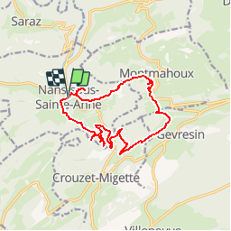
Tocht Stappen van 14,1 km beschikbaar op Bourgondië-Franche-Comté, Doubs, Nans-sous-Sainte-Anne. Deze tocht wordt voorgesteld door tracegps.
Beschrijving
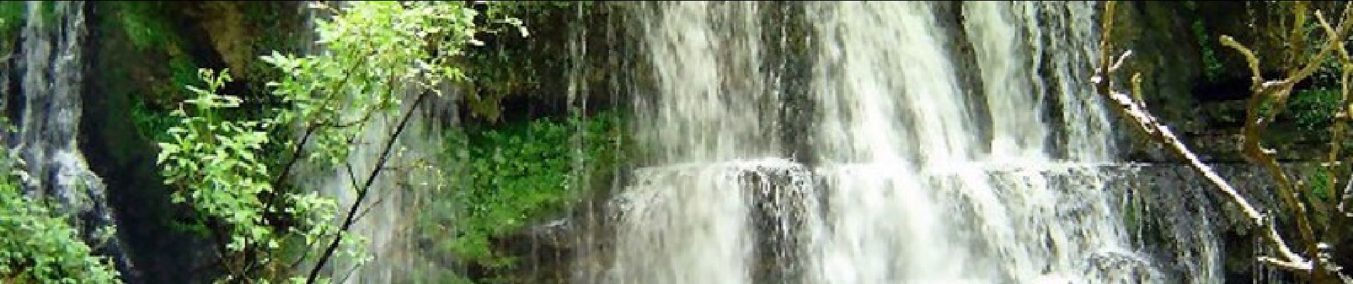
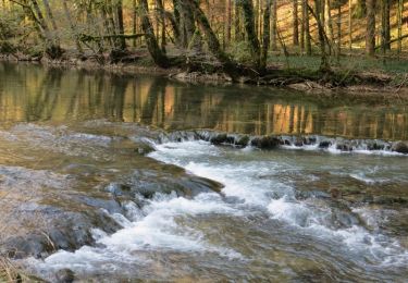
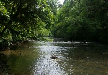
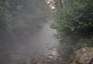
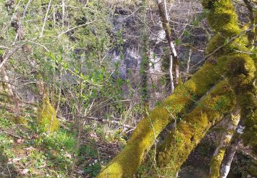
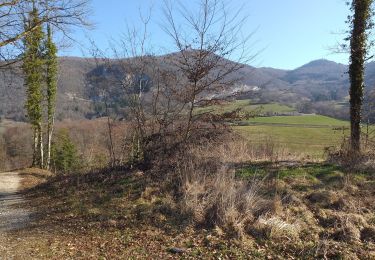
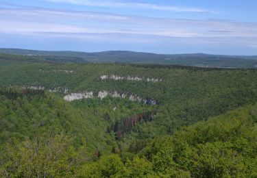
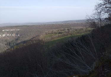
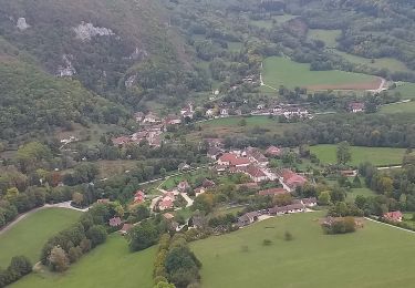
Cette très belle randonnée réunit le charme d'un lieu incontournable de Franche-Comté, le site de la source du Lison, avec l'ascension du Mont Mahoux et sa vue panoramique. Elle permet de découvrir les différents aspects du site, à la fois géologique (sources et résurgences, cascades, falaises et grottes), botanique (zones humides au bord du Lison, pelouses sèches au Mont Mahoux), faunistique (zone de nidification du faucon pèlerin, faune aquatique, ...) et socio-économique (exploitation des richesses naturelles du site par l'homme). La suite avec d’autres informations et photos est ICI
Plaatsbepaling
Opmerkingen
Wandeltochten in de omgeving
![Tocht Stappen Éternoz - Eternoz, lison - Photo](https://media.geolcdn.com/t/375/260/208ebe96-2cd0-48ef-ba00-81a5144b65f2.jpg&format=jpg&maxdim=2)
![Stappen Stappen](https://static1.geolcdn.com/sitytour/trail-icons/101.png)
Stappen
![](/images/other/stat-length.png)
![](https://static1.geolcdn.com/siteimages/upload/files/16400158638029165_repeat_loop_refresh_sync_direction_icon.png)
![Tocht Stappen Éternoz - Les Gorges du Lison - Eternoz - Photo](https://media.geolcdn.com/t/375/260/ext.jpg?maxdim=2&url=https%3A%2F%2Fservices.sitytrail.com%2FGeolivesWS%2FDownloadMedia.ashx%3FTrailID%3D317678%26Media%3D16971_2.jpg)
![Stappen Stappen](https://static1.geolcdn.com/sitytour/trail-icons/101.png)
Stappen
![](/images/other/stat-length.png)
![](https://static1.geolcdn.com/siteimages/upload/files/16400158638029165_repeat_loop_refresh_sync_direction_icon.png)
![Tocht Stappen Éternoz - eternoz belvédère chandelier - Photo](https://media.geolcdn.com/t/375/260/ext.jpg?maxdim=2&url=https%3A%2F%2Fservices.sitytrail.com%2FGeolivesWS%2FDownloadMedia.ashx%3FTrailID%3D310128%26Media%3Dfix__20140607143146.jpg)
![Stappen Stappen](https://static1.geolcdn.com/sitytour/trail-icons/101.png)
Stappen
![](/images/other/stat-length.png)
![](https://static1.geolcdn.com/siteimages/upload/files/16400158638029165_repeat_loop_refresh_sync_direction_icon.png)
![Tocht Stappen Nans-sous-Sainte-Anne - Boucle du Lison - Photo](https://media.geolcdn.com/t/375/260/88a5dc3c-618f-436b-b7c4-4eaeac97e8a4.jpg&format=jpg&maxdim=2)
![Stappen Stappen](https://static1.geolcdn.com/sitytour/trail-icons/101.png)
Stappen
![](/images/other/stat-length.png)
![](https://static1.geolcdn.com/siteimages/upload/files/16400158638029165_repeat_loop_refresh_sync_direction_icon.png)
![Tocht Stappen Éternoz - Coulans sur Lison - Photo](https://media.geolcdn.com/t/375/260/f76583f3-f01a-4c08-bae6-79048f4b92a9.jpg&format=jpg&maxdim=2)
![Stappen Stappen](https://static1.geolcdn.com/sitytour/trail-icons/101.png)
Stappen
![](/images/other/stat-length.png)
![](https://static1.geolcdn.com/siteimages/upload/files/16400158638029165_repeat_loop_refresh_sync_direction_icon.png)
![Tocht Stappen Nans-sous-Sainte-Anne - Nans sous st Anne](https://media.geolcdn.com/t/375/260/b6cfc0fd-6acf-4e57-870f-4690a7cde30a.jpg&format=jpg&maxdim=2)
![Stappen Stappen](https://static1.geolcdn.com/sitytour/trail-icons/101.png)
Stappen
![](/images/other/stat-length.png)
![](https://static1.geolcdn.com/siteimages/upload/files/16400158638029165_repeat_loop_refresh_sync_direction_icon.png)
![Tocht Stappen Éternoz - Nans sous ste Anne, Lizon - Photo](https://media.geolcdn.com/t/375/260/4af1776a-c1d4-468f-bcd4-6c5d450efb32.jpg&format=jpg&maxdim=2)
![Stappen Stappen](https://static1.geolcdn.com/sitytour/trail-icons/101.png)
Stappen
![](/images/other/stat-length.png)
![](https://static1.geolcdn.com/siteimages/upload/files/16400158638029165_repeat_loop_refresh_sync_direction_icon.png)
![Tocht Stappen Éternoz - éternoz la re-belle - Photo](https://media.geolcdn.com/t/375/260/4a290635-7f86-44d2-ab39-79b688193c33.jpg&format=jpg&maxdim=2)
![Stappen Stappen](https://static1.geolcdn.com/sitytour/trail-icons/101.png)
Stappen
![](/images/other/stat-length.png)
![](https://static1.geolcdn.com/siteimages/upload/files/16400158638029165_repeat_loop_refresh_sync_direction_icon.png)
![Tocht Stappen Nans-sous-Sainte-Anne - Nans st Anne, belvédères - Photo](https://media.geolcdn.com/t/375/260/0f39d73b-380e-401a-9105-12225f47b503.jpg&format=jpg&maxdim=2)
![Stappen Stappen](https://static1.geolcdn.com/sitytour/trail-icons/101.png)
Stappen
![](/images/other/stat-length.png)
![](https://static1.geolcdn.com/siteimages/upload/files/16400158638029165_repeat_loop_refresh_sync_direction_icon.png)
Super ' très bien élaboré Merci SityTrail
excellent