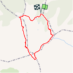
![](/images/other/stat-length.png)
![Tocht Stappen Taurinya - Pic du Canigou par le refuge des Cortalets - Photo](https://media.geolcdn.com/t/1900/400/ext.pjpeg?maxdim=2&url=https%3A%2F%2Fservices.sitytrail.com%2FGeolivesWS%2FDownloadMedia.ashx%3FTrailID%3D108651%26Media%3D1661_2.jpg)
Pic du Canigou par le refuge des Cortalets
tracegps
Gebruiker
![Lengte](/images/other/stat-length.png)
![Max. hoogte](https://static1.geolcdn.com/siteimages/upload/files/1508320355ic_sort_altitude_max_24dp.png)
![Positief hoogteverschil](https://static1.geolcdn.com/siteimages/upload/files/1508320355ic_sort_den_pos_24dp.png)
![Km-Effort](/images/other/stat-length.png)
![Min. hoogte](https://static1.geolcdn.com/siteimages/upload/files/1508320355ic_sort_altitude_min_24dp.png)
![Negatief hoogteverschil](https://static1.geolcdn.com/siteimages/upload/files/1508320355ic_sort_den_neg_24dp.png)
![Boucle](https://static1.geolcdn.com/siteimages/upload/files/16400158638029165_repeat_loop_refresh_sync_direction_icon.png)
![Stappen](https://static1.geolcdn.com/sitytour/trail-icons/101.png)
6h30
Moeilijkheid : Zeer moeilijk
![Scan deze QR-code om de tocht te openen in de SityTrail-applicatie](https://capi.geolives.com/qq0zvz2zws4bq2lad0pu/sitytour/trails/108651/qr.png?size=200)
Gratisgps-wandelapplicatie
Over ons
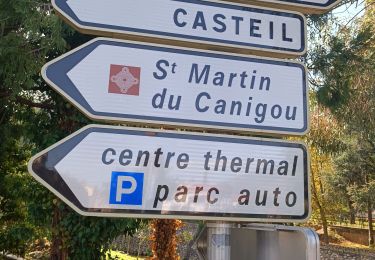
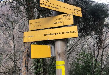
Tocht Stappen van 7,8 km beschikbaar op Occitanië, Pyrénées-Orientales, Taurinya. Deze tocht wordt voorgesteld door tracegps.
Beschrijving
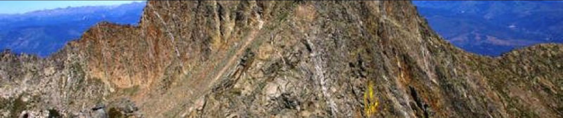
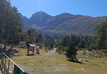
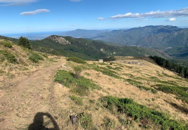
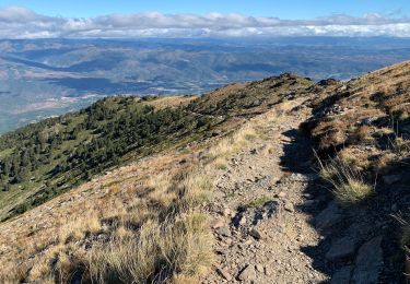
Une superbe randonnée qui nous mène vers le sommet mythique des Catalans, le Pic du Canigou. En boucle en partant du chalet des Cortalets, on passe au Pic Joffre puis au Pic du Canigou avant de redescendre par la cheminée Sud vers le porteille de Valmanya pour remonter au Pic Barbet et de redescendre par la crête jusqu'au refuge. D’autres informations et photos sont disponibles ICI Balade inspirée par le site « Les Balades et Randonnées de Fred »
Plaatsbepaling
Opmerkingen
Wandeltochten in de omgeving
![Tocht Stappen Taurinya - le Canigou depuis le col de Millères - Photo](https://media.geolcdn.com/t/375/260/ext.jpg?maxdim=2&url=https%3A%2F%2Fstatic1.geolcdn.com%2Fsiteimages%2Fupload%2Ffiles%2F1553511878bg_sport_marche.png)
![Stappen Stappen](https://static1.geolcdn.com/sitytour/trail-icons/101.png)
Stappen
![](/images/other/stat-length.png)
![](https://static1.geolcdn.com/siteimages/upload/files/16400158638029165_repeat_loop_refresh_sync_direction_icon.png)
![Tocht Stappen Taurinya - b - Photo](https://media.geolcdn.com/t/375/260/3dd340e8-99b2-41f7-a00f-44f941b5bfec.jpg&format=jpg&maxdim=2)
![Stappen Stappen](https://static1.geolcdn.com/sitytour/trail-icons/101.png)
Stappen
![](/images/other/stat-length.png)
![](https://static1.geolcdn.com/siteimages/upload/files/16400158638029165_repeat_loop_refresh_sync_direction_icon.png)
![Tocht sport Valmanya - 20241013 Los Masos-Prat Cabrera… - Photo](https://media.geolcdn.com/t/375/260/31e31d29-0e6a-46e9-9786-fccc3cfba894.jpg&format=jpg&maxdim=2)
sport
![](/images/other/stat-length.png)
![](https://static1.geolcdn.com/siteimages/upload/files/16400158638029165_repeat_loop_refresh_sync_direction_icon.png)
![Tocht Stappen Taurinya - les mines du Salver - Photo](https://media.geolcdn.com/t/375/260/d4f6c8be-7332-4c2c-bb83-4fdf39739546.jpg&format=jpg&maxdim=2)
![Stappen Stappen](https://static1.geolcdn.com/sitytour/trail-icons/101.png)
Stappen
![](/images/other/stat-length.png)
![](https://static1.geolcdn.com/siteimages/upload/files/16400158638029165_repeat_loop_refresh_sync_direction_icon.png)
![Tocht Stappen Taurinya - Jour 3 Pic du Canigou - Photo](https://media.geolcdn.com/t/375/260/4a654063-9e7f-4694-8336-f9269fb3df08.jpg&format=jpg&maxdim=2)
![Stappen Stappen](https://static1.geolcdn.com/sitytour/trail-icons/101.png)
Stappen
![](/images/other/stat-length.png)
![](https://static1.geolcdn.com/siteimages/upload/files/16400158638029165_repeat_loop_refresh_sync_direction_icon.png)
![Tocht Stappen Casteil - Jour 2 Pic du Canigou - Photo](https://media.geolcdn.com/t/375/260/638d215b-fce6-4508-ac14-7470431b6327.jpg&format=jpg&maxdim=2)
![Stappen Stappen](https://static1.geolcdn.com/sitytour/trail-icons/101.png)
Stappen
![](/images/other/stat-length.png)
![](https://static1.geolcdn.com/siteimages/upload/files/16400158638029165_repeat_loop_refresh_sync_direction_icon.png)
![Tocht Stappen Taurinya - 2022 TRANSPYRÉNÉENNE : refuge les Mariales le Canigou - les Cortalets - Refuge Bardera - Photo](https://media.geolcdn.com/t/375/260/34d0ca19-8985-4b27-87e8-d2fc7f767174.jpg&format=jpg&maxdim=2)
![Stappen Stappen](https://static1.geolcdn.com/sitytour/trail-icons/101.png)
Stappen
![](/images/other/stat-length.png)
![](https://static1.geolcdn.com/siteimages/upload/files/16400158638029165_repeat_loop_refresh_sync_direction_icon.png)
![Tocht Stappen Casteil - 2022 TRANSPYRÉNÉENNE : refuge des Marieles - Le Canihou- refuge des Cortalets - Photo](https://media.geolcdn.com/t/375/260/6854f852-cc25-4812-86bc-a58f423a6f1a.jpg&format=jpg&maxdim=2)
![Stappen Stappen](https://static1.geolcdn.com/sitytour/trail-icons/101.png)
Stappen
![](/images/other/stat-length.png)
![](https://static1.geolcdn.com/siteimages/upload/files/16400158638029165_repeat_loop_refresh_sync_direction_icon.png)
![Tocht Stappen Estoher - 20220227 Mas Maler- Mines de la Coume - Photo](https://media.geolcdn.com/t/375/260/94957a20-6255-4ff8-a701-35b976e1181d.jpg&format=jpg&maxdim=2)
![Stappen Stappen](https://static1.geolcdn.com/sitytour/trail-icons/101.png)
Stappen
![](/images/other/stat-length.png)
![](https://static1.geolcdn.com/siteimages/upload/files/16400158638029165_repeat_loop_refresh_sync_direction_icon.png)
super