![](/images/other/stat-length.png)
![Tocht Stappen Argoules - Circuit de Valloires - Photo](https://media.geolcdn.com/t/1900/400/ext.pjpeg?maxdim=2&url=https%3A%2F%2Fservices.sitytrail.com%2FGeolivesWS%2FDownloadMedia.ashx%3FTrailID%3D108591%26Media%3D1499_1.jpg)
Circuit de Valloires
tracegps
Gebruiker
![Lengte](/images/other/stat-length.png)
Lengte
7,4 km
![Max. hoogte](https://static1.geolcdn.com/siteimages/upload/files/1508320355ic_sort_altitude_max_24dp.png)
Max. hoogte
71 m
![Positief hoogteverschil](https://static1.geolcdn.com/siteimages/upload/files/1508320355ic_sort_den_pos_24dp.png)
Positief hoogteverschil
167 m
![Km-Effort](/images/other/stat-length.png)
Km-Effort
9,7 km
![Min. hoogte](https://static1.geolcdn.com/siteimages/upload/files/1508320355ic_sort_altitude_min_24dp.png)
Min. hoogte
7 m
![Negatief hoogteverschil](https://static1.geolcdn.com/siteimages/upload/files/1508320355ic_sort_den_neg_24dp.png)
Negatief hoogteverschil
166 m
![Boucle](https://static1.geolcdn.com/siteimages/upload/files/16400158638029165_repeat_loop_refresh_sync_direction_icon.png)
Boucle
Ja
Datum van aanmaak :
2014-12-10 00:00:00.0
Laatste wijziging :
2014-12-10 00:00:00.0
![Stappen](https://static1.geolcdn.com/sitytour/trail-icons/101.png)
2h30
Moeilijkheid : Zeer moeilijk
![Scan deze QR-code om de tocht te openen in de SityTrail-applicatie](https://capi.geolives.com/qq0zvz2zws4bq2lad0pu/sitytour/trails/108591/qr.png?size=200)
Gratisgps-wandelapplicatie
Over ons
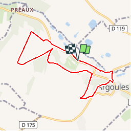
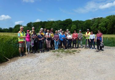
Tocht Stappen van 7,4 km beschikbaar op Hauts-de-France, Somme, Argoules. Deze tocht wordt voorgesteld door tracegps.
Beschrijving
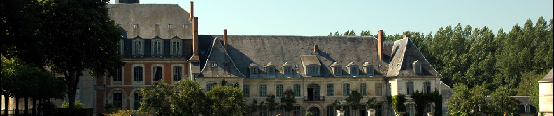
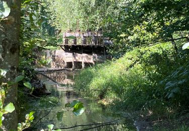
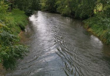
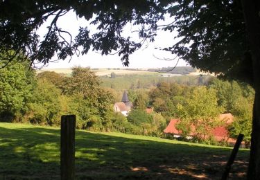
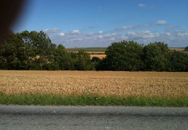
Une promenade champêtre autour d’une abbaye ancestrale et de ses splendides jardins fleuris dans la vallée de l’Authie. Téléchargez la fiche du circuit en format pdf. Partez à la découverte de la Côte Picarde et de la Baie de Somme à travers ses randonnées.
Plaatsbepaling
Land:
France
Regio :
Hauts-de-France
Departement/Provincie :
Somme
Gemeente :
Argoules
Locatie:
Unknown
Vertrek:(Dec)
Vertrek:(UTM)
416231 ; 5577906 (31U) N.
Opmerkingen
Wandeltochten in de omgeving
![Tocht Stappen Argoules - CAF Abbaye de Valloires - Photo](https://media.geolcdn.com/t/375/260/ext.jpg?maxdim=2&url=https%3A%2F%2Fstatic1.geolcdn.com%2Fsiteimages%2Fupload%2Ffiles%2F1553511878bg_sport_marche.png)
![Stappen Stappen](https://static1.geolcdn.com/sitytour/trail-icons/101.png)
CAF Abbaye de Valloires
Stappen
Gemakkelijk
(1)
Argoules,
Hauts-de-France,
Somme,
France
![](/images/other/stat-length.png)
24 km | 30 km-effort
5h 29min
![](https://static1.geolcdn.com/siteimages/upload/files/16400158638029165_repeat_loop_refresh_sync_direction_icon.png)
Ja
![Tocht Te voet Argoules - Valloire - Photo](https://media.geolcdn.com/t/375/260/ext.jpg?maxdim=2&url=https%3A%2F%2Fmedia.geolcdn.com%2Ff%2F4782af5c-6a5a-48bf-8440-dbcbfe15f4ac.jpeg)
![Te voet Te voet](https://static1.geolcdn.com/sitytour/trail-icons/100.png)
Valloire
Te voet
Gemakkelijk
Argoules,
Hauts-de-France,
Somme,
France
![](/images/other/stat-length.png)
8,1 km | 10,5 km-effort
2h 23min
![](https://static1.geolcdn.com/siteimages/upload/files/16400158638029165_repeat_loop_refresh_sync_direction_icon.png)
Ja
![Tocht Stappen Argoules - boucle autour de l'abbaye de Valloires - Photo](https://media.geolcdn.com/t/375/260/ext.jpg?maxdim=2&url=https%3A%2F%2Fmedia.geolcdn.com%2Ff%2Fea488535-ea4d-47da-9402-798a5dc5309b.jpg)
![Stappen Stappen](https://static1.geolcdn.com/sitytour/trail-icons/101.png)
boucle autour de l'abbaye de Valloires
Stappen
Medium
Argoules,
Hauts-de-France,
Somme,
France
![](/images/other/stat-length.png)
7 km | 8,7 km-effort
1h 44min
![](https://static1.geolcdn.com/siteimages/upload/files/16400158638029165_repeat_loop_refresh_sync_direction_icon.png)
Ja
![Tocht Stappen Argoules - Valloires - Photo](https://media.geolcdn.com/t/375/260/ext.jpg?maxdim=2&url=https%3A%2F%2Fmedia.geolcdn.com%2Ff%2F752fa8ce-1aab-4146-8269-5c1baee93863.jpg)
![Stappen Stappen](https://static1.geolcdn.com/sitytour/trail-icons/101.png)
Valloires
Stappen
Gemakkelijk
Argoules,
Hauts-de-France,
Somme,
France
![](/images/other/stat-length.png)
3,7 km | 4,6 km-effort
1h 6min
![](https://static1.geolcdn.com/siteimages/upload/files/16400158638029165_repeat_loop_refresh_sync_direction_icon.png)
Neen
![Tocht Stappen Argoules - Valloire argoules - Photo](https://media.geolcdn.com/t/375/260/ext.jpg?maxdim=2&url=https%3A%2F%2Fmedia.geolcdn.com%2Ff%2F8128bc8e-e27c-445a-ae21-99cfe7e7a531.jpg)
![Stappen Stappen](https://static1.geolcdn.com/sitytour/trail-icons/101.png)
Valloire argoules
Stappen
Heel gemakkelijk
(1)
Argoules,
Hauts-de-France,
Somme,
France
![](/images/other/stat-length.png)
4,7 km | 5,6 km-effort
1h 8min
![](https://static1.geolcdn.com/siteimages/upload/files/16400158638029165_repeat_loop_refresh_sync_direction_icon.png)
Neen
![Tocht Stappen Argoules - 8kArgoules - Photo](https://media.geolcdn.com/t/375/260/ext.jpg?maxdim=2&url=https%3A%2F%2Fmedia.geolcdn.com%2Ff%2F8d5a7810-046f-4f50-869d-a2d830d526f1.jpg)
![Stappen Stappen](https://static1.geolcdn.com/sitytour/trail-icons/101.png)
8kArgoules
Stappen
Medium
Argoules,
Hauts-de-France,
Somme,
France
![](/images/other/stat-length.png)
8,5 km | 10,9 km-effort
4h 0min
![](https://static1.geolcdn.com/siteimages/upload/files/16400158638029165_repeat_loop_refresh_sync_direction_icon.png)
Ja
![Tocht Stappen Argoules - LP80_Argoules-TourValloires 8km - Photo](https://media.geolcdn.com/t/375/260/ext.jpg?maxdim=2&url=https%3A%2F%2Fmedia.geolcdn.com%2Ff%2Fbce0568c-4c82-42f8-b756-a699b81ebd3b.jpg)
![Stappen Stappen](https://static1.geolcdn.com/sitytour/trail-icons/101.png)
LP80_Argoules-TourValloires 8km
Stappen
Medium
Argoules,
Hauts-de-France,
Somme,
France
![](/images/other/stat-length.png)
7,6 km | 9,8 km-effort
2h 6min
![](https://static1.geolcdn.com/siteimages/upload/files/16400158638029165_repeat_loop_refresh_sync_direction_icon.png)
Ja
![Tocht Stappen Buire-le-Sec - 2010-07-28 - 18h30m03 - Photo](https://media.geolcdn.com/t/375/260/ext.jpg?maxdim=2&url=https%3A%2F%2Fservices.sitytrail.com%2FGeolivesWS%2FDownloadMedia.ashx%3FTrailID%3D42467%26Media%3Dimage0.jpg)
![Stappen Stappen](https://static1.geolcdn.com/sitytour/trail-icons/101.png)
2010-07-28 - 18h30m03
Stappen
Heel gemakkelijk
Buire-le-Sec,
Hauts-de-France,
Pas-de-Calais,
France
![](/images/other/stat-length.png)
10,8 km | 11,8 km-effort
Onbekend
![](https://static1.geolcdn.com/siteimages/upload/files/16400158638029165_repeat_loop_refresh_sync_direction_icon.png)
Ja
![Tocht Stappen Buire-le-Sec - 2010-07-28 - 18h30m03 - Photo](https://media.geolcdn.com/t/375/260/ext.jpg?maxdim=2&url=https%3A%2F%2Fservices.sitytrail.com%2FGeolivesWS%2FDownloadMedia.ashx%3FTrailID%3D42393%26Media%3Dimage0.jpg)
![Stappen Stappen](https://static1.geolcdn.com/sitytour/trail-icons/101.png)
2010-07-28 - 18h30m03
Stappen
Heel gemakkelijk
Buire-le-Sec,
Hauts-de-France,
Pas-de-Calais,
France
![](/images/other/stat-length.png)
10,8 km | 11,8 km-effort
Onbekend
![](https://static1.geolcdn.com/siteimages/upload/files/16400158638029165_repeat_loop_refresh_sync_direction_icon.png)
Ja