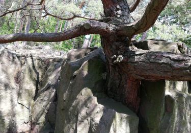
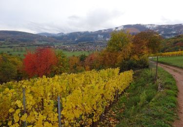
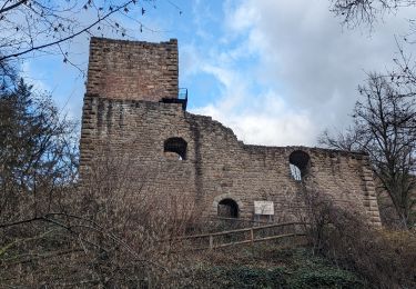
Tocht Stappen Vœgtlinshoffen - 2018 12 13 Voegtlinshoffen - Couvent St Marc - Photo

2018 12 13 Voegtlinshoffen - Couvent St Marc

 E.BURCK
E.BURCK

Gebruiker

© OpenStreetMap contributors
Lengte
Lengte
11,1 km
Max. hoogte
Max. hoogte
576 m
Positief hoogteverschil
368 m
Km-Effort
Km-Effort  
16 km
Min. hoogte
Min. hoogte
320 m
Negatief hoogteverschil
363 m
Boucle
Boucle
Ja
Datum van aanmaak :
2019-05-22 16:11:45.756
Laatste wijziging :
2019-12-18 14:43:04.182

(0 Bericht)

Stappen
Stappen
3h21
Moeilijkheid : Medium

Scan deze QR-code om de tocht te openen in de SityTrail-applicatie

Gratisgps-wandelapplicatie

Logo SityTrail SityTrail

IGN / Geografische instituten

SityTrail uit de App Store downloaden SityTrail uit Google Play downloaden

Logo SityTrail SityTrail World

De wereld gaat voor u open

SityTrail uit de App Store downloaden SityTrail uit Google Play downloaden SityTrail op Huawei AppGallery downloaden

Over ons

Tocht Stappen van 11,1 km beschikbaar op Grand Est, Haut-Rhin, Vœgtlinshoffen. Deze tocht wordt voorgesteld door E.BURCK.

Beschrijving

320 m de dénivelé et 11.2 km. Voegtlinshoffen pour aller manger au couvent St Marc.

ACCÈS :  
- Voegtlinshoffen.
- Par la RN 83 direction Rouffach.
- soit par Gueberschwihr direction Voegtlinshoffen, la salle est à droite l'entrée du Village.
- soit par Obermorschwihr vers Voegtlinshoffen direction Gueberschwihr, la salle est à gauche à la sortie du village.
             
PARKING de la salle polyvalente, rue du Hatschbourg à Voegtlinshoffen.
48.018494,  7.282152
ou N 48°01'07", E 007°16'56"            
               
RESTAURATION :  
Restauration au couvent St Marc.  Gueberschwihr.
Tél: 03 89 49 31 01

Hoogteprofiel

Plaatsbepaling

Land:
France
Regio :
Grand Est
Departement/Provincie :
Haut-Rhin
Gemeente :
Vœgtlinshoffen
Locatie:
Unknown
Vertrek:(Dec)
Vertrek:(UTM)
371908 ; 5319768 (32U) N.

Wandeltochten in de omgeving

Tocht Stappen Wettolsheim - 4 châteaux Wettolsheim Husseren - Photo
Stappen
apa

Stappen

Medium
(1)
Wettolsheim, Grand Est, Haut-Rhin, France
11,7 km | 17,7 km-effort
4h 28min
Neen
Tocht Stappen Osenbach - Osenbach - Sentier des Sols - Photo
Stappen
gscheven

Stappen

Gemakkelijk
(1)
Osenbach, Grand Est, Haut-Rhin, France
4,7 km | 6,6 km-effort
3h 0min
Ja
Tocht Stappen Eguisheim - suuntoapp-Hiking-2023-12-29T09-05-16Z - Photo
Stappen
GUIDE
holtzv

Stappen

Medium
Eguisheim, Grand Est, Haut-Rhin, France
22 km | 32 km-effort
7h 16min
Ja
Tocht Stappen Pfaffenheim - Schauenberg 1 - Photo
Stappen
regisbodilis

Stappen

Gemakkelijk
(1)
Pfaffenheim, Grand Est, Haut-Rhin, France
10,3 km | 16,5 km-effort
3h 30min
Ja
Tocht Stappen Eguisheim - SityTrail - 2709807 - eguisheim-husseren-les-chateux- - Photo
Stappen
ABICHE

Stappen

Medium
(1)
Eguisheim, Grand Est, Haut-Rhin, France
8,4 km | 11,5 km-effort
2h 37min
Ja
Tocht Stappen Pfaffenheim - Marche TL 10/2024 - Parking Chataignier- ND du Schauenburg-Rocher du Coucou-Carrières de Gueberschwihr-Sentier de découvertes- Taverne médiévale-Chapelle St Léonard et retour - Photo
Stappen
patrickbeyrath

Stappen

Moeilijk
(1)
Pfaffenheim, Grand Est, Haut-Rhin, France
8,5 km | 12,5 km-effort
2h 50min
Ja
Tocht Stappen Gueberschwihr - Gueberschwihr - Voegtlinshoffen - N.-D. de Schauenberg - Pfaffenheim - Photo
Stappen
Bart2015

Stappen

Moeilijk
Gueberschwihr, Grand Est, Haut-Rhin, France
13,1 km | 18,9 km-effort
4h 17min
Ja
Tocht Stappen Wintzenheim - Reco Rando du CLAS du 18/07/2024. par PBo - Photo
Stappen
boubou68

Stappen

Zeer moeilijk
(1)
Wintzenheim, Grand Est, Haut-Rhin, France
18,9 km | 27 km-effort
4h 43min
Ja
Tocht Stappen Husseren-les-Châteaux - Husseren les Châteaux - Photo
Stappen
oscar1

Stappen

Gemakkelijk
Husseren-les-Châteaux, Grand Est, Haut-Rhin, France
12,7 km | 19,1 km-effort
3h 24min
Ja


Sluiten
Mijn abonnementen