![](/images/other/stat-length.png)
![Tocht Stappen Montfaucon - La croix de Montfaucon - Photo](https://media.geolcdn.com/t/1900/400/ext.pjpeg?maxdim=2&url=https%3A%2F%2Fservices.sitytrail.com%2FGeolivesWS%2FDownloadMedia.ashx%3FTrailID%3D108364%26Media%3D1040_2.jpg)
La croix de Montfaucon
tracegps
Gebruiker
![Lengte](/images/other/stat-length.png)
Lengte
14,7 km
![Max. hoogte](https://static1.geolcdn.com/siteimages/upload/files/1508320355ic_sort_altitude_max_24dp.png)
Max. hoogte
216 m
![Positief hoogteverschil](https://static1.geolcdn.com/siteimages/upload/files/1508320355ic_sort_den_pos_24dp.png)
Positief hoogteverschil
228 m
![Km-Effort](/images/other/stat-length.png)
Km-Effort
17,8 km
![Min. hoogte](https://static1.geolcdn.com/siteimages/upload/files/1508320355ic_sort_altitude_min_24dp.png)
Min. hoogte
132 m
![Negatief hoogteverschil](https://static1.geolcdn.com/siteimages/upload/files/1508320355ic_sort_den_neg_24dp.png)
Negatief hoogteverschil
226 m
![Boucle](https://static1.geolcdn.com/siteimages/upload/files/16400158638029165_repeat_loop_refresh_sync_direction_icon.png)
Boucle
Ja
Datum van aanmaak :
2014-12-10 00:00:00.0
Laatste wijziging :
2014-12-10 00:00:00.0
![Stappen](https://static1.geolcdn.com/sitytour/trail-icons/101.png)
3h45
Moeilijkheid : Zeer moeilijk
![Scan deze QR-code om de tocht te openen in de SityTrail-applicatie](https://capi.geolives.com/qq0zvz2zws4bq2lad0pu/sitytour/trails/108364/qr.png?size=200)
Gratisgps-wandelapplicatie
Over ons
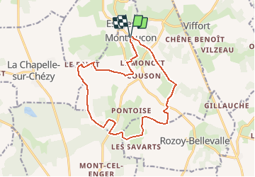
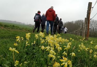
Tocht Stappen van 14,7 km beschikbaar op Hauts-de-France, Aisne, Montfaucon. Deze tocht wordt voorgesteld door tracegps.
Beschrijving
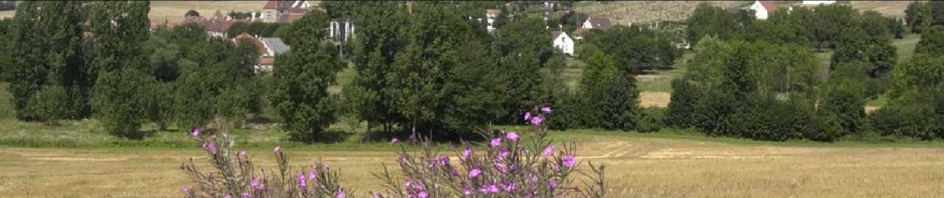
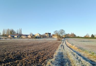
La géographie éclatée de Montfaucon, dans la vallée du Dolloir, confère à ce parcours une ambiance champêtre, avec une sensation d'isolement propice à la rêverie. Toutes les infos sont ICI
Plaatsbepaling
Land:
France
Regio :
Hauts-de-France
Departement/Provincie :
Aisne
Gemeente :
Montfaucon
Locatie:
Unknown
Vertrek:(Dec)
Vertrek:(UTM)
531097 ; 5422748 (31U) N.
Opmerkingen
Wandeltochten in de omgeving
![Tocht Stappen Chézy-sur-Marne - CHEZY 090125 - Photo](https://media.geolcdn.com/t/375/260/098b0d85-ebf4-4a2f-b279-cb16b4216acf.jpg&format=jpg&maxdim=2)
![Stappen Stappen](https://static1.geolcdn.com/sitytour/trail-icons/101.png)
CHEZY 090125
Stappen
Moeilijk
(1)
Chézy-sur-Marne,
Hauts-de-France,
Aisne,
France
![](/images/other/stat-length.png)
11,1 km | 13,3 km-effort
3h 1min
![](https://static1.geolcdn.com/siteimages/upload/files/16400158638029165_repeat_loop_refresh_sync_direction_icon.png)
Ja
![Tocht Stappen Chézy-sur-Marne - Les grenadiers de la Garde - Photo](https://media.geolcdn.com/t/375/260/ext.jpg?maxdim=2&url=https%3A%2F%2Fservices.sitytrail.com%2FGeolivesWS%2FDownloadMedia.ashx%3FTrailID%3D108363%26Media%3D1039_2.jpg)
![Stappen Stappen](https://static1.geolcdn.com/sitytour/trail-icons/101.png)
Les grenadiers de la Garde
Stappen
Zeer moeilijk
(1)
Chézy-sur-Marne,
Hauts-de-France,
Aisne,
France
![](/images/other/stat-length.png)
14,8 km | 18,8 km-effort
4h 30min
![](https://static1.geolcdn.com/siteimages/upload/files/16400158638029165_repeat_loop_refresh_sync_direction_icon.png)
Ja
![Tocht Te voet Chézy-sur-Marne - CHEZY / MARNE VERSION 21 KM FINAL - Photo](https://media.geolcdn.com/t/375/260/ext.jpg?maxdim=2&url=https%3A%2F%2Fstatic1.geolcdn.com%2Fsiteimages%2Fupload%2Ffiles%2F1545311037marcheuse_200dpi.jpg)
![Te voet Te voet](https://static1.geolcdn.com/sitytour/trail-icons/100.png)
CHEZY / MARNE VERSION 21 KM FINAL
Te voet
Medium
(1)
Chézy-sur-Marne,
Hauts-de-France,
Aisne,
France
![](/images/other/stat-length.png)
21 km | 27 km-effort
6h 2min
![](https://static1.geolcdn.com/siteimages/upload/files/16400158638029165_repeat_loop_refresh_sync_direction_icon.png)
Ja
![Tocht Stappen Dhuys et Morin-en-Brie - Fontenelle-en-Brie du 12-01-2022 - Photo](https://media.geolcdn.com/t/375/260/64e24db2-5b70-4c81-a4d4-125398f586f3.jpg&format=jpg&maxdim=2)
![Stappen Stappen](https://static1.geolcdn.com/sitytour/trail-icons/101.png)
Fontenelle-en-Brie du 12-01-2022
Stappen
Medium
Dhuys et Morin-en-Brie,
Hauts-de-France,
Aisne,
France
![](/images/other/stat-length.png)
11,1 km | 12,5 km-effort
2h 35min
![](https://static1.geolcdn.com/siteimages/upload/files/16400158638029165_repeat_loop_refresh_sync_direction_icon.png)
Ja
![Tocht Stappen Azy-sur-Marne - BONNEIL - Photo](https://media.geolcdn.com/t/375/260/ext.jpg?maxdim=2&url=https%3A%2F%2Fstatic1.geolcdn.com%2Fsiteimages%2Fupload%2Ffiles%2F1553511878bg_sport_marche.png)
![Stappen Stappen](https://static1.geolcdn.com/sitytour/trail-icons/101.png)
BONNEIL
Stappen
Medium
(1)
Azy-sur-Marne,
Hauts-de-France,
Aisne,
France
![](/images/other/stat-length.png)
8,7 km | 10,8 km-effort
2h 21min
![](https://static1.geolcdn.com/siteimages/upload/files/16400158638029165_repeat_loop_refresh_sync_direction_icon.png)
Ja
![Tocht Stappen Azy-sur-Marne - La corniche d'Azy - Photo](https://media.geolcdn.com/t/375/260/ext.jpg?maxdim=2&url=https%3A%2F%2Fservices.sitytrail.com%2FGeolivesWS%2FDownloadMedia.ashx%3FTrailID%3D202820%26Media%3Dba605bfc-351c-41c6-aa51-b89ab3123535.jpg)
![Stappen Stappen](https://static1.geolcdn.com/sitytour/trail-icons/101.png)
La corniche d'Azy
Stappen
Heel gemakkelijk
Azy-sur-Marne,
Hauts-de-France,
Aisne,
France
![](/images/other/stat-length.png)
10,6 km | 14,2 km-effort
Onbekend
![](https://static1.geolcdn.com/siteimages/upload/files/16400158638029165_repeat_loop_refresh_sync_direction_icon.png)
Ja
![Tocht Stappen Dhuys et Morin-en-Brie - Fontenelle en Brie du 25-01-2024 - Photo](https://media.geolcdn.com/t/375/260/88209a05-4218-4d0c-ad09-4d63cf620c86.jpg&format=jpg&maxdim=2)
![Stappen Stappen](https://static1.geolcdn.com/sitytour/trail-icons/101.png)
Fontenelle en Brie du 25-01-2024
Stappen
Medium
Dhuys et Morin-en-Brie,
Hauts-de-France,
Aisne,
France
![](/images/other/stat-length.png)
10,2 km | 11,3 km-effort
2h 33min
![](https://static1.geolcdn.com/siteimages/upload/files/16400158638029165_repeat_loop_refresh_sync_direction_icon.png)
Ja
![Tocht Stappen Chézy-sur-Marne - Chézy-sur-Marne du 19/04/2023 - Photo](https://media.geolcdn.com/t/375/260/00e260b2-1ffe-438f-8665-828b73e38bd9.jpg&format=jpg&maxdim=2)
![Stappen Stappen](https://static1.geolcdn.com/sitytour/trail-icons/101.png)
Chézy-sur-Marne du 19/04/2023
Stappen
Moeilijk
Chézy-sur-Marne,
Hauts-de-France,
Aisne,
France
![](/images/other/stat-length.png)
12,5 km | 15,1 km-effort
3h 25min
![](https://static1.geolcdn.com/siteimages/upload/files/16400158638029165_repeat_loop_refresh_sync_direction_icon.png)
Ja
![Tocht Stappen Viffort - Viffort du 05-04-2022 - Photo](https://media.geolcdn.com/t/375/260/6a38da00-6e8c-4851-ae5a-5c03310e8c57.jpg&format=jpg&maxdim=2)
![Stappen Stappen](https://static1.geolcdn.com/sitytour/trail-icons/101.png)
Viffort du 05-04-2022
Stappen
Medium
Viffort,
Hauts-de-France,
Aisne,
France
![](/images/other/stat-length.png)
10,1 km | 11,6 km-effort
2h 11min
![](https://static1.geolcdn.com/siteimages/upload/files/16400158638029165_repeat_loop_refresh_sync_direction_icon.png)
Ja
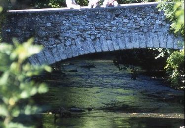
Cette jolie randonnée n'a rien de très difficile je la classerai difficile tout au plus, les seules difficultés résident dans le franchissement du ru de champ de faye et de celui de la Madeleine. Les franchissements se font par des gués donc inaccessibles en périodes humides.