![](/images/other/stat-length.png)
![Tocht Stappen Reuilly-Sauvigny - Fables et Champagne 3 - Photo](https://media.geolcdn.com/t/1900/400/ext.pjpeg?maxdim=2&url=https%3A%2F%2Fstatic1.geolcdn.com%2Fsiteimages%2Fupload%2Ffiles%2F1553511878bg_sport_marche.png)
Fables et Champagne 3
tracegps
Gebruiker
![Lengte](/images/other/stat-length.png)
![Max. hoogte](https://static1.geolcdn.com/siteimages/upload/files/1508320355ic_sort_altitude_max_24dp.png)
![Positief hoogteverschil](https://static1.geolcdn.com/siteimages/upload/files/1508320355ic_sort_den_pos_24dp.png)
![Km-Effort](/images/other/stat-length.png)
![Min. hoogte](https://static1.geolcdn.com/siteimages/upload/files/1508320355ic_sort_altitude_min_24dp.png)
![Negatief hoogteverschil](https://static1.geolcdn.com/siteimages/upload/files/1508320355ic_sort_den_neg_24dp.png)
![Boucle](https://static1.geolcdn.com/siteimages/upload/files/16400158638029165_repeat_loop_refresh_sync_direction_icon.png)
![Stappen](https://static1.geolcdn.com/sitytour/trail-icons/101.png)
6h30
Moeilijkheid : Zeer moeilijk
![Scan deze QR-code om de tocht te openen in de SityTrail-applicatie](https://capi.geolives.com/qq0zvz2zws4bq2lad0pu/sitytour/trails/108351/qr.png?size=200)
Gratisgps-wandelapplicatie
Over ons
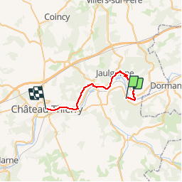
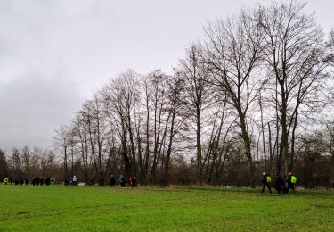
Tocht Stappen van 23 km beschikbaar op Hauts-de-France, Aisne, Reuilly-Sauvigny. Deze tocht wordt voorgesteld door tracegps.
Beschrijving
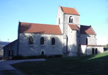
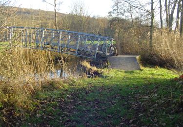
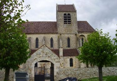
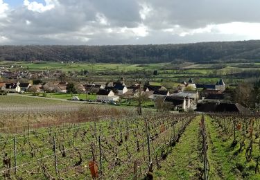
Un itinéraire d'eaux ruisselantes et de vins pétillants sur les traces de Jean de La Fontaine. Ce dernier était bon marcheur et de tempérament spirituel. On peut deviner qu'il trouva dans les pas bucoliques de sa charge forestière l'inspiration de bon nombre de ses vers. Jalonné de villages bien conservés (habitat en pierre meulière, églises, fontaines, lavoirs) et de caves à champagne, ce circuit peut être saisi d'un seul regard depuis le mémorial américain de la cote 204. En trois jours, on remonte les vallées viticoles de la Marne et du Surmelin, bénéficiant de larges vues sur les effets de relief du paysage. Toutes les infos sont ICI
Plaatsbepaling
Opmerkingen
Wandeltochten in de omgeving
![Tocht Stappen Mont-Saint-Père - Le coteau des orchidées - Photo](https://media.geolcdn.com/t/375/260/ext.jpg?maxdim=2&url=https%3A%2F%2Fservices.sitytrail.com%2FGeolivesWS%2FDownloadMedia.ashx%3FTrailID%3D108165%26Media%3D565_1.jpg)
![Stappen Stappen](https://static1.geolcdn.com/sitytour/trail-icons/101.png)
Stappen
![](/images/other/stat-length.png)
![](https://static1.geolcdn.com/siteimages/upload/files/16400158638029165_repeat_loop_refresh_sync_direction_icon.png)
![Tocht Stappen Jaulgonne - GR15 de Jaulgonne à Château du 29/01/2025 - Photo](https://media.geolcdn.com/t/375/260/da85ecf8-5aa6-4eea-a458-ccaed6b8a68d.jpg&format=jpg&maxdim=2)
![Stappen Stappen](https://static1.geolcdn.com/sitytour/trail-icons/101.png)
Stappen
![](/images/other/stat-length.png)
![](https://static1.geolcdn.com/siteimages/upload/files/16400158638029165_repeat_loop_refresh_sync_direction_icon.png)
![Tocht Stappen Mont-Saint-Père - Mont st Père - Bonneil par le GR15 du 16-04-2024 - Photo](https://media.geolcdn.com/t/375/260/105504aa-0c76-40c2-8c92-e2efde603871.jpg&format=jpg&maxdim=2)
![Stappen Stappen](https://static1.geolcdn.com/sitytour/trail-icons/101.png)
Stappen
![](/images/other/stat-length.png)
![](https://static1.geolcdn.com/siteimages/upload/files/16400158638029165_repeat_loop_refresh_sync_direction_icon.png)
![Stappen Stappen](https://static1.geolcdn.com/sitytour/trail-icons/101.png)
Stappen
![](/images/other/stat-length.png)
![](https://static1.geolcdn.com/siteimages/upload/files/16400158638029165_repeat_loop_refresh_sync_direction_icon.png)
![Tocht Stappen Mézy-Moulins - La rose sur la Marne - Photo](https://media.geolcdn.com/t/375/260/ext.jpg?maxdim=2&url=https%3A%2F%2Fservices.sitytrail.com%2FGeolivesWS%2FDownloadMedia.ashx%3FTrailID%3D202825%26Media%3Dc61eb99f-ad58-4cc0-bbd2-e88dc7ec2188.jpg)
![Stappen Stappen](https://static1.geolcdn.com/sitytour/trail-icons/101.png)
Stappen
![](/images/other/stat-length.png)
![](https://static1.geolcdn.com/siteimages/upload/files/16400158638029165_repeat_loop_refresh_sync_direction_icon.png)
![Tocht Mountainbike Mont-Saint-Père - Vallée du Surmelin - Mont Saint Père - Photo](https://media.geolcdn.com/t/375/260/ext.jpg?maxdim=2&url=https%3A%2F%2Fservices.sitytrail.com%2FGeolivesWS%2FDownloadMedia.ashx%3FTrailID%3D104119%26Media%3D7189_4.jpg)
![Mountainbike Mountainbike](https://static1.geolcdn.com/sitytour/trail-icons/202.png)
Mountainbike
![](/images/other/stat-length.png)
![](https://static1.geolcdn.com/siteimages/upload/files/16400158638029165_repeat_loop_refresh_sync_direction_icon.png)
![Tocht Stappen Mézy-Moulins - Mézy-Moulins Rando-Santé du 26-04-2024 - Photo](https://media.geolcdn.com/t/375/260/20922d8e-9cb8-4b7f-acf9-96f8a9bdbdfa.jpg&format=jpg&maxdim=2)
![Stappen Stappen](https://static1.geolcdn.com/sitytour/trail-icons/101.png)
Stappen
![](/images/other/stat-length.png)
![](https://static1.geolcdn.com/siteimages/upload/files/16400158638029165_repeat_loop_refresh_sync_direction_icon.png)
![Tocht Stappen Mont-Saint-Père - Mont St Père du 23-01-2024 - Photo](https://media.geolcdn.com/t/375/260/362b147d-76e2-4427-a864-3c6d3a7f4e98.jpg&format=jpg&maxdim=2)
![Stappen Stappen](https://static1.geolcdn.com/sitytour/trail-icons/101.png)
Stappen
![](/images/other/stat-length.png)
![](https://static1.geolcdn.com/siteimages/upload/files/16400158638029165_repeat_loop_refresh_sync_direction_icon.png)
![Tocht Stappen Passy-sur-Marne - Passy-sur-Marne du 25/03/2023 - Photo](https://media.geolcdn.com/t/375/260/d71e5d91-9e40-419a-8c75-ceade166f501.jpg&format=jpg&maxdim=2)
![Stappen Stappen](https://static1.geolcdn.com/sitytour/trail-icons/101.png)
Stappen
![](/images/other/stat-length.png)
![](https://static1.geolcdn.com/siteimages/upload/files/16400158638029165_repeat_loop_refresh_sync_direction_icon.png)