![](/images/other/stat-length.png)
![Tocht Paard Saint-Pierre-de-Rivière - St Pierre de Rivière - St Martin de Caralp - Photo](https://media.geolcdn.com/t/1900/400/ext.pjpeg?maxdim=2&url=https%3A%2F%2Fservices.sitytrail.com%2FGeolivesWS%2FDownloadMedia.ashx%3FTrailID%3D108265%26Media%3D907_1.jpg)
St Pierre de Rivière - St Martin de Caralp
tracegps
Gebruiker
![Lengte](/images/other/stat-length.png)
Lengte
8,9 km
![Max. hoogte](https://static1.geolcdn.com/siteimages/upload/files/1508320355ic_sort_altitude_max_24dp.png)
Max. hoogte
732 m
![Positief hoogteverschil](https://static1.geolcdn.com/siteimages/upload/files/1508320355ic_sort_den_pos_24dp.png)
Positief hoogteverschil
419 m
![Km-Effort](/images/other/stat-length.png)
Km-Effort
14 km
![Min. hoogte](https://static1.geolcdn.com/siteimages/upload/files/1508320355ic_sort_altitude_min_24dp.png)
Min. hoogte
480 m
![Negatief hoogteverschil](https://static1.geolcdn.com/siteimages/upload/files/1508320355ic_sort_den_neg_24dp.png)
Negatief hoogteverschil
285 m
![Boucle](https://static1.geolcdn.com/siteimages/upload/files/16400158638029165_repeat_loop_refresh_sync_direction_icon.png)
Boucle
Neen
Datum van aanmaak :
2014-12-10 00:00:00.0
Laatste wijziging :
2014-12-10 00:00:00.0
![Paard](https://static1.geolcdn.com/sitytour/trail-icons/300.png)
1h00
Moeilijkheid : Medium
![Scan deze QR-code om de tocht te openen in de SityTrail-applicatie](https://capi.geolives.com/qq0zvz2zws4bq2lad0pu/sitytour/trails/108265/qr.png?size=200)
Gratisgps-wandelapplicatie
Over ons
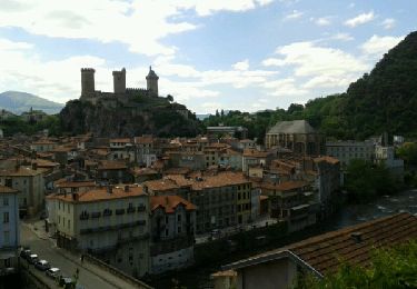
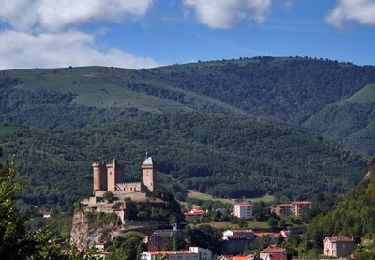
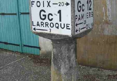
Tocht Paard van 8,9 km beschikbaar op Occitanië, Ariège, Saint-Pierre-de-Rivière. Deze tocht wordt voorgesteld door tracegps.
Beschrijving
Balade proposée par le Bureau des Guides Équestres Transpyrénéens Toutes les randonnées équestres dans les Pyrénées Sans Frontières à Cheval
Plaatsbepaling
Land:
France
Regio :
Occitanië
Departement/Provincie :
Ariège
Gemeente :
Saint-Pierre-de-Rivière
Locatie:
Unknown
Vertrek:(Dec)
Vertrek:(UTM)
382152 ; 4757794 (31T) N.
Opmerkingen
Wandeltochten in de omgeving
![Tocht Stappen Prayols - Cuminge - Photo](https://media.geolcdn.com/t/375/260/ext.jpg?maxdim=2&url=https%3A%2F%2Fstatic1.geolcdn.com%2Fsiteimages%2Fupload%2Ffiles%2F1553511878bg_sport_marche.png)
![Stappen Stappen](https://static1.geolcdn.com/sitytour/trail-icons/101.png)
Cuminge
Stappen
Gemakkelijk
(1)
Prayols,
Occitanië,
Ariège,
France
![](/images/other/stat-length.png)
3,5 km | 6,1 km-effort
1h 0min
![](https://static1.geolcdn.com/siteimages/upload/files/16400158638029165_repeat_loop_refresh_sync_direction_icon.png)
Ja
![Tocht Te voet Brassac - Le Picou depuis Brassac - Photo](https://media.geolcdn.com/t/375/260/22e65925-2aed-45df-a24b-d9dbd1aee596.jpeg&format=jpg&maxdim=2)
![Te voet Te voet](https://static1.geolcdn.com/sitytour/trail-icons/100.png)
Le Picou depuis Brassac
Te voet
Gemakkelijk
Brassac,
Occitanië,
Ariège,
France
![](/images/other/stat-length.png)
5 km | 14,7 km-effort
3h 20min
![](https://static1.geolcdn.com/siteimages/upload/files/16400158638029165_repeat_loop_refresh_sync_direction_icon.png)
Neen
![Tocht Stappen Foix - 01 - FOIX à ROQUEFIXADE - Chemin des Bons-Hommes GR107 GR367 - Photo](https://media.geolcdn.com/t/375/260/ext.jpg?maxdim=2&url=https%3A%2F%2Fservices.sitytrail.com%2FGeolivesWS%2FDownloadMedia.ashx%3FTrailID%3D576319%26Media%3Dfix__20160507165235.jpg)
![Stappen Stappen](https://static1.geolcdn.com/sitytour/trail-icons/101.png)
01 - FOIX à ROQUEFIXADE - Chemin des Bons-Hommes GR107 GR367
Stappen
Moeilijk
Foix,
Occitanië,
Ariège,
France
![](/images/other/stat-length.png)
18,6 km | 30 km-effort
6h 36min
![](https://static1.geolcdn.com/siteimages/upload/files/16400158638029165_repeat_loop_refresh_sync_direction_icon.png)
Neen
![Tocht Stappen Foix - pech de foix - Photo](https://media.geolcdn.com/t/375/260/ext.jpg?maxdim=2&url=https%3A%2F%2Fservices.sitytrail.com%2FGeolivesWS%2FDownloadMedia.ashx%3FTrailID%3D302514%26Media%3Dfix__20140517151247.jpg)
![Stappen Stappen](https://static1.geolcdn.com/sitytour/trail-icons/101.png)
pech de foix
Stappen
Heel gemakkelijk
(1)
Foix,
Occitanië,
Ariège,
France
![](/images/other/stat-length.png)
7,5 km | 13,6 km-effort
3h 43min
![](https://static1.geolcdn.com/siteimages/upload/files/16400158638029165_repeat_loop_refresh_sync_direction_icon.png)
Ja
![Tocht Fiets Foix - A vélo en Basse Ariège - Foix - Photo](https://media.geolcdn.com/t/375/260/ext.jpg?maxdim=2&url=https%3A%2F%2Fservices.sitytrail.com%2FGeolivesWS%2FDownloadMedia.ashx%3FTrailID%3D215209%26Media%3D15823_6.jpg)
![Fiets Fiets](https://static1.geolcdn.com/sitytour/trail-icons/200.png)
A vélo en Basse Ariège - Foix
Fiets
Medium
Foix,
Occitanië,
Ariège,
France
![](/images/other/stat-length.png)
97 km | 111 km-effort
4h 49min
![](https://static1.geolcdn.com/siteimages/upload/files/16400158638029165_repeat_loop_refresh_sync_direction_icon.png)
Ja
![Tocht Fiets Foix - Port de Lers - Foix - Photo](https://media.geolcdn.com/t/375/260/ext.jpg?maxdim=2&url=https%3A%2F%2Fservices.sitytrail.com%2FGeolivesWS%2FDownloadMedia.ashx%3FTrailID%3D214964%26Media%3D15533_3.jpg)
![Fiets Fiets](https://static1.geolcdn.com/sitytour/trail-icons/200.png)
Port de Lers - Foix
Fiets
Moeilijk
Foix,
Occitanië,
Ariège,
France
![](/images/other/stat-length.png)
115 km | 152 km-effort
6h 7min
![](https://static1.geolcdn.com/siteimages/upload/files/16400158638029165_repeat_loop_refresh_sync_direction_icon.png)
Ja
![Tocht Fiets Foix - De Foix au lac de Montbel - Photo](https://media.geolcdn.com/t/375/260/ext.jpg?maxdim=2&url=https%3A%2F%2Fservices.sitytrail.com%2FGeolivesWS%2FDownloadMedia.ashx%3FTrailID%3D173108%26Media%3D14657_6.jpg)
![Fiets Fiets](https://static1.geolcdn.com/sitytour/trail-icons/200.png)
De Foix au lac de Montbel
Fiets
Moeilijk
Foix,
Occitanië,
Ariège,
France
![](/images/other/stat-length.png)
104 km | 124 km-effort
5h 0min
![](https://static1.geolcdn.com/siteimages/upload/files/16400158638029165_repeat_loop_refresh_sync_direction_icon.png)
Ja
![Tocht Fiets Foix - Sortie cyclo vers Mirepoix - Photo](https://media.geolcdn.com/t/375/260/ext.jpg?maxdim=2&url=https%3A%2F%2Fservices.sitytrail.com%2FGeolivesWS%2FDownloadMedia.ashx%3FTrailID%3D136884%26Media%3D13554_6.jpg)
![Fiets Fiets](https://static1.geolcdn.com/sitytour/trail-icons/200.png)
Sortie cyclo vers Mirepoix
Fiets
Medium
Foix,
Occitanië,
Ariège,
France
![](/images/other/stat-length.png)
81 km | 94 km-effort
3h 4min
![](https://static1.geolcdn.com/siteimages/upload/files/16400158638029165_repeat_loop_refresh_sync_direction_icon.png)
Ja
![Tocht Fiets Foix - De Foix à Montségur - Photo](https://media.geolcdn.com/t/375/260/ext.jpg?maxdim=2&url=https%3A%2F%2Fservices.sitytrail.com%2FGeolivesWS%2FDownloadMedia.ashx%3FTrailID%3D118791%26Media%3D12998_5.jpg)
![Fiets Fiets](https://static1.geolcdn.com/sitytour/trail-icons/200.png)
De Foix à Montségur
Fiets
Moeilijk
Foix,
Occitanië,
Ariège,
France
![](/images/other/stat-length.png)
87 km | 109 km-effort
4h 13min
![](https://static1.geolcdn.com/siteimages/upload/files/16400158638029165_repeat_loop_refresh_sync_direction_icon.png)
Ja