![](/images/other/stat-length.png)
Ballade 24 2018
jpipacific
Gebruiker
![Lengte](/images/other/stat-length.png)
![Max. hoogte](https://static1.geolcdn.com/siteimages/upload/files/1508320355ic_sort_altitude_max_24dp.png)
![Positief hoogteverschil](https://static1.geolcdn.com/siteimages/upload/files/1508320355ic_sort_den_pos_24dp.png)
![Km-Effort](/images/other/stat-length.png)
![Min. hoogte](https://static1.geolcdn.com/siteimages/upload/files/1508320355ic_sort_altitude_min_24dp.png)
![Negatief hoogteverschil](https://static1.geolcdn.com/siteimages/upload/files/1508320355ic_sort_den_neg_24dp.png)
![Boucle](https://static1.geolcdn.com/siteimages/upload/files/16400158638029165_repeat_loop_refresh_sync_direction_icon.png)
![Moto-cross](https://static1.geolcdn.com/sitytour/trail-icons/406.png)
3h30
Moeilijkheid : Medium
![Scan deze QR-code om de tocht te openen in de SityTrail-applicatie](https://capi.geolives.com/qq0zvz2zws4bq2lad0pu/sitytour/trails/1077199/qr.png?size=200)
Gratisgps-wandelapplicatie
Over ons
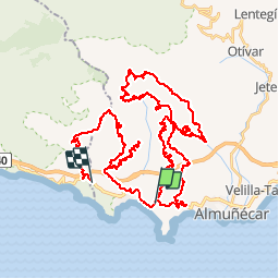
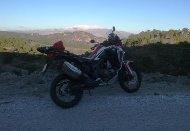
Tocht Moto-cross van 71 km beschikbaar op Andalusië, Granada, Almuñécar. Deze tocht wordt voorgesteld door jpipacific.
Beschrijving
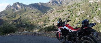
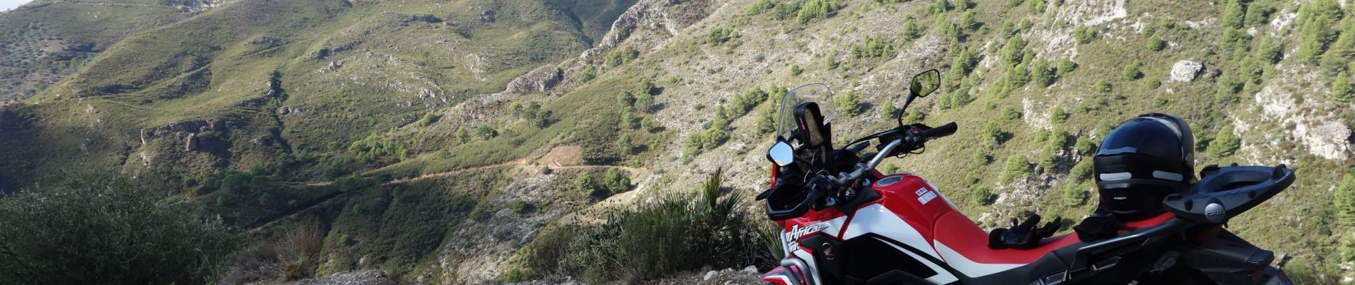
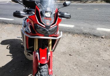
Faite le 26 nov 2018 . Africa Twin CRF 1000.
Très jolie randonnée.Je l'ai faite après de fortes pluies mais avec les Continental TKC 70 il n'y a pas eu de problème. Le faible kilométrage prend du temps car la progression est lente même sur les parties goudronnées car ça tourne beaucoup.
POI's
Plaatsbepaling
Opmerkingen
Wandeltochten in de omgeving
![Moto-cross Moto-cross](https://static1.geolcdn.com/sitytour/trail-icons/406.png)
Moto-cross
![](/images/other/stat-length.png)
![](https://static1.geolcdn.com/siteimages/upload/files/16400158638029165_repeat_loop_refresh_sync_direction_icon.png)
![Moto-cross Moto-cross](https://static1.geolcdn.com/sitytour/trail-icons/406.png)
Moto-cross
![](/images/other/stat-length.png)
![](https://static1.geolcdn.com/siteimages/upload/files/16400158638029165_repeat_loop_refresh_sync_direction_icon.png)
![Tocht Moto-cross Almuñécar - Wikiloc - CIRCULAR ANTENAS DE LUJAR con JEAN PIERRE Embalse de Rules et Puente de Rufino sobre el Rio Guadalfeo depuis La Herradura - Photo](https://media.geolcdn.com/t/375/260/43b4eeeb-d8f1-4903-9cb1-d5aa368183a6.jpg&format=jpg&maxdim=2)
![Moto-cross Moto-cross](https://static1.geolcdn.com/sitytour/trail-icons/406.png)
Moto-cross
![](/images/other/stat-length.png)
![](https://static1.geolcdn.com/siteimages/upload/files/16400158638029165_repeat_loop_refresh_sync_direction_icon.png)
![Tocht Moto-cross Almuñécar - Priego de Córdoba - Photo](https://media.geolcdn.com/t/375/260/df831d7f-fcc7-4297-8987-fd383337b3f4.jpg&format=jpg&maxdim=2)
![Moto-cross Moto-cross](https://static1.geolcdn.com/sitytour/trail-icons/406.png)
Moto-cross
![](/images/other/stat-length.png)
![](https://static1.geolcdn.com/siteimages/upload/files/16400158638029165_repeat_loop_refresh_sync_direction_icon.png)
![Tocht Moto-cross Almuñécar - Sierra de los Guejares - Photo](https://media.geolcdn.com/t/375/260/d63dc761-686a-48df-ad61-1c74397cdee4.png&format=jpg&maxdim=2)
![Moto-cross Moto-cross](https://static1.geolcdn.com/sitytour/trail-icons/406.png)
Moto-cross
![](/images/other/stat-length.png)
![](https://static1.geolcdn.com/siteimages/upload/files/16400158638029165_repeat_loop_refresh_sync_direction_icon.png)
![Tocht Stappen Nerja - Montes Cerro Caleta - Photo](https://media.geolcdn.com/t/375/260/42a3f5e5-5c24-48a4-92ae-1b1aa382f506.jpg&format=jpg&maxdim=2)
![Stappen Stappen](https://static1.geolcdn.com/sitytour/trail-icons/101.png)
Stappen
![](/images/other/stat-length.png)
![](https://static1.geolcdn.com/siteimages/upload/files/16400158638029165_repeat_loop_refresh_sync_direction_icon.png)
![Tocht Moto-cross Almuñécar - Rutas de Cabras y caminos de Guajar - Photo](https://media.geolcdn.com/t/375/260/82352ca5-494e-4583-b27b-37049f511f86.png&format=jpg&maxdim=2)
![Moto-cross Moto-cross](https://static1.geolcdn.com/sitytour/trail-icons/406.png)
Moto-cross
![](/images/other/stat-length.png)
![](https://static1.geolcdn.com/siteimages/upload/files/16400158638029165_repeat_loop_refresh_sync_direction_icon.png)
![Tocht Moto-cross Almuñécar - Wikiloc - Torviscón - La Calahorra- La Herradura - Photo](https://media.geolcdn.com/t/375/260/a7626166-1deb-4829-b07b-ddf9ada46c1a.jpg&format=jpg&maxdim=2)
![Moto-cross Moto-cross](https://static1.geolcdn.com/sitytour/trail-icons/406.png)
Moto-cross
![](/images/other/stat-length.png)
![](https://static1.geolcdn.com/siteimages/upload/files/16400158638029165_repeat_loop_refresh_sync_direction_icon.png)
![Tocht Stappen Almuñécar - Loja - Passerelle mirador de Karts - Ruta de Cabras - Photo](https://media.geolcdn.com/t/375/260/a657c34d-9834-4224-925e-48faa0c3cd5b.jpg&format=jpg&maxdim=2)
![Stappen Stappen](https://static1.geolcdn.com/sitytour/trail-icons/101.png)
Stappen
![](/images/other/stat-length.png)
![](https://static1.geolcdn.com/siteimages/upload/files/16400158638029165_repeat_loop_refresh_sync_direction_icon.png)