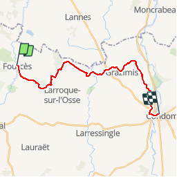
![](/images/other/stat-length.png)
![Tocht Stappen Fourcès - De Fources à Condom - Photo](https://media.geolcdn.com/t/1900/400/ext.pjpeg?maxdim=2&url=https%3A%2F%2Fstatic1.geolcdn.com%2Fsiteimages%2Fupload%2Ffiles%2F1553511878bg_sport_marche.png)
De Fources à Condom
tracegps
Gebruiker
![Lengte](/images/other/stat-length.png)
![Max. hoogte](https://static1.geolcdn.com/siteimages/upload/files/1508320355ic_sort_altitude_max_24dp.png)
![Positief hoogteverschil](https://static1.geolcdn.com/siteimages/upload/files/1508320355ic_sort_den_pos_24dp.png)
![Km-Effort](/images/other/stat-length.png)
![Min. hoogte](https://static1.geolcdn.com/siteimages/upload/files/1508320355ic_sort_altitude_min_24dp.png)
![Negatief hoogteverschil](https://static1.geolcdn.com/siteimages/upload/files/1508320355ic_sort_den_neg_24dp.png)
![Boucle](https://static1.geolcdn.com/siteimages/upload/files/16400158638029165_repeat_loop_refresh_sync_direction_icon.png)
![Stappen](https://static1.geolcdn.com/sitytour/trail-icons/101.png)
5h00
Moeilijkheid : Moeilijk
![Scan deze QR-code om de tocht te openen in de SityTrail-applicatie](https://capi.geolives.com/qq0zvz2zws4bq2lad0pu/sitytour/trails/107195/qr.png?size=200)
Gratisgps-wandelapplicatie
Over ons
Tocht Stappen van 21 km beschikbaar op Occitanië, Gers, Fourcès. Deze tocht wordt voorgesteld door tracegps.
Beschrijving
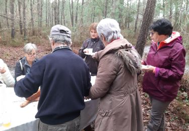
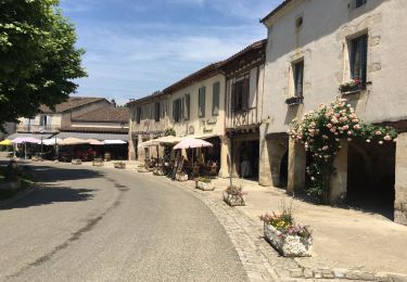
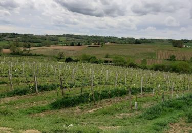
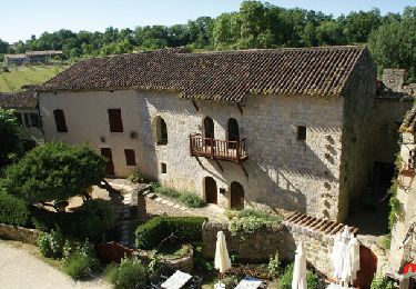
Départ au centre du village de Fources, village construit autour d’un château remplacé aujourd’hui par une place ombragée de platanes. C'est une originale bastide ronde dont les maisons créent un décor théâtral de colombages et d’arcades. Outre quelques délices gastronomiques incontournables en cette terre gasconne. Randonnée pour découvrir les beaux points de vue, des collines du Gers.
Plaatsbepaling
Opmerkingen
Wandeltochten in de omgeving
![Tocht Stappen Montréal - fources - Photo](https://media.geolcdn.com/t/375/260/ext.jpg?maxdim=2&url=https%3A%2F%2Fstatic1.geolcdn.com%2Fsiteimages%2Fupload%2Ffiles%2F1553511878bg_sport_marche.png)
![Stappen Stappen](https://static1.geolcdn.com/sitytour/trail-icons/101.png)
![Tocht Stappen Mézin - Tustem boucle - Photo](https://media.geolcdn.com/t/375/260/00d33605-6b44-4947-b49e-1690659a9cf2.jpg&format=jpg&maxdim=2)
![Stappen Stappen](https://static1.geolcdn.com/sitytour/trail-icons/101.png)
Stappen
![](/images/other/stat-length.png)
![](https://static1.geolcdn.com/siteimages/upload/files/16400158638029165_repeat_loop_refresh_sync_direction_icon.png)
![Stappen Stappen](https://static1.geolcdn.com/sitytour/trail-icons/101.png)
Stappen
![](/images/other/stat-length.png)
![](https://static1.geolcdn.com/siteimages/upload/files/16400158638029165_repeat_loop_refresh_sync_direction_icon.png)
![Tocht Elektrische fiets Montréal - 04-06-19 - Photo](https://media.geolcdn.com/t/375/260/823fbf2d-918d-4557-a071-da280458074a.jpg&format=jpg&maxdim=2)
![Elektrische fiets Elektrische fiets](https://static1.geolcdn.com/sitytour/trail-icons/205.png)
![Tocht Stappen Montréal - chemin de la Tenareze à Montréal du gers - Photo](https://media.geolcdn.com/t/375/260/eac716ae-b167-4abb-917d-988ca0115f30.jpg&format=jpg&maxdim=2)
![Stappen Stappen](https://static1.geolcdn.com/sitytour/trail-icons/101.png)
Stappen
![](/images/other/stat-length.png)
![](https://static1.geolcdn.com/siteimages/upload/files/16400158638029165_repeat_loop_refresh_sync_direction_icon.png)
![Tocht Fiets Montréal - Montréal - Fourcès - Larressingle - Photo](https://media.geolcdn.com/t/375/260/83486d4f-6345-4995-a2c8-47da1265dffe.jpg&format=jpg&maxdim=2)
![Fiets Fiets](https://static1.geolcdn.com/sitytour/trail-icons/200.png)
Fiets
![](/images/other/stat-length.png)
![](https://static1.geolcdn.com/siteimages/upload/files/16400158638029165_repeat_loop_refresh_sync_direction_icon.png)
![Tocht Mountainbike Montréal - Montréal du gers, eauze,aire sur adour, - Photo](https://media.geolcdn.com/t/375/260/f7f777b6-d8d1-4a2e-9f28-5bfb8d854863.jpg&format=jpg&maxdim=2)
![Mountainbike Mountainbike](https://static1.geolcdn.com/sitytour/trail-icons/202.png)
Mountainbike
![](/images/other/stat-length.png)
![](https://static1.geolcdn.com/siteimages/upload/files/16400158638029165_repeat_loop_refresh_sync_direction_icon.png)
![Tocht Stappen Montréal - GR 65 Montréal > Eauze - Photo](https://media.geolcdn.com/t/375/260/c3a6f798-931f-4f02-8273-9c89a4048faa.jpg&format=jpg&maxdim=2)
![Stappen Stappen](https://static1.geolcdn.com/sitytour/trail-icons/101.png)
Stappen
![](/images/other/stat-length.png)
![](https://static1.geolcdn.com/siteimages/upload/files/16400158638029165_repeat_loop_refresh_sync_direction_icon.png)
![Tocht Stappen Montréal - Compostelle Montréal a Manciet - Photo](https://media.geolcdn.com/t/375/260/ext.jpg?maxdim=2&url=https%3A%2F%2Fstatic1.geolcdn.com%2Fsiteimages%2Fupload%2Ffiles%2F1553511878bg_sport_marche.png)
![Stappen Stappen](https://static1.geolcdn.com/sitytour/trail-icons/101.png)
Stappen
![](/images/other/stat-length.png)
![](https://static1.geolcdn.com/siteimages/upload/files/16400158638029165_repeat_loop_refresh_sync_direction_icon.png)