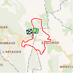
![](/images/other/stat-length.png)
![Tocht Stappen Valcivières - Le col des Supeyres - Photo](https://media.geolcdn.com/t/1900/400/ext.pjpeg?maxdim=2&url=https%3A%2F%2Fservices.sitytrail.com%2FGeolivesWS%2FDownloadMedia.ashx%3FTrailID%3D107150%26Media%3D11993_1.jpg)
Le col des Supeyres
tracegps
Gebruiker
![Lengte](/images/other/stat-length.png)
![Max. hoogte](https://static1.geolcdn.com/siteimages/upload/files/1508320355ic_sort_altitude_max_24dp.png)
![Positief hoogteverschil](https://static1.geolcdn.com/siteimages/upload/files/1508320355ic_sort_den_pos_24dp.png)
![Km-Effort](/images/other/stat-length.png)
![Min. hoogte](https://static1.geolcdn.com/siteimages/upload/files/1508320355ic_sort_altitude_min_24dp.png)
![Negatief hoogteverschil](https://static1.geolcdn.com/siteimages/upload/files/1508320355ic_sort_den_neg_24dp.png)
![Boucle](https://static1.geolcdn.com/siteimages/upload/files/16400158638029165_repeat_loop_refresh_sync_direction_icon.png)
![Stappen](https://static1.geolcdn.com/sitytour/trail-icons/101.png)
4h30
Moeilijkheid : Medium
![Scan deze QR-code om de tocht te openen in de SityTrail-applicatie](https://capi.geolives.com/qq0zvz2zws4bq2lad0pu/sitytour/trails/107150/qr.png?size=200)
Gratisgps-wandelapplicatie
Over ons
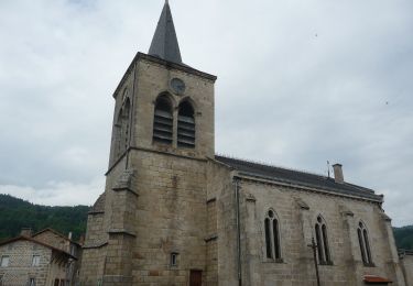
Tocht Stappen van 13 km beschikbaar op Auvergne-Rhône-Alpes, Puy-de-Dôme, Valcivières. Deze tocht wordt voorgesteld door tracegps.
Beschrijving
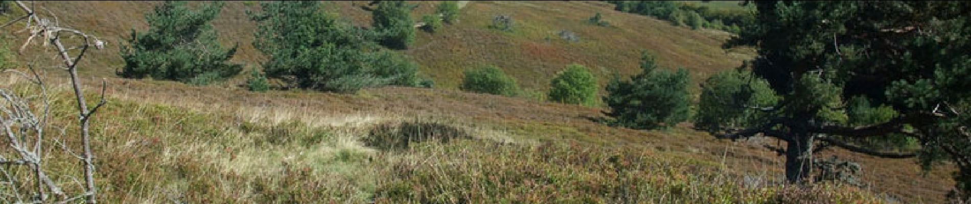
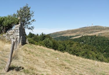
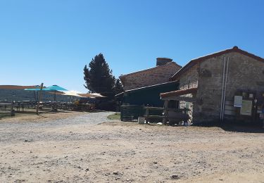
Départ au col des Supeyres ou à la Jasserie du Coq Noir. Passage devant les anciennes Jasseries des Supeyres encore couvertes de chaumes. Vues de toutes parts par beau temps. L'itinéraire sur les "Hautes Chaumes" peut être cependant envahi par le brouillard ou des nuages, donc attention!
Plaatsbepaling
Opmerkingen
Wandeltochten in de omgeving
![Tocht Stappen Valcivières - Les Jasseries des Supeyres - Valcivières - Photo](https://media.geolcdn.com/t/375/260/ext.jpg?maxdim=2&url=https%3A%2F%2Fservices.sitytrail.com%2FGeolivesWS%2FDownloadMedia.ashx%3FTrailID%3D173065%26Media%3D14595_6.jpg)
![Stappen Stappen](https://static1.geolcdn.com/sitytour/trail-icons/101.png)
Stappen
![](/images/other/stat-length.png)
![](https://static1.geolcdn.com/siteimages/upload/files/16400158638029165_repeat_loop_refresh_sync_direction_icon.png)
![Tocht Stappen Valcivières - Le colporteur des jasseries - Col des Supeyres -Valcivières - Photo](https://media.geolcdn.com/t/375/260/ext.jpg?maxdim=2&url=https%3A%2F%2Fservices.sitytrail.com%2FGeolivesWS%2FDownloadMedia.ashx%3FTrailID%3D107152%26Media%3D11995_3.jpg)
![Stappen Stappen](https://static1.geolcdn.com/sitytour/trail-icons/101.png)
Stappen
![](/images/other/stat-length.png)
![](https://static1.geolcdn.com/siteimages/upload/files/16400158638029165_repeat_loop_refresh_sync_direction_icon.png)
![Tocht Te voet Saint-Anthème - Le Colporteur des Jasseries - Photo](https://media.geolcdn.com/t/375/260/bb8cf573-2abe-46cd-9375-5ca50a964f5d.jpeg&format=jpg&maxdim=2)
![Te voet Te voet](https://static1.geolcdn.com/sitytour/trail-icons/100.png)
Te voet
![](/images/other/stat-length.png)
![](https://static1.geolcdn.com/siteimages/upload/files/16400158638029165_repeat_loop_refresh_sync_direction_icon.png)
![Tocht Te voet Valcivières - Les Hautes Chaumes - Photo](https://media.geolcdn.com/t/375/260/c021c51c-10d6-4fa3-97fc-c48a9b2a32e9.jpeg&format=jpg&maxdim=2)
![Te voet Te voet](https://static1.geolcdn.com/sitytour/trail-icons/100.png)
Te voet
![](/images/other/stat-length.png)
![](https://static1.geolcdn.com/siteimages/upload/files/16400158638029165_repeat_loop_refresh_sync_direction_icon.png)
![Tocht Te voet Job - La Vallee du Fossat - Les Rocher de la Pause - Photo](https://media.geolcdn.com/t/375/260/b8b4d88d-5dd3-4b1f-b29d-19aefab037bc.jpeg&format=jpg&maxdim=2)
![Te voet Te voet](https://static1.geolcdn.com/sitytour/trail-icons/100.png)
Te voet
![](/images/other/stat-length.png)
![](https://static1.geolcdn.com/siteimages/upload/files/16400158638029165_repeat_loop_refresh_sync_direction_icon.png)
![Tocht Paard Saint-Bonnet-le-Courreau - Chalmazel J2 Garnier - Col de la loge - Photo](https://media.geolcdn.com/t/375/260/ext.jpg?maxdim=2&url=https%3A%2F%2Fstatic1.geolcdn.com%2Fsiteimages%2Fupload%2Ffiles%2F1524743154cheval.jpg)
![Paard Paard](https://static1.geolcdn.com/sitytour/trail-icons/300.png)
Paard
![](/images/other/stat-length.png)
![](https://static1.geolcdn.com/siteimages/upload/files/16400158638029165_repeat_loop_refresh_sync_direction_icon.png)
![Tocht Stappen Saint-Bonnet-le-Courreau - chorsin Rena garnier - Photo](https://media.geolcdn.com/t/375/260/01da3d0e-1eee-49dc-b25c-4d9a02a718bd.jpg&format=jpg&maxdim=2)
![Stappen Stappen](https://static1.geolcdn.com/sitytour/trail-icons/101.png)
Stappen
![](/images/other/stat-length.png)
![](https://static1.geolcdn.com/siteimages/upload/files/16400158638029165_repeat_loop_refresh_sync_direction_icon.png)
![Tocht Stappen Saint-Anthème - Col des Supeyres au départ du Coq noir - Photo](https://media.geolcdn.com/t/375/260/a5f589cb-cae4-4a52-a71d-8c519e83f668.jpg&format=jpg&maxdim=2)
![Stappen Stappen](https://static1.geolcdn.com/sitytour/trail-icons/101.png)
Stappen
![](/images/other/stat-length.png)
![](https://static1.geolcdn.com/siteimages/upload/files/16400158638029165_repeat_loop_refresh_sync_direction_icon.png)
![Tocht Te voet Valcivières - La Vallée de Billeyre - Photo](https://media.geolcdn.com/t/375/260/a2529fa4-5508-45b9-8cca-57983194a2c3.jpeg&format=jpg&maxdim=2)
![Te voet Te voet](https://static1.geolcdn.com/sitytour/trail-icons/100.png)
Te voet
![](/images/other/stat-length.png)
![](https://static1.geolcdn.com/siteimages/upload/files/16400158638029165_repeat_loop_refresh_sync_direction_icon.png)
mooie wandeling, afwisselend terrein, mooie weide-zichten