3,2 km | 5,1 km-effort
De Marquefave à Lacaugne
tracegps
Gebruiker
Lengte
13,7 km
Max. hoogte
325 m
Positief hoogteverschil
340 m
Km-Effort
18,2 km
Min. hoogte
199 m
Negatief hoogteverschil
340 m
Boucle
Ja
Datum van aanmaak :
2014-12-10 00:00:00.0
Laatste wijziging :
2014-12-10 00:00:00.0
4h00
Moeilijkheid : Medium
Gratisgps-wandelapplicatie
Over ons
Tocht Stappen van 13,7 km beschikbaar op Occitanië, Haute-Garonne, Marquefave. Deze tocht wordt voorgesteld door tracegps.
Beschrijving
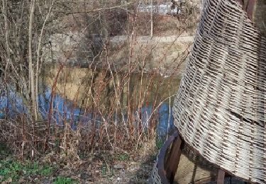
Départ de Marquefave, très beaux point de vues sur les Pyrénées mais un peut trop de bitume a mon gout.
Plaatsbepaling
Land:
France
Regio :
Occitanië
Departement/Provincie :
Haute-Garonne
Gemeente :
Marquefave
Locatie:
Unknown
Vertrek:(Dec)
Vertrek:(UTM)
357799 ; 4797684 (31T) N.
Opmerkingen
Wandeltochten in de omgeving
viagarona2
Mountainbike
Medium
Longages,
Occitanië,
Haute-Garonne,
France
50 km | 59 km-effort
7h 40min
Neen
Carbonne abris
Stappen
Heel gemakkelijk
Carbonne,
Occitanië,
Haute-Garonne,
France
11,1 km | 13,3 km-effort
2h 25min
Ja
montgazoin
Stappen
Medium
Montgazin,
Occitanië,
Haute-Garonne,
France
7,4 km | 0 m-effort
2h 12min
Ja
montaut fait
Stappen
Gemakkelijk
Montaut,
Occitanië,
Haute-Garonne,
France
10,2 km | 13,4 km-effort
2h 54min
Ja
carbonne abris fait 2024
Stappen
Medium
Carbonne,
Occitanië,
Haute-Garonne,
France
9,8 km | 11,4 km-effort
2h 17min
Ja
Montgazin fait 2024 mai
Stappen
Gemakkelijk
Montgazin,
Occitanië,
Haute-Garonne,
France
7,5 km | 9,6 km-effort
1h 53min
Ja
Alain Montgazin
Stappen
Medium
Montgazin,
Occitanië,
Haute-Garonne,
France
7,5 km | 9,6 km-effort
1h 50min
Ja
Montgazin JP
Stappen
Medium
Montgazin,
Occitanië,
Haute-Garonne,
France
7,4 km | 9,5 km-effort
2h 5min
Ja
site. quitterie