
Senoville - Cap Rozel

tracegps
Gebruiker

Lengte
27 km

Max. hoogte
94 m

Positief hoogteverschil
325 m

Km-Effort
31 km

Min. hoogte
1 m

Negatief hoogteverschil
324 m
Boucle
Ja
Datum van aanmaak :
2014-12-10 00:00:00.0
Laatste wijziging :
2014-12-10 00:00:00.0
2h49
Moeilijkheid : Moeilijk

Gratisgps-wandelapplicatie
Over ons
Tocht Mountainbike van 27 km beschikbaar op Normandië, Manche, Sénoville. Deze tocht wordt voorgesteld door tracegps.
Beschrijving
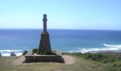
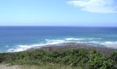
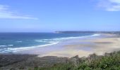
Bonjour à tous, Un circuit mixte, route et chemin, une belle montée pour accéder au cap Rozel et de bonnes descentes.(attention beaucoup de cailloux) les vues sont agréables surtout en haut du cap Rozel. Bonne rando.
Plaatsbepaling
Land:
France
Regio :
Normandië
Departement/Provincie :
Manche
Gemeente :
Sénoville
Locatie:
Unknown
Vertrek:(Dec)
Vertrek:(UTM)
590102 ; 5476380 (30U) N.
Opmerkingen
Wandeltochten in de omgeving
Tour de Senoville en VTT


Mountainbike
Gemakkelijk
Sénoville,
Normandië,
Manche,
France

11,3 km | 13,1 km-effort
1h 0min
Ja
Senoville - Cap Carteret


Mountainbike
Medium
Sénoville,
Normandië,
Manche,
France

23 km | 27 km-effort
2h 0min
Ja

Le Tour de Nathan - Pierreville


Mountainbike
Medium
Pierreville,
Normandië,
Manche,
France

28 km | 34 km-effort
2h 0min
Ja

surtainville grande


Stappen
Moeilijk
Surtainville,
Normandië,
Manche,
France

14,4 km | 16,2 km-effort
2h 47min
Neen

Le Vretot


Stappen
Moeilijk
Bricquebec-en-Cotentin,
Normandië,
Manche,
France

12,2 km | 15,4 km-effort
2h 54min
Ja

29 décembre 2020


Motorfiets
Heel gemakkelijk
Sénoville,
Normandië,
Manche,
France

101 km | 120 km-effort
10h 26min
Ja

3 moulins et allée couverte


Stappen
Les Moitiers-d'Allonne,
Normandië,
Manche,
France

11,2 km | 0 m-effort
2h 45min
Neen

le vretot


Mountainbike
Heel gemakkelijk
Bricquebec-en-Cotentin,
Normandië,
Manche,
France

24 km | 28 km-effort
2h 8min
Ja

Hatainville


sport
Heel gemakkelijk
Les Moitiers-d'Allonne,
Normandië,
Manche,
France

8,3 km | 9,6 km-effort
Onbekend
Ja


 SityTrail


