


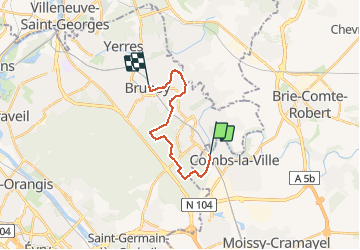

16,8 km | 18,6 km-effort


Gebruiker


Gratisgps-wandelapplicatie
 SityTrail
IGN / Geografische instituten
SityTrail World
De wereld gaat voor u open
Tocht Stappen van 13,1 km beschikbaar op Île-de-France, Seine-et-Marne, Combs-la-Ville. Deze tocht wordt voorgesteld door tracegps.
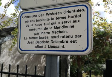
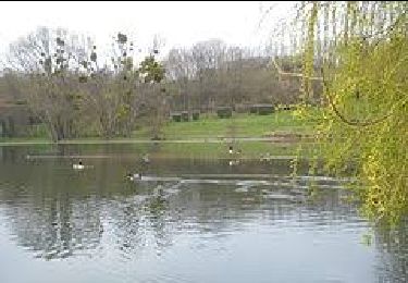
Départ à la gare RER de Combs la Ville, arrivée à la Gare RER de Brunoy. Parcours en sous-bois jusqu'aux bords de l'Yerre. Daniel BAIJOT


Stappen

Stappen
Te voet

Stappen

Stappen

Te voet
Te voet

Te voet

Stappen