


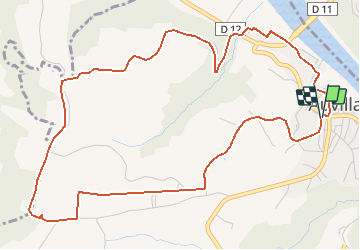

17,3 km | 23 km-effort


Gebruiker


Gratisgps-wandelapplicatie
 SityTrail
IGN / Geografische instituten
SityTrail World
De wereld gaat voor u open
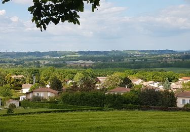
Tocht Stappen van 6,7 km beschikbaar op Occitanië, Tarn-et-Garonne, Auvillar. Deze tocht wordt voorgesteld door tracegps.
Départ de la place des Moines(à coté de la gendarmerie). Rejoindre le cœur du village en passant sous la Tour de l'Horloge. Rallier la halle circulaire.

Stappen
Stappen
Stappen
Stappen

Mountainbike
Stappen


sport
sport

Stappen