![](/images/other/stat-length.png)
![Tocht Stappen Salles-la-Source - Salles la Source - Pont les Bains - Photo](https://media.geolcdn.com/t/1900/400/ext.pjpeg?maxdim=2&url=https%3A%2F%2Fservices.sitytrail.com%2FGeolivesWS%2FDownloadMedia.ashx%3FTrailID%3D106455%26Media%3D10967_6.jpg)
Salles la Source - Pont les Bains
tracegps
Gebruiker
![Lengte](/images/other/stat-length.png)
![Max. hoogte](https://static1.geolcdn.com/siteimages/upload/files/1508320355ic_sort_altitude_max_24dp.png)
![Positief hoogteverschil](https://static1.geolcdn.com/siteimages/upload/files/1508320355ic_sort_den_pos_24dp.png)
![Km-Effort](/images/other/stat-length.png)
![Min. hoogte](https://static1.geolcdn.com/siteimages/upload/files/1508320355ic_sort_altitude_min_24dp.png)
![Negatief hoogteverschil](https://static1.geolcdn.com/siteimages/upload/files/1508320355ic_sort_den_neg_24dp.png)
![Boucle](https://static1.geolcdn.com/siteimages/upload/files/16400158638029165_repeat_loop_refresh_sync_direction_icon.png)
![Stappen](https://static1.geolcdn.com/sitytour/trail-icons/101.png)
4h30
Moeilijkheid : Moeilijk
![Scan deze QR-code om de tocht te openen in de SityTrail-applicatie](https://capi.geolives.com/qq0zvz2zws4bq2lad0pu/sitytour/trails/106455/qr.png?size=200)
Gratisgps-wandelapplicatie
Over ons
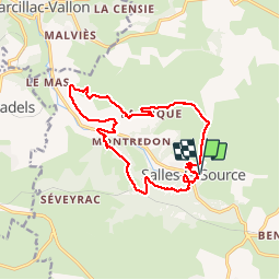
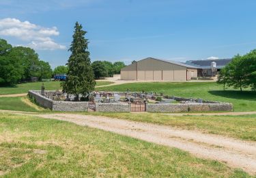
Tocht Stappen van 15,8 km beschikbaar op Occitanië, Aveyron, Salles-la-Source. Deze tocht wordt voorgesteld door tracegps.
Beschrijving
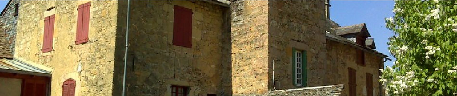
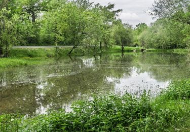
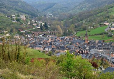
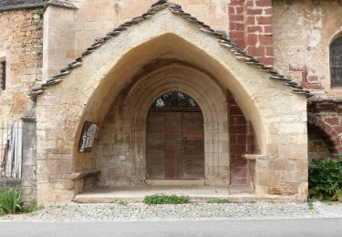
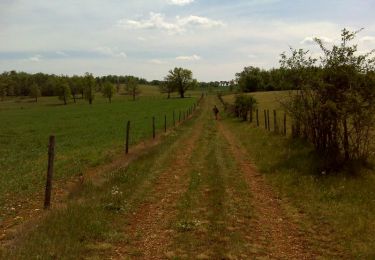
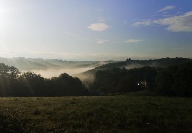
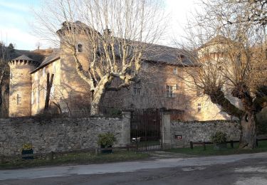
Amis randonneurs bonjour. Aujourd'hui je vous propose une petite balade d'environ 16 km, le parking randonneurs se situe dans le haut de Salles la source à côté de l'église, ça tombe très bien c'est de là que nous allons partir. Randonnée sans difficulté particulière mais quand même avec un dénivelé qui avoisine les 900 m. Elle sera assez difficile pour certains, surtout après Pont les Bains où il y a une petite grimpette de près de 2 km et on est content d'arriver en haut. Dans l'ensemble bon chemin, joli sentier, un peu de petites routes, pas désagréable pour moi qui déteste marcher sur le goudron!! Mais quand on n'a pas le choix tant pis!! Cette randonnée est en grande partie balisé en jaune, à l'origine elle est donnée pour 12 kilomètres, et comme je l'ai rallongé un peu vous aurez des morceaux non balisés mais sur des sentiers bien tracés et avec le GPS aucun risque de se perdre. Je joins le lien vers PICASA où j'ai mis les photos de la randonnée une quarantaine, normalement ça marche. Bonne balade.
Plaatsbepaling
Opmerkingen
Wandeltochten in de omgeving
![Tocht Te voet Onet-le-Château - Circuit 20 Vabres - Photo](https://media.geolcdn.com/t/375/260/1433d9f6-de3b-438e-a0f0-7d050107ea52.jpeg&format=jpg&maxdim=2)
![Te voet Te voet](https://static1.geolcdn.com/sitytour/trail-icons/100.png)
Te voet
![](/images/other/stat-length.png)
![](https://static1.geolcdn.com/siteimages/upload/files/16400158638029165_repeat_loop_refresh_sync_direction_icon.png)
![Tocht Te voet Sébazac-Concourès - Circuit 19 Onet-l'Eglise - Photo](https://media.geolcdn.com/t/375/260/f3e3249e-a733-405f-9846-4886826338a7.jpeg&format=jpg&maxdim=2)
![Te voet Te voet](https://static1.geolcdn.com/sitytour/trail-icons/100.png)
Te voet
![](/images/other/stat-length.png)
![](https://static1.geolcdn.com/siteimages/upload/files/16400158638029165_repeat_loop_refresh_sync_direction_icon.png)
![Tocht Te voet Sébazac-Concourès - Lo Camin de Pueg Rossel - Photo](https://media.geolcdn.com/t/375/260/a5ce6399-9a3f-423c-94f6-fc1978b983fd.jpeg&format=jpg&maxdim=2)
![Te voet Te voet](https://static1.geolcdn.com/sitytour/trail-icons/100.png)
Te voet
![](/images/other/stat-length.png)
![](https://static1.geolcdn.com/siteimages/upload/files/16400158638029165_repeat_loop_refresh_sync_direction_icon.png)
![Tocht Te voet Sébazac-Concourès - Virada De Rescondudon (autour du Rescondudou) - Photo](https://media.geolcdn.com/t/375/260/f3e3249e-a733-405f-9846-4886826338a7.jpeg&format=jpg&maxdim=2)
![Te voet Te voet](https://static1.geolcdn.com/sitytour/trail-icons/100.png)
Te voet
![](/images/other/stat-length.png)
![](https://static1.geolcdn.com/siteimages/upload/files/16400158638029165_repeat_loop_refresh_sync_direction_icon.png)
![Tocht Te voet Marcillac-Vallon - De la Vigne à la Forêt - Photo](https://media.geolcdn.com/t/375/260/de358808-995a-4e66-a7bc-7643c08a89f0.jpeg&format=jpg&maxdim=2)
![Te voet Te voet](https://static1.geolcdn.com/sitytour/trail-icons/100.png)
Te voet
![](/images/other/stat-length.png)
![](https://static1.geolcdn.com/siteimages/upload/files/16400158638029165_repeat_loop_refresh_sync_direction_icon.png)
![Tocht Te voet Salles-la-Source - La Vallée du Créneau - Photo](https://media.geolcdn.com/t/375/260/ee97b81b-0eb5-4d45-8a72-f23b6cf42bf2.jpeg&format=jpg&maxdim=2)
![Te voet Te voet](https://static1.geolcdn.com/sitytour/trail-icons/100.png)
Te voet
![](/images/other/stat-length.png)
![](https://static1.geolcdn.com/siteimages/upload/files/16400158638029165_repeat_loop_refresh_sync_direction_icon.png)
![Tocht Stappen Sébazac-Concourès - Onet l'église - Limouze - Le Tindoul de la Vayssière - Photo](https://media.geolcdn.com/t/375/260/ext.jpg?maxdim=2&url=https%3A%2F%2Fservices.sitytrail.com%2FGeolivesWS%2FDownloadMedia.ashx%3FTrailID%3D106511%26Media%3D11061_6.jpg)
![Stappen Stappen](https://static1.geolcdn.com/sitytour/trail-icons/101.png)
Stappen
![](/images/other/stat-length.png)
![](https://static1.geolcdn.com/siteimages/upload/files/16400158638029165_repeat_loop_refresh_sync_direction_icon.png)
![Tocht Mountainbike Onet-le-Château - Rodez Agglomeration - Liaison C - Vabre-Sebazac - Photo](https://media.geolcdn.com/t/375/260/e143497d-5910-4818-8a11-ed9f1297ae4b.jpg&format=jpg&maxdim=2)
![Mountainbike Mountainbike](https://static1.geolcdn.com/sitytour/trail-icons/202.png)
Mountainbike
![](/images/other/stat-length.png)
![](https://static1.geolcdn.com/siteimages/upload/files/16400158638029165_repeat_loop_refresh_sync_direction_icon.png)
![Tocht Stappen Salles-la-Source - salle la source par le Tindoul - Photo](https://media.geolcdn.com/t/375/260/ext.jpg?maxdim=2&url=https%3A%2F%2Fservices.sitytrail.com%2FGeolivesWS%2FDownloadMedia.ashx%3FTrailID%3D893042%26Media%3Dfix__20180124171554.jpg)
![Stappen Stappen](https://static1.geolcdn.com/sitytour/trail-icons/101.png)
Stappen
![](/images/other/stat-length.png)
![](https://static1.geolcdn.com/siteimages/upload/files/16400158638029165_repeat_loop_refresh_sync_direction_icon.png)