


7 km | 8 km-effort

Gebruiker


Gratisgps-wandelapplicatie
 SityTrail
IGN / Geografische instituten
SityTrail World
De wereld gaat voor u open
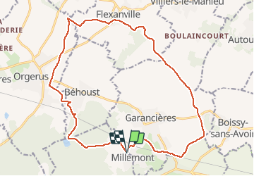
Tocht Mountainbike van 19,6 km beschikbaar op Île-de-France, Yvelines, Garancières. Deze tocht wordt voorgesteld door tracegps.
Circuit agréable de campagne, 20kms environ sans dénivelé significatif. Nous avons fait ce circuit dans le sens des aiguilles ; aucun problème d'orientation particulier.


Stappen
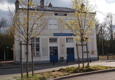
![Tocht Stappen Montfort-l'Amaury - Yvelines_[Rando_Journée]_Montfort=>Les Mesnuls=>Autour_de_Montfort - Tronçon 1 - Photo](https://media.geolcdn.com/t/375/260/9a77b4d0-afa4-42cb-beea-4a17fa8cb8c3.jpg&format=jpg&maxdim=2)
Stappen
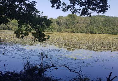
![Tocht Stappen Montfort-l'Amaury - Yvelines_[Rando_Journée]_Montfort=>Les Mesnuls=>Autour_de_Montfort - Tronçon 2 - Photo](https://media.geolcdn.com/t/375/260/3a031c20-1fc4-4232-b97e-93470db48f02.jpg&format=jpg&maxdim=2)
Stappen
Stappen

Stappen
Stappen
Stappen
Stappen
Stappen