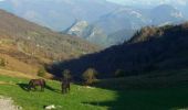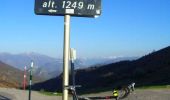

Col de Port - Foix

tracegps
Gebruiker

Lengte
68 km

Max. hoogte
1256 m

Positief hoogteverschil
1272 m

Km-Effort
85 km

Min. hoogte
378 m

Negatief hoogteverschil
1273 m
Boucle
Ja
Datum van aanmaak :
2014-12-10 00:00:00.0
Laatste wijziging :
2014-12-10 00:00:00.0
2h30
Moeilijkheid : Moeilijk

Gratisgps-wandelapplicatie
Over ons
Tocht Fiets van 68 km beschikbaar op Occitanië, Ariège, Foix. Deze tocht wordt voorgesteld door tracegps.
Beschrijving
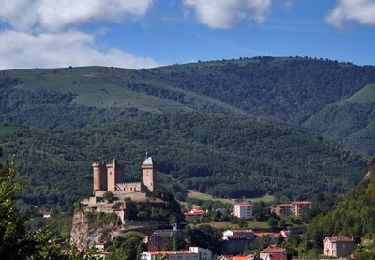
Le début du col est un peu raide, mais quel panorama au sommet. Une variante pour rentrer à Foix peut se faire en prenant le col de Péguère puis le col des Marrous. Pour cela descendre en direction de Massat et prendre à droite à environ 3 km.
Plaatsbepaling
Land:
France
Regio :
Occitanië
Departement/Provincie :
Ariège
Gemeente :
Foix
Locatie:
Unknown
Vertrek:(Dec)
Vertrek:(UTM)
386498 ; 4757052 (31T) N.
Opmerkingen
Wandeltochten in de omgeving
Prat Albis - Verniolle


Mountainbike
Moeilijk
(1)
Ganac,
Occitanië,
Ariège,
France

30 km | 36 km-effort
2h 30min
Neen

Cuminge


Stappen
Gemakkelijk
(1)
Prayols,
Occitanië,
Ariège,
France

3,5 km | 6,1 km-effort
1h 0min
Ja
01 - FOIX à ROQUEFIXADE - Chemin des Bons-Hommes GR107 GR367


Stappen
Moeilijk
Foix,
Occitanië,
Ariège,
France

18,6 km | 30 km-effort
6h 36min
Neen
De Saint-Paul à Montgailhard


Stappen
Medium
Saint-Paul-de-Jarrat,
Occitanië,
Ariège,
France

9,9 km | 11,7 km-effort
2h 30min
Ja
pech de foix


Stappen
Heel gemakkelijk
(1)
Foix,
Occitanië,
Ariège,
France

7,5 km | 13,6 km-effort
3h 43min
Ja

prat - prayols 1


Mountainbike
Medium
(1)
Ganac,
Occitanië,
Ariège,
France

7,7 km | 11,1 km-effort
41min
Neen
A vélo en Basse Ariège - Foix


Fiets
Medium
Foix,
Occitanië,
Ariège,
France

97 km | 111 km-effort
4h 49min
Ja
Port de Lers - Foix


Fiets
Moeilijk
Foix,
Occitanië,
Ariège,
France

115 km | 152 km-effort
6h 7min
Ja
De Foix au lac de Montbel


Fiets
Moeilijk
Foix,
Occitanië,
Ariège,
France

104 km | 124 km-effort
5h 0min
Ja


 SityTrail


