![](/images/other/stat-length.png)
![Tocht Noords wandelen Loyat - 2018-10-25 TOUR DU LAC AU DUC - Photo](https://media.geolcdn.com/t/1900/400/ext.pjpeg?maxdim=2&url=https%3A%2F%2Fstatic1.geolcdn.com%2Fsiteimages%2Fupload%2Ffiles%2F1545311037marcheuse_200dpi.jpg)
2018-10-25 TOUR DU LAC AU DUC
rousseau.mich
Gebruiker
![Lengte](/images/other/stat-length.png)
Lengte
16,9 km
![Max. hoogte](https://static1.geolcdn.com/siteimages/upload/files/1508320355ic_sort_altitude_max_24dp.png)
Max. hoogte
47 m
![Positief hoogteverschil](https://static1.geolcdn.com/siteimages/upload/files/1508320355ic_sort_den_pos_24dp.png)
Positief hoogteverschil
110 m
![Km-Effort](/images/other/stat-length.png)
Km-Effort
18,3 km
![Min. hoogte](https://static1.geolcdn.com/siteimages/upload/files/1508320355ic_sort_altitude_min_24dp.png)
Min. hoogte
24 m
![Negatief hoogteverschil](https://static1.geolcdn.com/siteimages/upload/files/1508320355ic_sort_den_neg_24dp.png)
Negatief hoogteverschil
111 m
![Boucle](https://static1.geolcdn.com/siteimages/upload/files/16400158638029165_repeat_loop_refresh_sync_direction_icon.png)
Boucle
Ja
Datum van aanmaak :
2019-01-15 17:56:47.235
Laatste wijziging :
2019-01-15 17:56:47.235
![Noords wandelen](https://static1.geolcdn.com/sitytour/trail-icons/102.png)
3h48
Moeilijkheid : Heel gemakkelijk
![Scan deze QR-code om de tocht te openen in de SityTrail-applicatie](https://capi.geolives.com/qq0zvz2zws4bq2lad0pu/sitytour/trails/1061691/qr.png?size=200)
Gratisgps-wandelapplicatie
Over ons
Tocht Noords wandelen van 16,9 km beschikbaar op Bretagne, Morbihan, Loyat. Deze tocht wordt voorgesteld door rousseau.mich.
Beschrijving
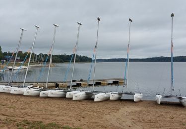
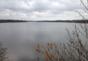
Départ devant l'entrée du camping de Loya. Attention arrivée au 2éme pont 30 m après prende le petit chemin a gauche ne pas aller tout droit cul de sac parcours faisable par endroit uniquement lorsque le lac est à son plus bas niveau.
Plaatsbepaling
Land:
France
Regio :
Bretagne
Departement/Provincie :
Morbihan
Gemeente :
Loyat
Locatie:
Unknown
Vertrek:(Dec)
Vertrek:(UTM)
546187 ; 5314848 (30T) N.
Opmerkingen
Wandeltochten in de omgeving
![Tocht Paardrijden Néant-sur-Yvel - Broceliande - Photo](https://media.geolcdn.com/t/375/260/203abf06-19c3-4c8f-9ce2-990712cb0787.jpg&format=jpg&maxdim=2)
![Paardrijden Paardrijden](https://static1.geolcdn.com/sitytour/trail-icons/301.png)
Broceliande
Paardrijden
Medium
(1)
Néant-sur-Yvel,
Bretagne,
Morbihan,
France
![](/images/other/stat-length.png)
22 km | 26 km-effort
4h 46min
![](https://static1.geolcdn.com/siteimages/upload/files/16400158638029165_repeat_loop_refresh_sync_direction_icon.png)
Ja
![Tocht Stappen Taupont - GR_37_CG_41_Taupont_Josselin_20221015 - Photo](https://media.geolcdn.com/t/375/260/b059b59c-3864-4263-a6bd-503c5fbf3996.jpg&format=jpg&maxdim=2)
![Stappen Stappen](https://static1.geolcdn.com/sitytour/trail-icons/101.png)
GR_37_CG_41_Taupont_Josselin_20221015
Stappen
Zeer moeilijk
Taupont,
Bretagne,
Morbihan,
France
![](/images/other/stat-length.png)
21 km | 25 km-effort
5h 18min
![](https://static1.geolcdn.com/siteimages/upload/files/16400158638029165_repeat_loop_refresh_sync_direction_icon.png)
Neen
![Tocht Stappen Ploërmel - LAC AU DUC (56) - Photo](https://media.geolcdn.com/t/375/260/ext.jpg?maxdim=2&url=https%3A%2F%2Fservices.sitytrail.com%2FGeolivesWS%2FDownloadMedia.ashx%3FTrailID%3D489578%26Media%3D20151103121400.jpg)
![Stappen Stappen](https://static1.geolcdn.com/sitytour/trail-icons/101.png)
LAC AU DUC (56)
Stappen
Heel gemakkelijk
Ploërmel,
Bretagne,
Morbihan,
France
![](/images/other/stat-length.png)
14,6 km | 16,1 km-effort
2h 42min
![](https://static1.geolcdn.com/siteimages/upload/files/16400158638029165_repeat_loop_refresh_sync_direction_icon.png)
Ja
![Tocht Andere activiteiten Taupont - taupins - Photo](https://media.geolcdn.com/t/375/260/ext.jpg?maxdim=2&url=https%3A%2F%2Fservices.sitytrail.com%2FGeolivesWS%2FDownloadMedia.ashx%3FTrailID%3D838567%26Media%3D20171001143518.jpg)
![Andere activiteiten Andere activiteiten](https://static1.geolcdn.com/sitytour/trail-icons/900.png)
taupins
Andere activiteiten
Heel gemakkelijk
Taupont,
Bretagne,
Morbihan,
France
![](/images/other/stat-length.png)
21 km | 24 km-effort
5h 59min
![](https://static1.geolcdn.com/siteimages/upload/files/16400158638029165_repeat_loop_refresh_sync_direction_icon.png)
Neen
![Tocht Noords wandelen Taupont - 2018-09-30 TAUPONT CHEMIN DES CHAPELLES - Photo](https://media.geolcdn.com/t/375/260/ext.jpg?maxdim=2&url=https%3A%2F%2Fservices.sitytrail.com%2FGeolivesWS%2FDownloadMedia.ashx%3FTrailID%3D1049033%26Media%3D20180930163130.jpg)
![Noords wandelen Noords wandelen](https://static1.geolcdn.com/sitytour/trail-icons/102.png)
2018-09-30 TAUPONT CHEMIN DES CHAPELLES
Noords wandelen
Heel gemakkelijk
Taupont,
Bretagne,
Morbihan,
France
![](/images/other/stat-length.png)
11,5 km | 13 km-effort
2h 36min
![](https://static1.geolcdn.com/siteimages/upload/files/16400158638029165_repeat_loop_refresh_sync_direction_icon.png)
Ja
![Tocht Stappen Néant-sur-Yvel - néant sur Yvel à Paimpont - Photo](https://media.geolcdn.com/t/375/260/ext.jpg?maxdim=2&url=https%3A%2F%2Fstatic1.geolcdn.com%2Fsiteimages%2Fupload%2Ffiles%2F1553511878bg_sport_marche.png)
![Stappen Stappen](https://static1.geolcdn.com/sitytour/trail-icons/101.png)
néant sur Yvel à Paimpont
Stappen
Medium
Néant-sur-Yvel,
Bretagne,
Morbihan,
France
![](/images/other/stat-length.png)
19,8 km | 23 km-effort
4h 18min
![](https://static1.geolcdn.com/siteimages/upload/files/16400158638029165_repeat_loop_refresh_sync_direction_icon.png)
Neen
![Tocht Noords wandelen Ploërmel - LAC AU DUC. 25 06 13 - Photo](https://media.geolcdn.com/t/375/260/ext.jpg?maxdim=2&url=https%3A%2F%2Fstatic1.geolcdn.com%2Fsiteimages%2Fupload%2Ffiles%2F1545311037marcheuse_200dpi.jpg)
![Noords wandelen Noords wandelen](https://static1.geolcdn.com/sitytour/trail-icons/102.png)
LAC AU DUC. 25 06 13
Noords wandelen
Heel gemakkelijk
Ploërmel,
Bretagne,
Morbihan,
France
![](/images/other/stat-length.png)
7,9 km | 9,1 km-effort
1h 28min
![](https://static1.geolcdn.com/siteimages/upload/files/16400158638029165_repeat_loop_refresh_sync_direction_icon.png)
Ja
![Tocht Stappen Ploërmel - Le tour du lac au Duc - Ploërmel - Photo](https://media.geolcdn.com/t/375/260/ext.jpg?maxdim=2&url=https%3A%2F%2Fstatic1.geolcdn.com%2Fsiteimages%2Fupload%2Ffiles%2F1553511878bg_sport_marche.png)
![Stappen Stappen](https://static1.geolcdn.com/sitytour/trail-icons/101.png)
Le tour du lac au Duc - Ploërmel
Stappen
Medium
Ploërmel,
Bretagne,
Morbihan,
France
![](/images/other/stat-length.png)
13,7 km | 15,2 km-effort
4h 0min
![](https://static1.geolcdn.com/siteimages/upload/files/16400158638029165_repeat_loop_refresh_sync_direction_icon.png)
Ja
![Tocht Stappen Taupont - Circuit des chapelles - Ploërmel - Photo](https://media.geolcdn.com/t/375/260/ext.jpg?maxdim=2&url=https%3A%2F%2Fstatic1.geolcdn.com%2Fsiteimages%2Fupload%2Ffiles%2F1553511878bg_sport_marche.png)
![Stappen Stappen](https://static1.geolcdn.com/sitytour/trail-icons/101.png)
Circuit des chapelles - Ploërmel
Stappen
Medium
Taupont,
Bretagne,
Morbihan,
France
![](/images/other/stat-length.png)
12,7 km | 14,6 km-effort
3h 30min
![](https://static1.geolcdn.com/siteimages/upload/files/16400158638029165_repeat_loop_refresh_sync_direction_icon.png)
Ja