![](/images/other/stat-length.png)
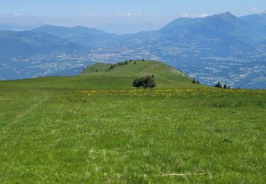
![Tocht Mountainbike Mens - Au pied de l'Obiou - Mens - Photo](https://media.geolcdn.com/t/1900/400/ext.pjpeg?maxdim=2&url=https%3A%2F%2Fstatic1.geolcdn.com%2Fsiteimages%2Fupload%2Ffiles%2F1524743154velo.jpg)
Au pied de l'Obiou - Mens
tracegps
Gebruiker
![Lengte](/images/other/stat-length.png)
![Max. hoogte](https://static1.geolcdn.com/siteimages/upload/files/1508320355ic_sort_altitude_max_24dp.png)
![Positief hoogteverschil](https://static1.geolcdn.com/siteimages/upload/files/1508320355ic_sort_den_pos_24dp.png)
![Km-Effort](/images/other/stat-length.png)
![Min. hoogte](https://static1.geolcdn.com/siteimages/upload/files/1508320355ic_sort_altitude_min_24dp.png)
![Negatief hoogteverschil](https://static1.geolcdn.com/siteimages/upload/files/1508320355ic_sort_den_neg_24dp.png)
![Boucle](https://static1.geolcdn.com/siteimages/upload/files/16400158638029165_repeat_loop_refresh_sync_direction_icon.png)
![Mountainbike](https://static1.geolcdn.com/sitytour/trail-icons/202.png)
1h15
Moeilijkheid : Medium
![Scan deze QR-code om de tocht te openen in de SityTrail-applicatie](https://capi.geolives.com/qq0zvz2zws4bq2lad0pu/sitytour/trails/106032/qr.png?size=200)
Gratisgps-wandelapplicatie
Over ons
Tocht Mountainbike van 17,2 km beschikbaar op Auvergne-Rhône-Alpes, Isère, Mens. Deze tocht wordt voorgesteld door tracegps.
Beschrijving
Circuit n°3 (bleu) de la base VTT FFCT du Trièves. Itinéraire roulant sans difficulté technique, mais assez long. Bon intermédiaire avant de se lancer sur des circuits plus techniques et difficiles, il est idéal pour la mise en jambe des plus sportifs en début de saison.
Plaatsbepaling
Opmerkingen
Wandeltochten in de omgeving
![Tocht Stappen Mens - Bonnet Calvin reco - Photo](https://media.geolcdn.com/t/375/260/71237d58-2b29-4521-9351-2dded8929675.jpg&format=jpg&maxdim=2)
![Stappen Stappen](https://static1.geolcdn.com/sitytour/trail-icons/101.png)
Stappen
![](/images/other/stat-length.png)
![](https://static1.geolcdn.com/siteimages/upload/files/16400158638029165_repeat_loop_refresh_sync_direction_icon.png)
![Tocht Stappen Saint-Baudille-et-Pipet - Bonnet de Calvin - Photo](https://media.geolcdn.com/t/375/260/b711d778-2624-48ca-9a09-33141db7aca2.jpg&format=jpg&maxdim=2)
![Stappen Stappen](https://static1.geolcdn.com/sitytour/trail-icons/101.png)
Stappen
![](/images/other/stat-length.png)
![](https://static1.geolcdn.com/siteimages/upload/files/16400158638029165_repeat_loop_refresh_sync_direction_icon.png)
![Tocht Stappen Saint-Baudille-et-Pipet - Des Lames d'Arçon au Col de l'Aiguille - Photo](https://media.geolcdn.com/t/375/260/6a7d919f-0a46-4fb6-a03a-1cd4dec1d339.jpg&format=jpg&maxdim=2)
![Stappen Stappen](https://static1.geolcdn.com/sitytour/trail-icons/101.png)
Stappen
![](/images/other/stat-length.png)
![](https://static1.geolcdn.com/siteimages/upload/files/16400158638029165_repeat_loop_refresh_sync_direction_icon.png)
![Tocht Stappen Mens - bonnet de Calvin - Photo](https://media.geolcdn.com/t/375/260/809ecc75-03b4-4bae-9bda-776611be3043.jpg&format=jpg&maxdim=2)
![Stappen Stappen](https://static1.geolcdn.com/sitytour/trail-icons/101.png)
Stappen
![](/images/other/stat-length.png)
![](https://static1.geolcdn.com/siteimages/upload/files/16400158638029165_repeat_loop_refresh_sync_direction_icon.png)
![Tocht Stappen Mens - Esclops Trièves Tour de Mens - Photo](https://media.geolcdn.com/t/375/260/009e9f5f-8365-4132-9701-b10e3311f406.jpg&format=jpg&maxdim=2)
![Stappen Stappen](https://static1.geolcdn.com/sitytour/trail-icons/101.png)
Stappen
![](/images/other/stat-length.png)
![](https://static1.geolcdn.com/siteimages/upload/files/16400158638029165_repeat_loop_refresh_sync_direction_icon.png)
![Tocht Stappen Saint-Baudille-et-Pipet - Esclops Trièves Col de l'Aiguille - Photo](https://media.geolcdn.com/t/375/260/c1c5675d-bfe6-4e05-80f5-bbfac132efec.jpg&format=jpg&maxdim=2)
![Stappen Stappen](https://static1.geolcdn.com/sitytour/trail-icons/101.png)
Stappen
![](/images/other/stat-length.png)
![](https://static1.geolcdn.com/siteimages/upload/files/16400158638029165_repeat_loop_refresh_sync_direction_icon.png)
![Tocht Stappen Saint-Baudille-et-Pipet - Col de la l'Aiguille - Photo](https://media.geolcdn.com/t/375/260/2743f076-6474-4350-bcdf-a04402ad0013.jpg&format=jpg&maxdim=2)
![Stappen Stappen](https://static1.geolcdn.com/sitytour/trail-icons/101.png)
Stappen
![](/images/other/stat-length.png)
![](https://static1.geolcdn.com/siteimages/upload/files/16400158638029165_repeat_loop_refresh_sync_direction_icon.png)
![Tocht Elektrische fiets Saint-Baudille-et-Pipet - Sainte Baudille de Pipet - St Pancrasse - Photo](https://media.geolcdn.com/t/375/260/98775b0d-8be1-4414-b804-8cc2ea33e09e.jpg&format=jpg&maxdim=2)
![Elektrische fiets Elektrische fiets](https://static1.geolcdn.com/sitytour/trail-icons/205.png)
Elektrische fiets
![](/images/other/stat-length.png)
![](https://static1.geolcdn.com/siteimages/upload/files/16400158638029165_repeat_loop_refresh_sync_direction_icon.png)
![Tocht Stappen Mens - bonnet de Calvin - Photo](https://media.geolcdn.com/t/375/260/e0867dac-c8ad-4bc3-be49-12c40a0ad975.jpg&format=jpg&maxdim=2)
![Stappen Stappen](https://static1.geolcdn.com/sitytour/trail-icons/101.png)
Stappen
![](/images/other/stat-length.png)
![](https://static1.geolcdn.com/siteimages/upload/files/16400158638029165_repeat_loop_refresh_sync_direction_icon.png)