


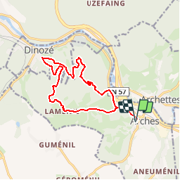

18,1 km | 23 km-effort

Gebruiker


Gratisgps-wandelapplicatie
 SityTrail
IGN / Geografische instituten
SityTrail World
De wereld gaat voor u open
Tocht Mountainbike van 13,5 km beschikbaar op Grand Est, Vogezen, Arches. Deze tocht wordt voorgesteld door tracegps.
Espace VTT FFC Chemins du Pays d'Epinal, Cœur des Vosges - circuit n°102 - La Malgrange Circuit officiel labellisé par la Fédération Française de Cyclisme. Tour facile par le Haut du Mont et dans les Bois d’Arches.

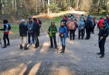
Te voet

Stappen
Stappen

Stappen
Stappen
Stappen
Stappen
Stappen