Tocht Stappen Carignan-de-Bordeaux - Boucle locale Carignan-de-Bordeaux / Latresne - Photo

Boucle locale Carignan-de-Bordeaux / Latresne

 tracegps
tracegps

Gebruiker

© OpenStreetMap contributors
Lengte
Lengte
4,2 km
Max. hoogte
Max. hoogte
66 m
Positief hoogteverschil
108 m
Km-Effort
Km-Effort  
5,7 km
Min. hoogte
Min. hoogte
4 m
Negatief hoogteverschil
110 m
Boucle
Boucle
Ja
Datum van aanmaak :
2014-12-10 00:00:00.0
Laatste wijziging :
2014-12-10 00:00:00.0

(0 Bericht)

Stappen
Stappen
1h30
Moeilijkheid : Gemakkelijk

Scan deze QR-code om de tocht te openen in de SityTrail-applicatie

Gratisgps-wandelapplicatie

Logo SityTrail SityTrail

IGN / Geografische instituten

SityTrail uit de App Store downloaden SityTrail uit Google Play downloaden

Logo SityTrail SityTrail World

De wereld gaat voor u open

SityTrail uit de App Store downloaden SityTrail uit Google Play downloaden SityTrail op Huawei AppGallery downloaden

Over ons

Tocht Stappen van 4,2 km beschikbaar op Nieuw-Aquitanië, Gironde, Carignan-de-Bordeaux. Deze tocht wordt voorgesteld door tracegps.

Beschrijving

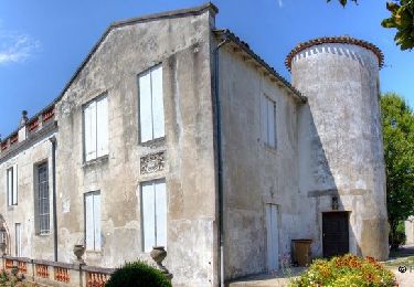
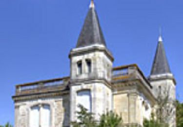
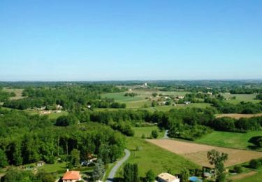
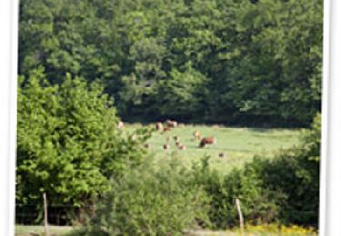
Cette boucle locale mise en place par le Conseil Général de la Gironde vous emmènera à travers le vignoble des coteaux bordelais. Vous croiserez un petit ruisseau et son petit pont, un lavoir, les châteaux Malherbes et Gassies, d'anciens habitats troglodytes et le hameau de la Seleyre.

Hoogteprofiel

Foto's

POI's

POI Carignan-de-Bordeaux - Village de Cuchet - Photo
tracegps
CARIGNAN-DE-BORDEAUX 
POI Carignan-de-Bordeaux - Domaine du Grand Arnaud - Photo
tracegps
CARIGNAN-DE-BORDEAUX 
POI Carignan-de-Bordeaux - Lavoir de Bonnefond - Photo
tracegps
CARIGNAN-DE-BORDEAUX 
POI Latresne - Château de Malherbes - Photo
tracegps

Plaatsbepaling

Land:
France
Regio :
Nieuw-Aquitanië
Departement/Provincie :
Gironde
Gemeente :
Carignan-de-Bordeaux
Locatie:
Unknown
Vertrek:(Dec)
Vertrek:(UTM)
698522 ; 4964293 (30T) N.

Wandeltochten in de omgeving

Tocht Stappen Latresne - Circuit de Saint Pantaléon - Latresne - Photo
Stappen
tracegps

Stappen

Medium
(1)
Latresne, Nieuw-Aquitanië, Gironde, France
5,7 km | 7 km-effort
1h 49min
Ja
Tocht Stappen Latresne - Circuit des châteaux - Latresne  - Photo
Stappen
tracegps

Stappen

Medium
(1)
Latresne, Nieuw-Aquitanië, Gironde, France
4,3 km | 5,7 km-effort
1h 30min
Ja
Tocht Fiets Bouliac - Piste Cyclable Bordeaux - Sauveterre de Guyenne - Roger Labépie - Photo
Fiets
tracegps

Fiets

Medium
(1)
Bouliac, Nieuw-Aquitanië, Gironde, France
50 km | 57 km-effort
3h 0min
Neen
Tocht Stappen Bouliac - Circuit de Macanan - Bouliac - Photo
Stappen
tracegps

Stappen

Gemakkelijk
(1)
Bouliac, Nieuw-Aquitanië, Gironde, France
3 km | 4,1 km-effort
1h 0min
Ja
Tocht Stappen Bouliac - Circuit des coteaux - Bouliac - Photo
Stappen
tracegps

Stappen

Gemakkelijk
(1)
Bouliac, Nieuw-Aquitanië, Gironde, France
5,4 km | 6,9 km-effort
1h 40min
Ja
Tocht Mountainbike Bouliac - 33-Bouliac-20120513 - Photo
Mountainbike
Gus64

Mountainbike

Medium
(2)
Bouliac, Nieuw-Aquitanië, Gironde, France
47 km | 58 km-effort
3h 50min
Ja
Tocht Stappen Fargues-Saint-Hilaire - vers le coin de paradis  - Photo
Stappen
la gane

Stappen

Medium
Fargues-Saint-Hilaire, Nieuw-Aquitanië, Gironde, France
7,1 km | 8,2 km-effort
1h 55min
Ja
Tocht Fietstoerisme Latresne - Latresne-Courpiac - Photo
Fietstoerisme
ilur56

Fietstoerisme

Gemakkelijk
Latresne, Nieuw-Aquitanië, Gironde, France
34 km | 39 km-effort
2h 27min
Neen
Tocht Stappen Floirac - les 2 églises - Photo
Stappen
Eric De Smedt

Stappen

Gemakkelijk
Floirac, Nieuw-Aquitanië, Gironde, France
6,5 km | 8,5 km-effort
1h 32min
Ja


Sluiten
Mijn abonnementen