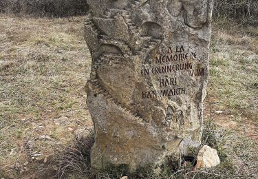
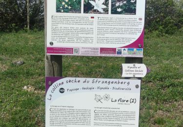
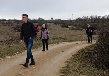
Tocht Mountainbike Bergholtz - Espace VTT - FFC Région de Guebwiller - n°17 - Circuit du Bollenberg  - Photo

Espace VTT - FFC Région de Guebwiller - n°17 - Circuit du Bollenberg

 tracegps
tracegps

Gebruiker

© OpenStreetMap contributors
Lengte
Lengte
9,2 km
Max. hoogte
Max. hoogte
332 m
Positief hoogteverschil
127 m
Km-Effort
Km-Effort  
10,9 km
Min. hoogte
Min. hoogte
231 m
Negatief hoogteverschil
128 m
Boucle
Boucle
Ja
Datum van aanmaak :
2014-12-10 00:00:00.0
Laatste wijziging :
2014-12-10 00:00:00.0

(0 Bericht)

Mountainbike
Mountainbike
40m
Moeilijkheid : Gemakkelijk

Scan deze QR-code om de tocht te openen in de SityTrail-applicatie

Gratisgps-wandelapplicatie

Logo SityTrail SityTrail

IGN / Geografische instituten

SityTrail uit de App Store downloaden SityTrail uit Google Play downloaden

Logo SityTrail SityTrail World

De wereld gaat voor u open

SityTrail uit de App Store downloaden SityTrail uit Google Play downloaden SityTrail op Huawei AppGallery downloaden

Over ons

Tocht Mountainbike van 9,2 km beschikbaar op Grand Est, Haut-Rhin, Bergholtz. Deze tocht wordt voorgesteld door tracegps.

Beschrijving

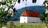
Espace VTT - FFC Région de Guebwiller - n°17 - Circuit du Bollenberg Circuit officiel labellisé par la Fédération Française de Cyclisme. Ce tracé familial, entièrement fléché dans le vignoble, comporte d’innombrables points de vue dont celui de la chapelle du Bollenberg, appelée aussi chapelle des Sorcières. La présence de sarcophages découverts à proximité de l’ancienne église atteste de l’existence de Bergholtz dès le Moyen-Âge. De par son appartenance à l’abbaye de Murbach (XIIème siècle), Bergholtz et Bergholtz-Zell ne forment qu’une seule communauté. Elles se sépareront en 1827. Les carrières de Bergholtz et Bergholtz-Zell fourniront les pierres de taille nécessaires à la construction de la forteresse de Neuf-Brisach (Vauban 1699) par le biais du canal Vauban. Topo guide VTT en vente à l’Office du Tourisme de Guebwiller-Soultz et les Pays du Florival - Antenne de Guebwiller - 71 Rue de la République - 68500 – Guebwiller Tel. : 03 89 76 10 63 - Fax :03 89 76 52 72 Crédit photos ; ©Pays d’Art et d’Histoire de la Région de Guebwiller

Hoogteprofiel

Foto's

Plaatsbepaling

Land:
France
Regio :
Grand Est
Departement/Provincie :
Haut-Rhin
Gemeente :
Bergholtz
Locatie:
Unknown
Vertrek:(Dec)
Vertrek:(UTM)
368883 ; 5308777 (32T) N.

Wandeltochten in de omgeving

Tocht Stappen Westhalten - 2021 03 04 Westhalten - Photo
Stappen
E.BURCK

Stappen

Gemakkelijk
(1)
Westhalten, Grand Est, Haut-Rhin, France
7,7 km | 11,3 km-effort
2h 21min
Ja
Tocht Stappen Rouffach - SityTrail - Rouffach vers Schauenberg variante - Photo
Stappen
E.BURCK

Stappen

Gemakkelijk
(1)
Rouffach, Grand Est, Haut-Rhin, France
10,6 km | 15,3 km-effort
3h 29min
Ja
Tocht Mountainbike Guebwiller - P4  Circuits du Florival 2021   - Photo
Mountainbike
duchaine.nicolas

Mountainbike

Medium
(1)
Guebwiller, Grand Est, Haut-Rhin, France
40 km | 53 km-effort
4h 31min
Neen
Tocht Mountainbike Westhalten - Westhalten - Le tour de la vallée Noble - Photo
Mountainbike
sit68000

Mountainbike

Moeilijk
(1)
Westhalten, Grand Est, Haut-Rhin, France
24 km | 33 km-effort
2h 30min
Ja
Tocht Stappen Westhalten - WESTHALTEN ZINKOEPHLE - Photo
Stappen
MarcOBRECHT

Stappen

Medium
Westhalten, Grand Est, Haut-Rhin, France
10,6 km | 15,3 km-effort
2h 56min
Ja
Tocht Stappen Jungholtz - Rando Retrouvailles...01/03/2024.par Jean Marc - Photo
Stappen
boubou68

Stappen

Zeer moeilijk
Jungholtz, Grand Est, Haut-Rhin, France
11,3 km | 19,2 km-effort
1h 35min
Ja
Tocht Stappen Westhalten - Westhalten - Rouffach  - Photo
Stappen
Richard68500

Stappen

Moeilijk
Westhalten, Grand Est, Haut-Rhin, France
8,9 km | 13 km-effort
3h 22min
Ja
Tocht Stappen Buhl - TL 11/23 avec un petit tour dans le vignoble avec départ du parking Côte de l'Appenthal et repas à la Taverne du Vigneron - Photo
Stappen
patrickbeyrath

Stappen

Medium
(1)
Buhl, Grand Est, Haut-Rhin, France
8,7 km | 12 km-effort
2h 43min
Ja
Tocht Wegfiets Issenheim - EXT-65 Issenheim-01 - Photo
Wegfiets
GUIDE
Specialized77

Wegfiets

Gemakkelijk
Issenheim, Grand Est, Haut-Rhin, France
65 km | 73 km-effort
3h 54min
Ja


Sluiten
Mijn abonnementen