Tocht Fiets Saône - Arc et Senans - Photo
 tracegps
tracegps

Gebruiker

© OpenStreetMap contributors
Lengte
Lengte
115 km
Max. hoogte
Max. hoogte
508 m
Positief hoogteverschil
1447 m
Km-Effort
Km-Effort  
134 km
Min. hoogte
Min. hoogte
211 m
Negatief hoogteverschil
1443 m
Boucle
Boucle
Ja
Datum van aanmaak :
2014-12-10 00:00:00.0
Laatste wijziging :
2014-12-10 00:00:00.0

(0 Bericht)

Fiets
Fiets
4h15
Moeilijkheid : Medium

Scan deze QR-code om de tocht te openen in de SityTrail-applicatie

Gratisgps-wandelapplicatie

Logo SityTrail SityTrail

IGN / Geografische instituten

SityTrail uit de App Store downloaden SityTrail uit Google Play downloaden

Logo SityTrail SityTrail World

De wereld gaat voor u open

SityTrail uit de App Store downloaden SityTrail uit Google Play downloaden SityTrail op Huawei AppGallery downloaden

Over ons

Tocht Fiets van 115 km beschikbaar op Bourgondië-Franche-Comté, Doubs, Saône. Deze tocht wordt voorgesteld door tracegps.

Beschrijving

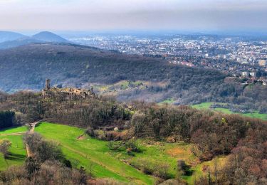
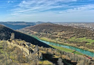
Circuit qui nous fait longer le Doubs par la Véloroute E6 sur environ 40 km, puis une piste cyclable vous emmènera jusqu'à Arc et Senans, où je vous conseille un petit arrêt pour visiter la Saline Royale et son musée Nicolas Ledoux, architecte ayant trop d'imagination pour son temps. Vous pouvez faire un tour sur le site de La Saline Royale.

Hoogteprofiel

Plaatsbepaling

Land:
France
Regio :
Bourgondië-Franche-Comté
Departement/Provincie :
Doubs
Gemeente :
Saône
Locatie:
Unknown
Vertrek:(Dec)
Vertrek:(UTM)
281897 ; 5234623 (32T) N.

Wandeltochten in de omgeving

Tocht Stappen Montfaucon - Du chateau au fort de Monfaucon - Photo
Stappen
yew

Stappen

Gemakkelijk
(1)
Montfaucon, Bourgondië-Franche-Comté, Doubs, France
6,9 km | 9,3 km-effort
1h 55min
Ja
Tocht Te voet Mamirolle - Sentier du Bois de la Fougère - Photo
Te voet
GUIDE+

Te voet

Gemakkelijk
Mamirolle, Bourgondië-Franche-Comté, Doubs, France
7,3 km | 8,7 km-effort
1h 58min
Ja
Tocht Te voet Montfaucon - Boucle de Nacra - Photo
Te voet
GUIDE+

Te voet

Gemakkelijk
Montfaucon, Bourgondië-Franche-Comté, Doubs, France
3 km | 4,4 km-effort
1h 0min
Ja
Tocht Te voet Saône - Sentier des Essarts - Photo
Te voet
GUIDE+

Te voet

Gemakkelijk
Saône, Bourgondië-Franche-Comté, Doubs, France
6,9 km | 8,1 km-effort
1h 50min
Ja
Tocht Te voet Montfaucon - Sentier des Falaises et du château - Photo
Te voet
GUIDE+

Te voet

Gemakkelijk
Montfaucon, Bourgondië-Franche-Comté, Doubs, France
5 km | 7,1 km-effort
1h 37min
Ja
Tocht Te voet Nancray - Sentier du Fonteny - Photo
Te voet
GUIDE+

Te voet

Gemakkelijk
Nancray, Bourgondië-Franche-Comté, Doubs, France
7,4 km | 9 km-effort
2h 2min
Ja
Tocht Te voet Montfaucon - Sentier du Fort et des Batteries - Photo
Te voet
GUIDE+

Te voet

Gemakkelijk
Montfaucon, Bourgondië-Franche-Comté, Doubs, France
6,6 km | 8,7 km-effort
1h 58min
Ja
Tocht Te voet Mamirolle - Sentier du Golf - Photo
Te voet
GUIDE+

Te voet

Gemakkelijk
Mamirolle, Bourgondië-Franche-Comté, Doubs, France
8,7 km | 10,4 km-effort
2h 21min
Ja
Tocht Te voet Nancray - Sentier du Moulin - Photo
Te voet
GUIDE+

Te voet

Gemakkelijk
Nancray, Bourgondië-Franche-Comté, Doubs, France
9,5 km | 12,5 km-effort
2h 50min
Ja


Sluiten
Mijn abonnementen