


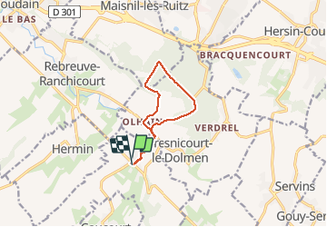

7,8 km | 8,8 km-effort

Gebruiker


Gratisgps-wandelapplicatie
 SityTrail
IGN / Geografische instituten
SityTrail World
De wereld gaat voor u open
Tocht Stappen van 8 km beschikbaar op Hauts-de-France, Pas-de-Calais, Gauchin-Légal. Deze tocht wordt voorgesteld door tracegps.
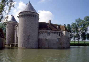
Le départ de cette randonnée se situe à l'endroit ou est attaché le Gal. Montée dans la forêt d'Olhain puis descente avec passage à proximité du château.


Stappen
Stappen

Te voet
Andere activiteiten

Stappen
Stappen
Stappen

Stappen

Stappen