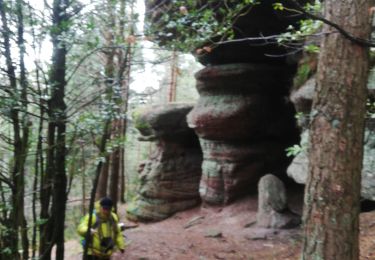
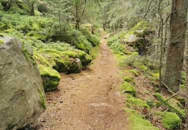
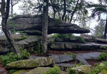
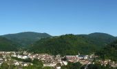
Tocht Mountainbike Sainte-Croix-aux-Mines - Espace VTT FFC Val d'Argent - Circuit n°12 - Le circuit du Hury - Photo

Espace VTT FFC Val d'Argent - Circuit n°12 - Le circuit du Hury

 tracegps
tracegps

Gebruiker

© OpenStreetMap contributors
Lengte
Lengte
12,9 km
Max. hoogte
Max. hoogte
696 m
Positief hoogteverschil
410 m
Km-Effort
Km-Effort  
18,3 km
Min. hoogte
Min. hoogte
296 m
Negatief hoogteverschil
409 m
Boucle
Boucle
Ja
Datum van aanmaak :
2014-12-10 00:00:00.0
Laatste wijziging :
2014-12-10 00:00:00.0

(0 Bericht)

Mountainbike
Mountainbike
1h19
Moeilijkheid : Medium

Scan deze QR-code om de tocht te openen in de SityTrail-applicatie

Gratisgps-wandelapplicatie

Logo SityTrail SityTrail

IGN / Geografische instituten

SityTrail uit de App Store downloaden SityTrail uit Google Play downloaden

Logo SityTrail SityTrail World

De wereld gaat voor u open

SityTrail uit de App Store downloaden SityTrail uit Google Play downloaden SityTrail op Huawei AppGallery downloaden

Over ons

Tocht Mountainbike van 12,9 km beschikbaar op Grand Est, Haut-Rhin, Sainte-Croix-aux-Mines. Deze tocht wordt voorgesteld door tracegps.

Beschrijving

Espace VTT FFC Val d'Argent - Circuit n°12 - Le circuit du Hury Circuit officiel labellisé par la Fédération Française de Cyclisme. Départ : Parking situé à l’arrière de la mairie de Ste-Croix-aux-Mines. La longue portion ascendante de ce parcours est moins laborieuse qu’elle n’y paraît puisqu’elle emprunte une petite route goudronnée longeant le ruisseau de la Goutte St-Blaise. Et quel plaisir à la descente !! Le Hury doit son nom à l’extraction de la houille qui fut très importante jusqu’à la Révolution. L’endroit, initialement appelé houillerie a évolué pour devenir aujourd’hui « Hury ».

Hoogteprofiel

Foto's

Plaatsbepaling

Land:
France
Regio :
Grand Est
Departement/Provincie :
Haut-Rhin
Gemeente :
Sainte-Croix-aux-Mines
Locatie:
Unknown
Vertrek:(Dec)
Vertrek:(UTM)
368393 ; 5346999 (32U) N.

Wandeltochten in de omgeving

Tocht Stappen Breitenau - 2024-07-23_20h26m34_G 12 - Photo
Stappen
LUTZMarc

Stappen

Gemakkelijk
(1)
Breitenau, Grand Est, Bas-Rhin, France
15,4 km | 22 km-effort
4h 59min
Ja
Tocht sport Ribeauvillé - Grande verrerie - Rocher des Géants  - Photo
sport
berni68

sport

Heel gemakkelijk
Ribeauvillé, Grand Est, Haut-Rhin, France
9,3 km | 15,3 km-effort
Onbekend
Neen
Tocht Stappen Sainte-Marie-aux-Mines - taenichel - Photo
Stappen
apa

Stappen

Medium
Sainte-Marie-aux-Mines, Grand Est, Haut-Rhin, France
13,3 km | 19,1 km-effort
5h 26min
Ja
Tocht Stappen Sainte-Marie-aux-Mines - Col du Haut de Ribeauvillé - Rochers des Géants (Rother n°31) - Photo
Stappen
Bart2015

Stappen

Medium
Sainte-Marie-aux-Mines, Grand Est, Haut-Rhin, France
15,3 km | 22 km-effort
3h 56min
Ja
Tocht Stappen Rombach-le-Franc - Col de Fouchy  - Photo
Stappen
apa

Stappen

Medium
Rombach-le-Franc, Grand Est, Haut-Rhin, France
11,8 km | 17,6 km-effort
3h 23min
Ja
Tocht Stappen Lièpvre - Liépvre - Roche des Fées, Roche de Chalmont, Rocher du Coucou, château du Frankenbourg - Photo
Stappen
Bart2015

Stappen

Moeilijk
Lièpvre, Grand Est, Haut-Rhin, France
19,4 km | 31 km-effort
5h 53min
Ja
Tocht Stappen Ribeauvillé - boucle la grande verrerie-roche des 3 tables-roche des reptiles-roche des géants-la grande verrerie  - Photo
Stappen
fbienmuller

Stappen

Medium
(1)
Ribeauvillé, Grand Est, Haut-Rhin, France
15 km | 23 km-effort
4h 24min
Ja
Tocht Stappen Ribeauvillé - 2021-07-17 Marche La Grande Verrerie Taennchel - Photo
Stappen
GUIDE
holtzv

Stappen

Medium
Ribeauvillé, Grand Est, Haut-Rhin, France
13,2 km | 21 km-effort
4h 41min
Ja
Tocht Stappen Thannenkirch - TAENCHEL CCA 200827 - Photo
Stappen
Gatge

Stappen

Heel gemakkelijk
Thannenkirch, Grand Est, Haut-Rhin, France
12,7 km | 18,7 km-effort
5h 2min
Ja


Sluiten
Mijn abonnementen