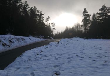
Tocht Mountainbike Ribeauvillé - Espace VTT FFC Val d'Argent - Circuit n°8 - Le tertre de la Fille Morte - Photo

Espace VTT FFC Val d'Argent - Circuit n°8 - Le tertre de la Fille Morte

 tracegps
tracegps

Gebruiker

© OpenStreetMap contributors
Lengte
Lengte
18,5 km
Max. hoogte
Max. hoogte
1143 m
Positief hoogteverschil
656 m
Km-Effort
Km-Effort  
27 km
Min. hoogte
Min. hoogte
618 m
Negatief hoogteverschil
653 m
Boucle
Boucle
Ja
Datum van aanmaak :
2014-12-10 00:00:00.0
Laatste wijziging :
2014-12-10 00:00:00.0

(1 Bericht)

Mountainbike
Mountainbike
2h00
Moeilijkheid : Moeilijk

Scan deze QR-code om de tocht te openen in de SityTrail-applicatie

Gratisgps-wandelapplicatie

Logo SityTrail SityTrail

IGN / Geografische instituten

SityTrail uit de App Store downloaden SityTrail uit Google Play downloaden

Logo SityTrail SityTrail World

De wereld gaat voor u open

SityTrail uit de App Store downloaden SityTrail uit Google Play downloaden SityTrail op Huawei AppGallery downloaden

Over ons

Tocht Mountainbike van 18,5 km beschikbaar op Grand Est, Haut-Rhin, Ribeauvillé. Deze tocht wordt voorgesteld door tracegps.

Beschrijving

Espace VTT FFC Val d'Argent - Circuit n°8 - Le tertre de la Fille Morte Circuit officiel labellisé par la Fédération Française de Cyclisme. Départ du Col du Haut de Ribeauvillé, parking à 100m (742m). Ce circuit s’adresse particulièrement aux vététistes à la recherche d’un circuit assez court et qui concentre une bonne dose de difficultés physiques et techniques. Les profils du parcours demandent à plusieurs reprises des efforts intenses et soutenus. Ce circuit se déroule en bonne partie sur la charmante commune d’Aubure, la plus haute d’Alsace. Il offre notamment des points de vue vers la plaine d’Alsace.

Hoogteprofiel

Foto's

Plaatsbepaling

Land:
France
Regio :
Grand Est
Departement/Provincie :
Haut-Rhin
Gemeente :
Ribeauvillé
Locatie:
Unknown
Vertrek:(Dec)
Vertrek:(UTM)
368671 ; 5343020 (32U) N.

Opmerkingen

Gelieve in te loggen om een commentaar of een beoordeling achter te laten


Wandeltochten in de omgeving

Tocht Stappen Ribeauvillé - 2023-08-26 Marche Ribeauville Taennchel - Photo
Stappen
GUIDE
holtzv

Stappen

Medium
(1)
Ribeauvillé, Grand Est, Haut-Rhin, France
20 km | 34 km-effort
7h 45min
Ja
Tocht Paardrijden Aubure - 2019-11-03 WE Aubure Taennchel - Photo
Paardrijden
GUIDE
holtzv

Paardrijden

Heel gemakkelijk
Aubure, Grand Est, Haut-Rhin, France
27 km | 41 km-effort
7h 45min
Ja
Tocht Paardrijden Aubure - 2019-11-02 WE Aubure Brezouard - Photo
Paardrijden
GUIDE
holtzv

Paardrijden

Heel gemakkelijk
Aubure, Grand Est, Haut-Rhin, France
25 km | 39 km-effort
5h 57min
Ja
Tocht sport Ribeauvillé - Grande verrerie - Rocher des Géants  - Photo
sport
berni68

sport

Heel gemakkelijk
Ribeauvillé, Grand Est, Haut-Rhin, France
9,3 km | 15,3 km-effort
Onbekend
Neen
Tocht Paardrijden Aubure - Circuit Alsace Vosges Aubure Orbey Et Cigognes - Photo
Paardrijden
GUIDE+

Paardrijden

Moeilijk
Aubure, Grand Est, Haut-Rhin, France
30 km | 44 km-effort
5h 44min
Neen
Tocht Stappen Sainte-Marie-aux-Mines - taenichel - Photo
Stappen
apa

Stappen

Medium
Sainte-Marie-aux-Mines, Grand Est, Haut-Rhin, France
13,3 km | 19,1 km-effort
5h 26min
Ja
Tocht Stappen Aubure - Aubure rocher du tétras  - Photo
Stappen
apa

Stappen

Medium
Aubure, Grand Est, Haut-Rhin, France
10,9 km | 14,6 km-effort
3h 54min
Ja
Tocht Stappen Sainte-Marie-aux-Mines - Col du Haut de Ribeauvillé - Rochers des Géants (Rother n°31) - Photo
Stappen
Bart2015

Stappen

Medium
Sainte-Marie-aux-Mines, Grand Est, Haut-Rhin, France
15,3 km | 22 km-effort
3h 56min
Ja
Tocht Stappen Aubure - Col de Freland Pierre des trois bans Aubure - Photo
Stappen
zazie

Stappen

Medium
Aubure, Grand Est, Haut-Rhin, France
7,9 km | 12,7 km-effort
1h 50min
Ja


Sluiten
Mijn abonnementen