![](/images/other/stat-length.png)
![Tocht Mountainbike Vinon-sur-Verdon - Les Têtes - Vinon sur Verdon - Photo](https://media.geolcdn.com/t/1900/400/ext.pjpeg?maxdim=2&url=https%3A%2F%2Fservices.sitytrail.com%2FGeolivesWS%2FDownloadMedia.ashx%3FTrailID%3D104966%26Media%3D8522_2.jpg)
Les Têtes - Vinon sur Verdon
tracegps
Gebruiker
![Lengte](/images/other/stat-length.png)
Lengte
18,3 km
![Max. hoogte](https://static1.geolcdn.com/siteimages/upload/files/1508320355ic_sort_altitude_max_24dp.png)
Max. hoogte
478 m
![Positief hoogteverschil](https://static1.geolcdn.com/siteimages/upload/files/1508320355ic_sort_den_pos_24dp.png)
Positief hoogteverschil
289 m
![Km-Effort](/images/other/stat-length.png)
Km-Effort
22 km
![Min. hoogte](https://static1.geolcdn.com/siteimages/upload/files/1508320355ic_sort_altitude_min_24dp.png)
Min. hoogte
271 m
![Negatief hoogteverschil](https://static1.geolcdn.com/siteimages/upload/files/1508320355ic_sort_den_neg_24dp.png)
Negatief hoogteverschil
290 m
![Boucle](https://static1.geolcdn.com/siteimages/upload/files/16400158638029165_repeat_loop_refresh_sync_direction_icon.png)
Boucle
Ja
Datum van aanmaak :
2014-12-10 00:00:00.0
Laatste wijziging :
2014-12-10 00:00:00.0
![Mountainbike](https://static1.geolcdn.com/sitytour/trail-icons/202.png)
1h30
Moeilijkheid : Medium
![Scan deze QR-code om de tocht te openen in de SityTrail-applicatie](https://capi.geolives.com/qq0zvz2zws4bq2lad0pu/sitytour/trails/104966/qr.png?size=200)
Gratisgps-wandelapplicatie
Over ons
Tocht Mountainbike van 18,3 km beschikbaar op Provence-Alpes-Côte d'Azur, Var, Vinon-sur-Verdon. Deze tocht wordt voorgesteld door tracegps.
Beschrijving
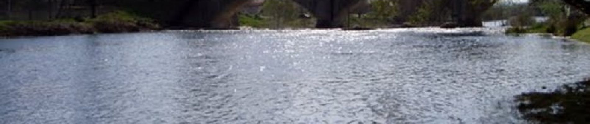
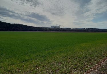
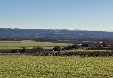
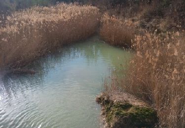
Circuit facile. Le départ se fait de Vinon sur Verdon, passage à Gréoux les Bains. Attention descente très raide à l'arrivé sur Gréoux.
Plaatsbepaling
Land:
France
Regio :
Provence-Alpes-Côte d'Azur
Departement/Provincie :
Var
Gemeente :
Vinon-sur-Verdon
Locatie:
Unknown
Vertrek:(Dec)
Vertrek:(UTM)
726304 ; 4845088 (31T) N.
Opmerkingen
Wandeltochten in de omgeving
![Tocht Stappen Corbières-en-Provence - 06-06-2023 Trou du loup - Photo](https://media.geolcdn.com/t/375/260/52bc598a-0a14-4497-a248-3a4b1527712d.jpg&format=jpg&maxdim=2)
![Stappen Stappen](https://static1.geolcdn.com/sitytour/trail-icons/101.png)
06-06-2023 Trou du loup
Stappen
Moeilijk
Corbières-en-Provence,
Provence-Alpes-Côte d'Azur,
Alpes-de-Haute-Provence,
France
![](/images/other/stat-length.png)
12,1 km | 16,3 km-effort
3h 42min
![](https://static1.geolcdn.com/siteimages/upload/files/16400158638029165_repeat_loop_refresh_sync_direction_icon.png)
Ja
![Tocht Stappen Vinon-sur-Verdon - Marie Coco - Vinon sur Verdon - Photo](https://media.geolcdn.com/t/375/260/ext.jpg?maxdim=2&url=https%3A%2F%2Fstatic1.geolcdn.com%2Fsiteimages%2Fupload%2Ffiles%2F1553511878bg_sport_marche.png)
![Stappen Stappen](https://static1.geolcdn.com/sitytour/trail-icons/101.png)
Marie Coco - Vinon sur Verdon
Stappen
Medium
(2)
Vinon-sur-Verdon,
Provence-Alpes-Côte d'Azur,
Var,
France
![](/images/other/stat-length.png)
14,5 km | 16,4 km-effort
3h 30min
![](https://static1.geolcdn.com/siteimages/upload/files/16400158638029165_repeat_loop_refresh_sync_direction_icon.png)
Ja
![Tocht Noords wandelen Vinon-sur-Verdon - en face la maison - Photo](https://media.geolcdn.com/t/375/260/56845acc-893e-44a5-b8e7-863548a4ce8e.jpg&format=jpg&maxdim=2)
![Noords wandelen Noords wandelen](https://static1.geolcdn.com/sitytour/trail-icons/102.png)
en face la maison
Noords wandelen
Heel gemakkelijk
Vinon-sur-Verdon,
Provence-Alpes-Côte d'Azur,
Var,
France
![](/images/other/stat-length.png)
7,6 km | 8,9 km-effort
1h 24min
![](https://static1.geolcdn.com/siteimages/upload/files/16400158638029165_repeat_loop_refresh_sync_direction_icon.png)
Ja
![Tocht Stappen Saint-Julien - St Julien - Grotte de Malavasse - Photo](https://media.geolcdn.com/t/375/260/c80d5ad6-4e61-45a1-a28d-af60e80bae63.jpg&format=jpg&maxdim=2)
![Stappen Stappen](https://static1.geolcdn.com/sitytour/trail-icons/101.png)
St Julien - Grotte de Malavasse
Stappen
Medium
(1)
Saint-Julien,
Provence-Alpes-Côte d'Azur,
Var,
France
![](/images/other/stat-length.png)
10,8 km | 15 km-effort
3h 45min
![](https://static1.geolcdn.com/siteimages/upload/files/16400158638029165_repeat_loop_refresh_sync_direction_icon.png)
Ja
![Tocht Stappen Vinon-sur-Verdon - Autour de Vinon 19.02.2022 - Photo](https://media.geolcdn.com/t/375/260/9b6f5588-d351-48dd-a234-d708fa85e578.jpg&format=jpg&maxdim=2)
![Stappen Stappen](https://static1.geolcdn.com/sitytour/trail-icons/101.png)
Autour de Vinon 19.02.2022
Stappen
Gemakkelijk
Vinon-sur-Verdon,
Provence-Alpes-Côte d'Azur,
Var,
France
![](/images/other/stat-length.png)
11,5 km | 14,1 km-effort
2h 49min
![](https://static1.geolcdn.com/siteimages/upload/files/16400158638029165_repeat_loop_refresh_sync_direction_icon.png)
Ja
![Tocht Stappen Corbières-en-Provence - 1Corbières, chemin de repentance et trou du Loup - Photo](https://media.geolcdn.com/t/375/260/ba26f280-ef39-47d0-a5ef-64a522b8f252.jpg&format=jpg&maxdim=2)
![Stappen Stappen](https://static1.geolcdn.com/sitytour/trail-icons/101.png)
1Corbières, chemin de repentance et trou du Loup
Stappen
Medium
Corbières-en-Provence,
Provence-Alpes-Côte d'Azur,
Alpes-de-Haute-Provence,
France
![](/images/other/stat-length.png)
8,9 km | 12,6 km-effort
2h 35min
![](https://static1.geolcdn.com/siteimages/upload/files/16400158638029165_repeat_loop_refresh_sync_direction_icon.png)
Ja
![Tocht Stappen Corbières-en-Provence - Corbières en Provence 04 - Photo](https://media.geolcdn.com/t/375/260/9aa6fe75-464d-48c4-b872-ba7c4730437f.jpg&format=jpg&maxdim=2)
![Stappen Stappen](https://static1.geolcdn.com/sitytour/trail-icons/101.png)
Corbières en Provence 04
Stappen
Heel gemakkelijk
Corbières-en-Provence,
Provence-Alpes-Côte d'Azur,
Alpes-de-Haute-Provence,
France
![](/images/other/stat-length.png)
15,5 km | 19,4 km-effort
2h 17min
![](https://static1.geolcdn.com/siteimages/upload/files/16400158638029165_repeat_loop_refresh_sync_direction_icon.png)
Neen
![Tocht Stappen Corbières-en-Provence - Corbieres Trou du Loup - Photo](https://media.geolcdn.com/t/375/260/97e466a6-ae40-4e6e-8c04-85036dc77a3f.jpg&format=jpg&maxdim=2)
![Stappen Stappen](https://static1.geolcdn.com/sitytour/trail-icons/101.png)
Corbieres Trou du Loup
Stappen
Gemakkelijk
Corbières-en-Provence,
Provence-Alpes-Côte d'Azur,
Alpes-de-Haute-Provence,
France
![](/images/other/stat-length.png)
13,3 km | 17 km-effort
3h 7min
![](https://static1.geolcdn.com/siteimages/upload/files/16400158638029165_repeat_loop_refresh_sync_direction_icon.png)
Ja
![Tocht Stappen Corbières-en-Provence - Le trou du Loup, P lotissement de Corbières ). - Photo](https://media.geolcdn.com/t/375/260/ext.jpg?maxdim=2&url=https%3A%2F%2Fservices.sitytrail.com%2FGeolivesWS%2FDownloadMedia.ashx%3FTrailID%3D908498%26Media%3Dfix__20180219100627.jpg)
![Stappen Stappen](https://static1.geolcdn.com/sitytour/trail-icons/101.png)
Le trou du Loup, P lotissement de Corbières ).
Stappen
Gemakkelijk
(1)
Corbières-en-Provence,
Provence-Alpes-Côte d'Azur,
Alpes-de-Haute-Provence,
France
![](/images/other/stat-length.png)
5,9 km | 8 km-effort
1h 50min
![](https://static1.geolcdn.com/siteimages/upload/files/16400158638029165_repeat_loop_refresh_sync_direction_icon.png)
Ja