![](/images/other/stat-length.png)
![Tocht Mountainbike Archail - Grande Traversée des PréAlpes à VTT : La Bâtie Neuve (Maison forestière ruinée) - Col du Défens - Photo](https://media.geolcdn.com/t/1900/400/ext.pjpeg?maxdim=2&url=https%3A%2F%2Fservices.sitytrail.com%2FGeolivesWS%2FDownloadMedia.ashx%3FTrailID%3D104770%26Media%3D8225_1.jpg)
Grande Traversée des PréAlpes à VTT : La Bâtie Neuve (Maison forestière ruinée) - Col du Défens
tracegps
Gebruiker
![Lengte](/images/other/stat-length.png)
![Max. hoogte](https://static1.geolcdn.com/siteimages/upload/files/1508320355ic_sort_altitude_max_24dp.png)
![Positief hoogteverschil](https://static1.geolcdn.com/siteimages/upload/files/1508320355ic_sort_den_pos_24dp.png)
![Km-Effort](/images/other/stat-length.png)
![Min. hoogte](https://static1.geolcdn.com/siteimages/upload/files/1508320355ic_sort_altitude_min_24dp.png)
![Negatief hoogteverschil](https://static1.geolcdn.com/siteimages/upload/files/1508320355ic_sort_den_neg_24dp.png)
![Boucle](https://static1.geolcdn.com/siteimages/upload/files/16400158638029165_repeat_loop_refresh_sync_direction_icon.png)
![Mountainbike](https://static1.geolcdn.com/sitytour/trail-icons/202.png)
5h00
Moeilijkheid : Moeilijk
![Scan deze QR-code om de tocht te openen in de SityTrail-applicatie](https://capi.geolives.com/qq0zvz2zws4bq2lad0pu/sitytour/trails/104770/qr.png?size=200)
Gratisgps-wandelapplicatie
Over ons
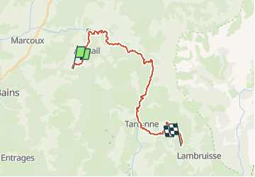
Tocht Mountainbike van 27 km beschikbaar op Provence-Alpes-Côte d'Azur, Alpes-de-Haute-Provence, Archail. Deze tocht wordt voorgesteld door tracegps.
Beschrijving
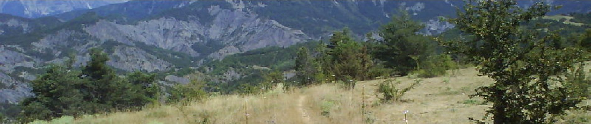
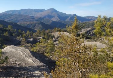
Grande Traversée des Préalpes, les Chemins du Soleil. Parcours officiel labellisé par la Fédération Française de Cyclisme. Vous entrez avec cette étape au cœur même des Chemins du Soleil. Vous retrouvez en premier lieu, les terres noires de la région, pour ensuite verser de larges gouttes de sueurs en gravissant le col de la Cine. Cette peine est récompensée par la descente en sentier relativement technique. Vous passerez sous un arc de pierre taillée dans la falaise en 1804 à l’initiative de l’homme, peu de temps avant de vous rafraîchir à la fontaine de Plan Chaude. Prenez le temps de vivre…, vous repartez pour un col certes moins éprouvant. Mesure de prudence : deux descentes aux profils abruptes. Au début du tronçon, dans les marnes, soyez vigilant à ne pas bloquer les roues. Vous diminuerez ainsi le facteur chute. La descente du col de La Cine impose une vitesse réduite et un doigt de pilotage. Consultez toutes les informations sur les hébergements et les services associés sur la fiche du tronçon.
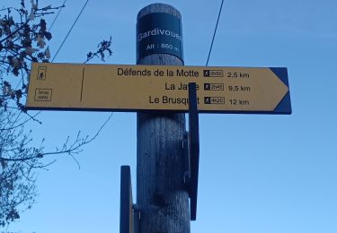
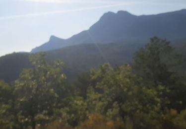
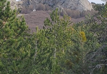
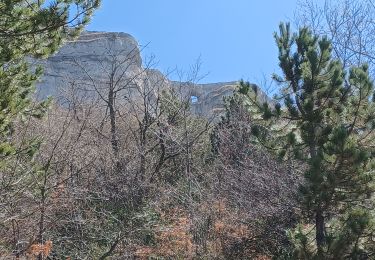
Plaatsbepaling
Opmerkingen
Wandeltochten in de omgeving
![Tocht Stappen Archail - Sommet de Couard - Photo](https://media.geolcdn.com/t/375/260/617bf3ec-d772-4852-a48b-6268ec9b769f.jpg&format=jpg&maxdim=2)
![Stappen Stappen](https://static1.geolcdn.com/sitytour/trail-icons/101.png)
Stappen
![](/images/other/stat-length.png)
![](https://static1.geolcdn.com/siteimages/upload/files/16400158638029165_repeat_loop_refresh_sync_direction_icon.png)
![Tocht Stappen Draix - DRAIX .REFUGE DE BELON .CRETE DE LA BLACHE .O L - Photo](https://media.geolcdn.com/t/375/260/e8831a04-d962-4369-8704-d88e490a9a32.jpg&format=jpg&maxdim=2)
![Stappen Stappen](https://static1.geolcdn.com/sitytour/trail-icons/101.png)
Stappen
![](/images/other/stat-length.png)
![](https://static1.geolcdn.com/siteimages/upload/files/16400158638029165_repeat_loop_refresh_sync_direction_icon.png)
![Tocht Stappen Digne-les-Bains - Chapelle St Pancrace 18.11.23 - Photo](https://media.geolcdn.com/t/375/260/583976d8-25d3-4c43-8a1a-417f5de6b4ec.jpg&format=jpg&maxdim=2)
![Stappen Stappen](https://static1.geolcdn.com/sitytour/trail-icons/101.png)
Stappen
![](/images/other/stat-length.png)
![](https://static1.geolcdn.com/siteimages/upload/files/16400158638029165_repeat_loop_refresh_sync_direction_icon.png)
![Tocht Stappen Marcoux - DIGNE . LES ROBINES DU BANASTRE n ol - Photo](https://media.geolcdn.com/t/375/260/dcce991a-de45-4ec5-a0f2-a1115a3d83c1.jpg&format=jpg&maxdim=2)
![Stappen Stappen](https://static1.geolcdn.com/sitytour/trail-icons/101.png)
Stappen
![](/images/other/stat-length.png)
![](https://static1.geolcdn.com/siteimages/upload/files/16400158638029165_repeat_loop_refresh_sync_direction_icon.png)
![Tocht Stappen Marcoux - Villar des dourbes archail 734m 12kms - Photo](https://media.geolcdn.com/t/375/260/1fbc3102-e22a-4a79-be22-3dc99b63495b.jpg&format=jpg&maxdim=2)
![Stappen Stappen](https://static1.geolcdn.com/sitytour/trail-icons/101.png)
Stappen
![](/images/other/stat-length.png)
![](https://static1.geolcdn.com/siteimages/upload/files/16400158638029165_repeat_loop_refresh_sync_direction_icon.png)
![Tocht Stappen Marcoux - Randonnee-des-chenes-des-buis-et-du-thym-crete-de-liman - Photo](https://media.geolcdn.com/t/375/260/f7e82ede-4968-4c52-a43e-16ff65fc7a09.jpg&format=jpg&maxdim=2)
![Stappen Stappen](https://static1.geolcdn.com/sitytour/trail-icons/101.png)
Stappen
![](/images/other/stat-length.png)
![](https://static1.geolcdn.com/siteimages/upload/files/16400158638029165_repeat_loop_refresh_sync_direction_icon.png)
![Tocht Stappen Marcoux - Marcoux crete de liman 950m 15kms - Photo](https://media.geolcdn.com/t/375/260/00b81580-75e6-426b-a40c-3e2806d477ba.jpg&format=jpg&maxdim=2)
![Stappen Stappen](https://static1.geolcdn.com/sitytour/trail-icons/101.png)
Stappen
![](/images/other/stat-length.png)
![](https://static1.geolcdn.com/siteimages/upload/files/16400158638029165_repeat_loop_refresh_sync_direction_icon.png)
![Tocht Stappen Archail - Archail cucuyon 10kms 850m - Photo](https://media.geolcdn.com/t/375/260/c348f6c1-7258-47d7-9586-40bbf4181938.jpg&format=jpg&maxdim=2)
![Stappen Stappen](https://static1.geolcdn.com/sitytour/trail-icons/101.png)
Stappen
![](/images/other/stat-length.png)
![](https://static1.geolcdn.com/siteimages/upload/files/16400158638029165_repeat_loop_refresh_sync_direction_icon.png)
![Tocht Stappen Digne-les-Bains - LES DOURBES o l - Photo](https://media.geolcdn.com/t/375/260/f70e72b3-406b-4409-8f9d-494cc1dc482f.jpg&format=jpg&maxdim=2)
![Stappen Stappen](https://static1.geolcdn.com/sitytour/trail-icons/101.png)
Stappen
![](/images/other/stat-length.png)
![](https://static1.geolcdn.com/siteimages/upload/files/16400158638029165_repeat_loop_refresh_sync_direction_icon.png)