![](/images/other/stat-length.png)
![Tocht Stappen Jonquières - Jonquières - Photo](https://media.geolcdn.com/t/1900/400/ext.pjpeg?maxdim=2&url=https%3A%2F%2Fservices.sitytrail.com%2FGeolivesWS%2FDownloadMedia.ashx%3FTrailID%3D104615%26Media%3D7995_3.jpg)
Jonquières
tracegps
Gebruiker
![Lengte](/images/other/stat-length.png)
Lengte
11,8 km
![Max. hoogte](https://static1.geolcdn.com/siteimages/upload/files/1508320355ic_sort_altitude_max_24dp.png)
Max. hoogte
373 m
![Positief hoogteverschil](https://static1.geolcdn.com/siteimages/upload/files/1508320355ic_sort_den_pos_24dp.png)
Positief hoogteverschil
311 m
![Km-Effort](/images/other/stat-length.png)
Km-Effort
15,9 km
![Min. hoogte](https://static1.geolcdn.com/siteimages/upload/files/1508320355ic_sort_altitude_min_24dp.png)
Min. hoogte
201 m
![Negatief hoogteverschil](https://static1.geolcdn.com/siteimages/upload/files/1508320355ic_sort_den_neg_24dp.png)
Negatief hoogteverschil
311 m
![Boucle](https://static1.geolcdn.com/siteimages/upload/files/16400158638029165_repeat_loop_refresh_sync_direction_icon.png)
Boucle
Ja
Datum van aanmaak :
2014-12-10 00:00:00.0
Laatste wijziging :
2014-12-10 00:00:00.0
![Stappen](https://static1.geolcdn.com/sitytour/trail-icons/101.png)
3h00
Moeilijkheid : Moeilijk
![Scan deze QR-code om de tocht te openen in de SityTrail-applicatie](https://capi.geolives.com/qq0zvz2zws4bq2lad0pu/sitytour/trails/104615/qr.png?size=200)
Gratisgps-wandelapplicatie
Over ons
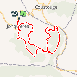
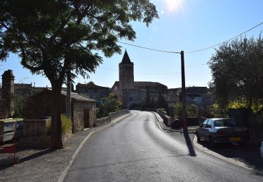
Tocht Stappen van 11,8 km beschikbaar op Occitanië, Aude, Jonquières. Deze tocht wordt voorgesteld door tracegps.
Beschrijving
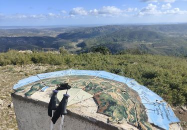
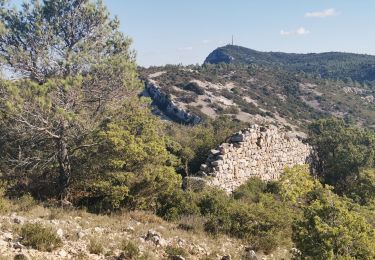
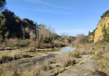
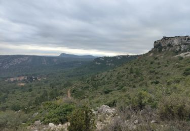
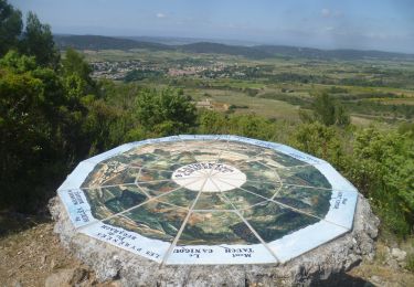
Cette randonnée nous plonge dans les Corbières profondes entres chênes verts et vignes avec des vues panoramiques sur les environs.
Plaatsbepaling
Land:
France
Regio :
Occitanië
Departement/Provincie :
Aude
Gemeente :
Jonquières
Locatie:
Unknown
Vertrek:(Dec)
Vertrek:(UTM)
477984 ; 4765510 (31T) N.
Opmerkingen
Wandeltochten in de omgeving
![Tocht Stappen Albas - En Corbières - La Ronde au coeur des Corbières - Albas à Quintillan - Photo](https://media.geolcdn.com/t/375/260/ext.jpg?maxdim=2&url=https%3A%2F%2Fservices.sitytrail.com%2FGeolivesWS%2FDownloadMedia.ashx%3FTrailID%3D172656%26Media%3D14027_5.jpg)
![Stappen Stappen](https://static1.geolcdn.com/sitytour/trail-icons/101.png)
En Corbières - La Ronde au coeur des Corbières - Albas à Quintillan
Stappen
Medium
(1)
Albas,
Occitanië,
Aude,
France
![](/images/other/stat-length.png)
10 km | 14,6 km-effort
3h 30min
![](https://static1.geolcdn.com/siteimages/upload/files/16400158638029165_repeat_loop_refresh_sync_direction_icon.png)
Neen
![Tocht Stappen Fontjoncouse - Saint Victor Jean Paul - Photo](https://media.geolcdn.com/t/375/260/7332a8c2-c16a-4775-89e4-30997326f1a1.jpg&format=jpg&maxdim=2)
![Stappen Stappen](https://static1.geolcdn.com/sitytour/trail-icons/101.png)
Saint Victor Jean Paul
Stappen
Medium
Fontjoncouse,
Occitanië,
Aude,
France
![](/images/other/stat-length.png)
16,4 km | 22 km-effort
5h 5min
![](https://static1.geolcdn.com/siteimages/upload/files/16400158638029165_repeat_loop_refresh_sync_direction_icon.png)
Ja
![Tocht Stappen Fontjoncouse - Fontjoncouse Saint Victoire - Photo](https://media.geolcdn.com/t/375/260/a0b8a6e9-656a-44e4-93e6-0cd16efc6478.jpg&format=jpg&maxdim=2)
![Stappen Stappen](https://static1.geolcdn.com/sitytour/trail-icons/101.png)
Fontjoncouse Saint Victoire
Stappen
Medium
Fontjoncouse,
Occitanië,
Aude,
France
![](/images/other/stat-length.png)
18,3 km | 24 km-effort
4h 44min
![](https://static1.geolcdn.com/siteimages/upload/files/16400158638029165_repeat_loop_refresh_sync_direction_icon.png)
Ja
![Tocht Te voet Saint-Laurent-de-la-Cabrerisse - Le cirque de Viviès St Laurent de la Cabrerisse - Photo](https://media.geolcdn.com/t/375/260/ext.jpg?maxdim=2&url=https%3A%2F%2Fstatic1.geolcdn.com%2Fsiteimages%2Fupload%2Ffiles%2F1545311037marcheuse_200dpi.jpg)
![Te voet Te voet](https://static1.geolcdn.com/sitytour/trail-icons/100.png)
Le cirque de Viviès St Laurent de la Cabrerisse
Te voet
Medium
(1)
Saint-Laurent-de-la-Cabrerisse,
Occitanië,
Aude,
France
![](/images/other/stat-length.png)
11,2 km | 14,8 km-effort
2h 20min
![](https://static1.geolcdn.com/siteimages/upload/files/16400158638029165_repeat_loop_refresh_sync_direction_icon.png)
Ja
![Tocht Stappen Saint-Laurent-de-la-Cabrerisse - Saint Laurent de la Cabrerisse - Photo](https://media.geolcdn.com/t/375/260/9193cc34-8575-4894-a2de-4b6fce4876bb.jpg&format=jpg&maxdim=2)
![Stappen Stappen](https://static1.geolcdn.com/sitytour/trail-icons/101.png)
Saint Laurent de la Cabrerisse
Stappen
Medium
Saint-Laurent-de-la-Cabrerisse,
Occitanië,
Aude,
France
![](/images/other/stat-length.png)
19,7 km | 26 km-effort
6h 2min
![](https://static1.geolcdn.com/siteimages/upload/files/16400158638029165_repeat_loop_refresh_sync_direction_icon.png)
Ja
![Tocht Stappen Coustouge - Coustouge Fontjoncouge - Photo](https://media.geolcdn.com/t/375/260/0e4a9282-9b3b-40d9-aa68-7fe0d2769990.jpg&format=jpg&maxdim=2)
![Stappen Stappen](https://static1.geolcdn.com/sitytour/trail-icons/101.png)
Coustouge Fontjoncouge
Stappen
Moeilijk
Coustouge,
Occitanië,
Aude,
France
![](/images/other/stat-length.png)
18,7 km | 26 km-effort
6h 44min
![](https://static1.geolcdn.com/siteimages/upload/files/16400158638029165_repeat_loop_refresh_sync_direction_icon.png)
Ja
![Tocht Stappen Fontjoncouse - fontjoncouse - Photo](https://media.geolcdn.com/t/375/260/72c83c87-79f7-4a31-87d0-a525a899bd76.jpg&format=jpg&maxdim=2)
![Stappen Stappen](https://static1.geolcdn.com/sitytour/trail-icons/101.png)
fontjoncouse
Stappen
Zeer moeilijk
Fontjoncouse,
Occitanië,
Aude,
France
![](/images/other/stat-length.png)
14,6 km | 19,6 km-effort
6h 25min
![](https://static1.geolcdn.com/siteimages/upload/files/16400158638029165_repeat_loop_refresh_sync_direction_icon.png)
Ja
![Tocht Te voet Saint-Laurent-de-la-Cabrerisse - Le Cirque De Viviès - Photo](https://media.geolcdn.com/t/375/260/4947ff3a-b691-4890-865d-de0986754cd3.jpeg&format=jpg&maxdim=2)
![Te voet Te voet](https://static1.geolcdn.com/sitytour/trail-icons/100.png)
Le Cirque De Viviès
Te voet
Medium
Saint-Laurent-de-la-Cabrerisse,
Occitanië,
Aude,
France
![](/images/other/stat-length.png)
23 km | 31 km-effort
6h 57min
![](https://static1.geolcdn.com/siteimages/upload/files/16400158638029165_repeat_loop_refresh_sync_direction_icon.png)
Ja
![Stappen Stappen](https://static1.geolcdn.com/sitytour/trail-icons/101.png)
ITILAR011V5035JF
Stappen
Medium
Saint-Laurent-de-la-Cabrerisse,
Occitanië,
Aude,
France
![](/images/other/stat-length.png)
7,2 km | 10,2 km-effort
2h 27min
![](https://static1.geolcdn.com/siteimages/upload/files/16400158638029165_repeat_loop_refresh_sync_direction_icon.png)
Ja