![](/images/other/stat-length.png)
![Tocht Mountainbike Chavelot - Espace VTT FFC Chemins du Coeur des Vosges - circuit n°83 - La Nivallée - Photo](https://media.geolcdn.com/t/1900/400/ext.pjpeg?maxdim=2&url=https%3A%2F%2Fservices.sitytrail.com%2FGeolivesWS%2FDownloadMedia.ashx%3FTrailID%3D104407%26Media%3D7641_1.jpg)
Espace VTT FFC Chemins du Coeur des Vosges - circuit n°83 - La Nivallée
tracegps
Gebruiker
![Lengte](/images/other/stat-length.png)
Lengte
5,3 km
![Max. hoogte](https://static1.geolcdn.com/siteimages/upload/files/1508320355ic_sort_altitude_max_24dp.png)
Max. hoogte
328 m
![Positief hoogteverschil](https://static1.geolcdn.com/siteimages/upload/files/1508320355ic_sort_den_pos_24dp.png)
Positief hoogteverschil
49 m
![Km-Effort](/images/other/stat-length.png)
Km-Effort
5,9 km
![Min. hoogte](https://static1.geolcdn.com/siteimages/upload/files/1508320355ic_sort_altitude_min_24dp.png)
Min. hoogte
299 m
![Negatief hoogteverschil](https://static1.geolcdn.com/siteimages/upload/files/1508320355ic_sort_den_neg_24dp.png)
Negatief hoogteverschil
48 m
![Boucle](https://static1.geolcdn.com/siteimages/upload/files/16400158638029165_repeat_loop_refresh_sync_direction_icon.png)
Boucle
Ja
Datum van aanmaak :
2014-12-10 00:00:00.0
Laatste wijziging :
2014-12-10 00:00:00.0
![Mountainbike](https://static1.geolcdn.com/sitytour/trail-icons/202.png)
30m
Moeilijkheid : Medium
![Scan deze QR-code om de tocht te openen in de SityTrail-applicatie](https://capi.geolives.com/qq0zvz2zws4bq2lad0pu/sitytour/trails/104407/qr.png?size=200)
Gratisgps-wandelapplicatie
Over ons
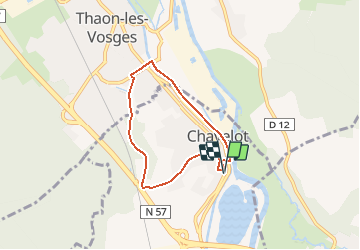
Tocht Mountainbike van 5,3 km beschikbaar op Grand Est, Vogezen, Chavelot. Deze tocht wordt voorgesteld door tracegps.
Beschrijving
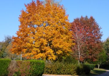
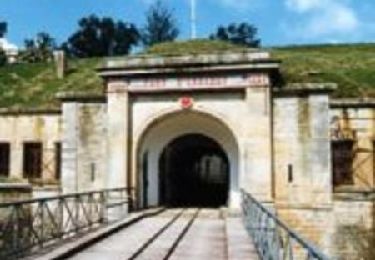
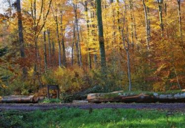
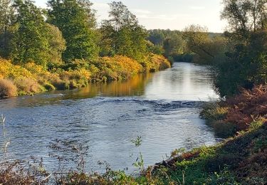
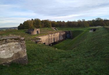
Espace VTT FFC Chemins du Cœur des Vosges - circuit n°83 - La Nivallée. Circuit officiel labellisé par la Fédération Française de Cyclisme. Petit parcours facile dans Chavelot.
Plaatsbepaling
Land:
France
Regio :
Grand Est
Departement/Provincie :
Vogezen
Gemeente :
Chavelot
Locatie:
Unknown
Vertrek:(Dec)
Vertrek:(UTM)
309810 ; 5345449 (32U) N.
Opmerkingen
Wandeltochten in de omgeving
![Tocht sport Épinal - Golbey - Photo](https://media.geolcdn.com/t/375/260/ext.jpg?maxdim=2&url=https%3A%2F%2Fsecurestorage.geolives.com%2Fsitytour%2Ftrail-bg%2Fdefault.jpg)
Golbey
sport
Heel gemakkelijk
(1)
Épinal,
Grand Est,
Vogezen,
France
![](/images/other/stat-length.png)
7,1 km | 7,8 km-effort
Onbekend
![](https://static1.geolcdn.com/siteimages/upload/files/16400158638029165_repeat_loop_refresh_sync_direction_icon.png)
Ja
![Tocht Stappen Capavenir-Vosges - Forêt Domevre - Photo](https://media.geolcdn.com/t/375/260/e54c4b23-692e-40c6-8220-ebc7918a39ed.jpg&format=jpg&maxdim=2)
![Stappen Stappen](https://static1.geolcdn.com/sitytour/trail-icons/101.png)
Forêt Domevre
Stappen
Medium
Capavenir-Vosges,
Grand Est,
Vogezen,
France
![](/images/other/stat-length.png)
7,2 km | 8,2 km-effort
1h 27min
![](https://static1.geolcdn.com/siteimages/upload/files/16400158638029165_repeat_loop_refresh_sync_direction_icon.png)
Ja
![Tocht Elektrische fiets Capavenir-Vosges - autour de Thaon - Photo](https://media.geolcdn.com/t/375/260/99330e46-7a7b-4e45-a19b-0f88fd22b536.jpg&format=jpg&maxdim=2)
![Elektrische fiets Elektrische fiets](https://static1.geolcdn.com/sitytour/trail-icons/205.png)
autour de Thaon
Elektrische fiets
Heel gemakkelijk
Capavenir-Vosges,
Grand Est,
Vogezen,
France
![](/images/other/stat-length.png)
53 km | 63 km-effort
2h 35min
![](https://static1.geolcdn.com/siteimages/upload/files/16400158638029165_repeat_loop_refresh_sync_direction_icon.png)
Neen
![Tocht Stappen Capavenir-Vosges - marche pop Thaon - Photo](https://media.geolcdn.com/t/375/260/a5d90113-a3c8-4b54-8274-dced14e2b420.jpg&format=jpg&maxdim=2)
![Stappen Stappen](https://static1.geolcdn.com/sitytour/trail-icons/101.png)
marche pop Thaon
Stappen
Medium
Capavenir-Vosges,
Grand Est,
Vogezen,
France
![](/images/other/stat-length.png)
21 km | 26 km-effort
3h 53min
![](https://static1.geolcdn.com/siteimages/upload/files/16400158638029165_repeat_loop_refresh_sync_direction_icon.png)
Ja
![Tocht Stappen Uxegney - Circuit d''Uxegney - Photo](https://media.geolcdn.com/t/375/260/ext.jpg?maxdim=2&url=https%3A%2F%2Fservices.sitytrail.com%2FGeolivesWS%2FDownloadMedia.ashx%3FTrailID%3D215267%26Media%3D15526_1.jpg)
![Stappen Stappen](https://static1.geolcdn.com/sitytour/trail-icons/101.png)
Circuit d''Uxegney
Stappen
Moeilijk
(1)
Uxegney,
Grand Est,
Vogezen,
France
![](/images/other/stat-length.png)
12,8 km | 15,1 km-effort
3h 30min
![](https://static1.geolcdn.com/siteimages/upload/files/16400158638029165_repeat_loop_refresh_sync_direction_icon.png)
Ja
![Tocht Stappen Domèvre-sur-Avière - Circuit de Domèvre sur Avière - Photo](https://media.geolcdn.com/t/375/260/ext.jpg?maxdim=2&url=https%3A%2F%2Fservices.sitytrail.com%2FGeolivesWS%2FDownloadMedia.ashx%3FTrailID%3D214905%26Media%3D15462_1.jpg)
![Stappen Stappen](https://static1.geolcdn.com/sitytour/trail-icons/101.png)
Circuit de Domèvre sur Avière
Stappen
Gemakkelijk
Domèvre-sur-Avière,
Grand Est,
Vogezen,
France
![](/images/other/stat-length.png)
8,2 km | 10,1 km-effort
1h 19min
![](https://static1.geolcdn.com/siteimages/upload/files/16400158638029165_repeat_loop_refresh_sync_direction_icon.png)
Ja
![Tocht Mountainbike Chavelot - Espace VTT FFC Chemins du Pays d'Epinal, Coeur des Vosges - circuit n°84 - La Grande Haie - Photo](https://media.geolcdn.com/t/375/260/ext.jpg?maxdim=2&url=https%3A%2F%2Fservices.sitytrail.com%2FGeolivesWS%2FDownloadMedia.ashx%3FTrailID%3D105943%26Media%3D9985_2.jpg)
![Mountainbike Mountainbike](https://static1.geolcdn.com/sitytour/trail-icons/202.png)
Espace VTT FFC Chemins du Pays d'Epinal, Coeur des Vosges - circuit n°84 - La...
Mountainbike
Medium
Chavelot,
Grand Est,
Vogezen,
France
![](/images/other/stat-length.png)
14,2 km | 16 km-effort
1h 10min
![](https://static1.geolcdn.com/siteimages/upload/files/16400158638029165_repeat_loop_refresh_sync_direction_icon.png)
Ja
![Tocht Stappen Capavenir-Vosges - thaon0 - Photo](https://media.geolcdn.com/t/375/260/cec3205f-c62c-4fc1-b2a1-15356ccf23a0.jpg&format=jpg&maxdim=2)
![Stappen Stappen](https://static1.geolcdn.com/sitytour/trail-icons/101.png)
thaon0
Stappen
Medium
Capavenir-Vosges,
Grand Est,
Vogezen,
France
![](/images/other/stat-length.png)
19,3 km | 21 km-effort
3h 46min
![](https://static1.geolcdn.com/siteimages/upload/files/16400158638029165_repeat_loop_refresh_sync_direction_icon.png)
Ja
![Tocht Stappen Uxegney - rando des forts - Photo](https://media.geolcdn.com/t/375/260/28622f95-692a-477b-b218-b6492ebef1a4.jpg&format=jpg&maxdim=2)
![Stappen Stappen](https://static1.geolcdn.com/sitytour/trail-icons/101.png)
rando des forts
Stappen
Medium
Uxegney,
Grand Est,
Vogezen,
France
![](/images/other/stat-length.png)
15,4 km | 18 km-effort
3h 21min
![](https://static1.geolcdn.com/siteimages/upload/files/16400158638029165_repeat_loop_refresh_sync_direction_icon.png)
Ja