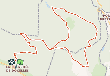
![](/images/other/stat-length.png)
![Tocht Mountainbike Épinal - Espace VTT FFC Chemins du Coeur des Vosges - circuit n°81 - La Roche Goutteuse - Photo](https://media.geolcdn.com/t/1900/400/ext.pjpeg?maxdim=2&url=https%3A%2F%2Fservices.sitytrail.com%2FGeolivesWS%2FDownloadMedia.ashx%3FTrailID%3D104405%26Media%3D7639_1.jpg)
Espace VTT FFC Chemins du Coeur des Vosges - circuit n°81 - La Roche Goutteuse
tracegps
Gebruiker
![Lengte](/images/other/stat-length.png)
Lengte
18,1 km
![Max. hoogte](https://static1.geolcdn.com/siteimages/upload/files/1508320355ic_sort_altitude_max_24dp.png)
Max. hoogte
441 m
![Positief hoogteverschil](https://static1.geolcdn.com/siteimages/upload/files/1508320355ic_sort_den_pos_24dp.png)
Positief hoogteverschil
328 m
![Km-Effort](/images/other/stat-length.png)
Km-Effort
22 km
![Min. hoogte](https://static1.geolcdn.com/siteimages/upload/files/1508320355ic_sort_altitude_min_24dp.png)
Min. hoogte
358 m
![Negatief hoogteverschil](https://static1.geolcdn.com/siteimages/upload/files/1508320355ic_sort_den_neg_24dp.png)
Negatief hoogteverschil
328 m
![Boucle](https://static1.geolcdn.com/siteimages/upload/files/16400158638029165_repeat_loop_refresh_sync_direction_icon.png)
Boucle
Ja
Datum van aanmaak :
2014-12-10 00:00:00.0
Laatste wijziging :
2014-12-10 00:00:00.0
![Mountainbike](https://static1.geolcdn.com/sitytour/trail-icons/202.png)
1h00
Moeilijkheid : Moeilijk
![Scan deze QR-code om de tocht te openen in de SityTrail-applicatie](https://capi.geolives.com/qq0zvz2zws4bq2lad0pu/sitytour/trails/104405/qr.png?size=200)
Gratisgps-wandelapplicatie
Over ons
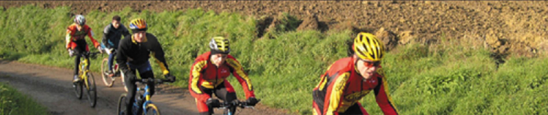
Tocht Mountainbike van 18,1 km beschikbaar op Grand Est, Vogezen, Épinal. Deze tocht wordt voorgesteld door tracegps.
Beschrijving
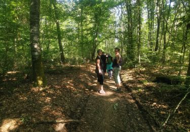
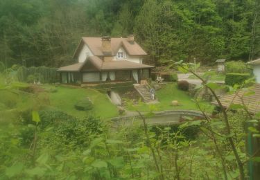
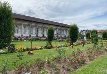
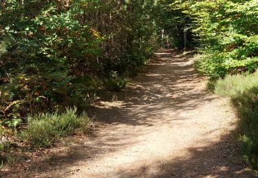
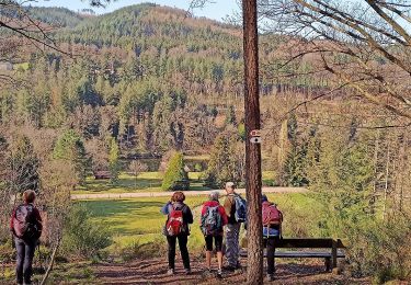
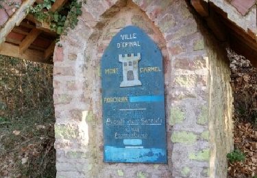
Espace VTT FFC Chemins du Cœur des Vosges - circuit n°81 - La Roche Goutteuse. Circuit officiel labellisé par la Fédération Française de Cyclisme. Balade difficile en forêt d’Épinal et le long du ruisseau de St Oger.
Plaatsbepaling
Land:
France
Regio :
Grand Est
Departement/Provincie :
Vogezen
Gemeente :
Épinal
Locatie:
Unknown
Vertrek:(Dec)
Vertrek:(UTM)
316493 ; 5337872 (32U) N.
Opmerkingen
Wandeltochten in de omgeving
![Tocht Stappen Épinal - Epinal - Photo](https://media.geolcdn.com/t/375/260/940302e4-e305-4d1c-a286-7e159c6cde8b.jpg&format=jpg&maxdim=2)
![Stappen Stappen](https://static1.geolcdn.com/sitytour/trail-icons/101.png)
![Tocht Stappen Deyvillers - Forêt de Deyvillers - Photo](https://media.geolcdn.com/t/375/260/c04fcb3e-d40c-4aef-88ca-341ec8442b95.jpg&format=jpg&maxdim=2)
![Stappen Stappen](https://static1.geolcdn.com/sitytour/trail-icons/101.png)
Forêt de Deyvillers
Stappen
Gemakkelijk
Deyvillers,
Grand Est,
Vogezen,
France
![](/images/other/stat-length.png)
8,9 km | 10,8 km-effort
2h 0min
![](https://static1.geolcdn.com/siteimages/upload/files/16400158638029165_repeat_loop_refresh_sync_direction_icon.png)
Ja
![Tocht Te voet Deyvillers - Circuit de la Feinge Orientale - Photo](https://media.geolcdn.com/t/375/260/44aeb232-afe9-4797-85eb-b9aec0811640.jpeg&format=jpg&maxdim=2)
![Te voet Te voet](https://static1.geolcdn.com/sitytour/trail-icons/100.png)
Circuit de la Feinge Orientale
Te voet
Gemakkelijk
Deyvillers,
Grand Est,
Vogezen,
France
![](/images/other/stat-length.png)
8,3 km | 10,3 km-effort
2h 20min
![](https://static1.geolcdn.com/siteimages/upload/files/16400158638029165_repeat_loop_refresh_sync_direction_icon.png)
Ja
![Tocht Te voet Deyvillers - Circuit des Tuileries - Photo](https://media.geolcdn.com/t/375/260/39efacd1-6bf7-4a5b-8f14-d8b8f00d4e82.jpeg&format=jpg&maxdim=2)
![Te voet Te voet](https://static1.geolcdn.com/sitytour/trail-icons/100.png)
Circuit des Tuileries
Te voet
Gemakkelijk
Deyvillers,
Grand Est,
Vogezen,
France
![](/images/other/stat-length.png)
15,1 km | 18,6 km-effort
4h 13min
![](https://static1.geolcdn.com/siteimages/upload/files/16400158638029165_repeat_loop_refresh_sync_direction_icon.png)
Neen
![Tocht Te voet Épinal - uzefaing 2 la grenouille - Photo](https://media.geolcdn.com/t/375/260/bbcf75ae-233b-421b-ab5d-c893e05cb26f.jpg&format=jpg&maxdim=2)
![Te voet Te voet](https://static1.geolcdn.com/sitytour/trail-icons/100.png)
uzefaing 2 la grenouille
Te voet
Medium
Épinal,
Grand Est,
Vogezen,
France
![](/images/other/stat-length.png)
18,1 km | 23 km-effort
5h 17min
![](https://static1.geolcdn.com/siteimages/upload/files/16400158638029165_repeat_loop_refresh_sync_direction_icon.png)
Ja
![Tocht Stappen Épinal - ste Barbe - Photo](https://media.geolcdn.com/t/375/260/ext.jpg?maxdim=2&url=https%3A%2F%2Fservices.sitytrail.com%2FGeolivesWS%2FDownloadMedia.ashx%3FTrailID%3D1071507%26Media%3Dfix__20181114151145.jpg)
![Stappen Stappen](https://static1.geolcdn.com/sitytour/trail-icons/101.png)
ste Barbe
Stappen
Heel gemakkelijk
Épinal,
Grand Est,
Vogezen,
France
![](/images/other/stat-length.png)
6,7 km | 9 km-effort
1h 55min
![](https://static1.geolcdn.com/siteimages/upload/files/16400158638029165_repeat_loop_refresh_sync_direction_icon.png)
Ja
![Tocht Stappen Épinal - 2016 03 22 - Photo](https://media.geolcdn.com/t/375/260/ext.jpg?maxdim=2&url=https%3A%2F%2Fservices.sitytrail.com%2FGeolivesWS%2FDownloadMedia.ashx%3FTrailID%3D542217%26Media%3Dfix__20160322163522.jpg)
![Stappen Stappen](https://static1.geolcdn.com/sitytour/trail-icons/101.png)
2016 03 22
Stappen
Gemakkelijk
Épinal,
Grand Est,
Vogezen,
France
![](/images/other/stat-length.png)
8,9 km | 12,4 km-effort
3h 8min
![](https://static1.geolcdn.com/siteimages/upload/files/16400158638029165_repeat_loop_refresh_sync_direction_icon.png)
Ja
![Tocht Stappen Deyvillers - devillers - Photo](https://media.geolcdn.com/t/375/260/f968a109-8d40-4322-84bf-e0c58e98ad63.jpg&format=jpg&maxdim=2)
![Stappen Stappen](https://static1.geolcdn.com/sitytour/trail-icons/101.png)
![Tocht Stappen Épinal - fontaine - Photo](https://media.geolcdn.com/t/375/260/5b7ced82-38b5-421b-8042-64ce4768483c.jpg&format=jpg&maxdim=2)
![Stappen Stappen](https://static1.geolcdn.com/sitytour/trail-icons/101.png)