![](/images/other/stat-length.png)
![Tocht Mountainbike Ducey-les-Chéris - Au fil de la Sélune - Photo](https://media.geolcdn.com/t/1900/400/ext.pjpeg?maxdim=2&url=https%3A%2F%2Fstatic1.geolcdn.com%2Fsiteimages%2Fupload%2Ffiles%2F1524743154velo.jpg)
Au fil de la Sélune
tracegps
Gebruiker
![Lengte](/images/other/stat-length.png)
Lengte
8,6 km
![Max. hoogte](https://static1.geolcdn.com/siteimages/upload/files/1508320355ic_sort_altitude_max_24dp.png)
Max. hoogte
34 m
![Positief hoogteverschil](https://static1.geolcdn.com/siteimages/upload/files/1508320355ic_sort_den_pos_24dp.png)
Positief hoogteverschil
68 m
![Km-Effort](/images/other/stat-length.png)
Km-Effort
9,5 km
![Min. hoogte](https://static1.geolcdn.com/siteimages/upload/files/1508320355ic_sort_altitude_min_24dp.png)
Min. hoogte
7 m
![Negatief hoogteverschil](https://static1.geolcdn.com/siteimages/upload/files/1508320355ic_sort_den_neg_24dp.png)
Negatief hoogteverschil
68 m
![Boucle](https://static1.geolcdn.com/siteimages/upload/files/16400158638029165_repeat_loop_refresh_sync_direction_icon.png)
Boucle
Ja
Datum van aanmaak :
2014-12-10 00:00:00.0
Laatste wijziging :
2014-12-10 00:00:00.0
![Mountainbike](https://static1.geolcdn.com/sitytour/trail-icons/202.png)
42m
Moeilijkheid : Gemakkelijk
![Scan deze QR-code om de tocht te openen in de SityTrail-applicatie](https://capi.geolives.com/qq0zvz2zws4bq2lad0pu/sitytour/trails/104371/qr.png?size=200)
Gratisgps-wandelapplicatie
Over ons
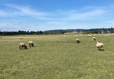
Tocht Mountainbike van 8,6 km beschikbaar op Normandië, Manche, Ducey-les-Chéris. Deze tocht wordt voorgesteld door tracegps.
Beschrijving
Belle balade en bord de la Sélune. Passage par le Bois d'Ardennes avec de très beaux endroits pour pique-niquer. à voir : Moulin de Quincampoix, ancienne Abbaye de Montmorel0 Retour sur Ducey par la route moins attrayant.
Plaatsbepaling
Land:
France
Regio :
Normandië
Departement/Provincie :
Manche
Gemeente :
Ducey-les-Chéris
Locatie:
Unknown
Vertrek:(Dec)
Vertrek:(UTM)
625575 ; 5386486 (30U) N.
Opmerkingen
Wandeltochten in de omgeving
![Tocht Stappen Ducey-les-Chéris - Au fil de la Sélune - Photo](https://media.geolcdn.com/t/375/260/ext.jpg?maxdim=2&url=https%3A%2F%2Fstatic1.geolcdn.com%2Fsiteimages%2Fupload%2Ffiles%2F1553511878bg_sport_marche.png)
![Stappen Stappen](https://static1.geolcdn.com/sitytour/trail-icons/101.png)
Au fil de la Sélune
Stappen
Medium
(1)
Ducey-les-Chéris,
Normandië,
Manche,
France
![](/images/other/stat-length.png)
8,6 km | 9,5 km-effort
2h 0min
![](https://static1.geolcdn.com/siteimages/upload/files/16400158638029165_repeat_loop_refresh_sync_direction_icon.png)
Ja
![Tocht Stappen Pontaubault - Pontaubault - Roche de Thorin - Photo](https://media.geolcdn.com/t/375/260/f89cf9fe-f318-4ff8-8764-f344122f3801.jpg&format=jpg&maxdim=2)
![Stappen Stappen](https://static1.geolcdn.com/sitytour/trail-icons/101.png)
Pontaubault - Roche de Thorin
Stappen
Medium
Pontaubault,
Normandië,
Manche,
France
![](/images/other/stat-length.png)
12,6 km | 13,8 km-effort
3h 38min
![](https://static1.geolcdn.com/siteimages/upload/files/16400158638029165_repeat_loop_refresh_sync_direction_icon.png)
Ja
![Tocht Fietstoerisme Pontaubault - Pontaucault - Mont-Saint-Michel - Photo](https://media.geolcdn.com/t/375/260/ext.jpg?maxdim=2&url=https%3A%2F%2Fstatic1.geolcdn.com%2Fsiteimages%2Fupload%2Ffiles%2F1524743154velo.jpg)
![Fietstoerisme Fietstoerisme](https://static1.geolcdn.com/sitytour/trail-icons/204.png)
Pontaucault - Mont-Saint-Michel
Fietstoerisme
Zeer moeilijk
Pontaubault,
Normandië,
Manche,
France
![](/images/other/stat-length.png)
39 km | 42 km-effort
4h 14min
![](https://static1.geolcdn.com/siteimages/upload/files/16400158638029165_repeat_loop_refresh_sync_direction_icon.png)
Ja
![Tocht Fietstoerisme Ducey-les-Chéris - Véloscénie Ducey Mont St Michel - Photo](https://media.geolcdn.com/t/375/260/ext.jpg?maxdim=2&url=https%3A%2F%2Fstatic1.geolcdn.com%2Fsiteimages%2Fupload%2Ffiles%2F1524743154velo.jpg)
![Fietstoerisme Fietstoerisme](https://static1.geolcdn.com/sitytour/trail-icons/204.png)
Véloscénie Ducey Mont St Michel
Fietstoerisme
Heel gemakkelijk
Ducey-les-Chéris,
Normandië,
Manche,
France
![](/images/other/stat-length.png)
33 km | 36 km-effort
2h 51min
![](https://static1.geolcdn.com/siteimages/upload/files/16400158638029165_repeat_loop_refresh_sync_direction_icon.png)
Neen
![Tocht Mountainbike Ducey-les-Chéris - F.DuceyStMalo37H89.369.VTT0 - Photo](https://media.geolcdn.com/t/375/260/ext.jpg?maxdim=2&url=https%3A%2F%2Fstatic1.geolcdn.com%2Fsiteimages%2Fupload%2Ffiles%2F1524743154velo.jpg)
![Mountainbike Mountainbike](https://static1.geolcdn.com/sitytour/trail-icons/202.png)
F.DuceyStMalo37H89.369.VTT0
Mountainbike
Medium
Ducey-les-Chéris,
Normandië,
Manche,
France
![](/images/other/stat-length.png)
89 km | 96 km-effort
6h 25min
![](https://static1.geolcdn.com/siteimages/upload/files/16400158638029165_repeat_loop_refresh_sync_direction_icon.png)
Neen
![Tocht Stappen Poilley - Courtils - Photo](https://media.geolcdn.com/t/375/260/ext.jpg?maxdim=2&url=https%3A%2F%2Fstatic1.geolcdn.com%2Fsiteimages%2Fupload%2Ffiles%2F1553511878bg_sport_marche.png)
![Stappen Stappen](https://static1.geolcdn.com/sitytour/trail-icons/101.png)
Courtils
Stappen
Heel gemakkelijk
Poilley,
Normandië,
Manche,
France
![](/images/other/stat-length.png)
14,9 km | 15,9 km-effort
3h 46min
![](https://static1.geolcdn.com/siteimages/upload/files/16400158638029165_repeat_loop_refresh_sync_direction_icon.png)
Neen
![Tocht Stappen Ducey-les-Chéris - Ducey - Photo](https://media.geolcdn.com/t/375/260/ext.jpg?maxdim=2&url=https%3A%2F%2Fstatic1.geolcdn.com%2Fsiteimages%2Fupload%2Ffiles%2F1553511878bg_sport_marche.png)
![Stappen Stappen](https://static1.geolcdn.com/sitytour/trail-icons/101.png)
Ducey
Stappen
Gemakkelijk
(1)
Ducey-les-Chéris,
Normandië,
Manche,
France
![](/images/other/stat-length.png)
11,5 km | 12,6 km-effort
2h 47min
![](https://static1.geolcdn.com/siteimages/upload/files/16400158638029165_repeat_loop_refresh_sync_direction_icon.png)
Ja
![Tocht Lopen Saint-Laurent-de-Terregatte - Autour de la Roche qui Boit - Photo](https://media.geolcdn.com/t/375/260/ext.jpg?maxdim=2&url=https%3A%2F%2Fstatic1.geolcdn.com%2Fsiteimages%2Fupload%2Ffiles%2F1524743154running.jpg)
![Lopen Lopen](https://static1.geolcdn.com/sitytour/trail-icons/103.png)
Autour de la Roche qui Boit
Lopen
Zeer moeilijk
Saint-Laurent-de-Terregatte,
Normandië,
Manche,
France
![](/images/other/stat-length.png)
12,4 km | 16,7 km-effort
1h 30min
![](https://static1.geolcdn.com/siteimages/upload/files/16400158638029165_repeat_loop_refresh_sync_direction_icon.png)
Ja
![Tocht Stappen Saint-Laurent-de-Terregatte - Autour de la Roche qui Boit - Photo](https://media.geolcdn.com/t/375/260/ext.jpg?maxdim=2&url=https%3A%2F%2Fstatic1.geolcdn.com%2Fsiteimages%2Fupload%2Ffiles%2F1553511878bg_sport_marche.png)
![Stappen Stappen](https://static1.geolcdn.com/sitytour/trail-icons/101.png)
Autour de la Roche qui Boit
Stappen
Zeer moeilijk
Saint-Laurent-de-Terregatte,
Normandië,
Manche,
France
![](/images/other/stat-length.png)
12,4 km | 16,7 km-effort
3h 30min
![](https://static1.geolcdn.com/siteimages/upload/files/16400158638029165_repeat_loop_refresh_sync_direction_icon.png)
Ja