![](/images/other/stat-length.png)
![Tocht Stappen Bavincourt - Le sentier de la longue Borne - Bavincourt - Photo](https://media.geolcdn.com/t/1900/400/ext.pjpeg?maxdim=2&url=https%3A%2F%2Fservices.sitytrail.com%2FGeolivesWS%2FDownloadMedia.ashx%3FTrailID%3D104255%26Media%3D7450_1.jpg)
Le sentier de la longue Borne - Bavincourt
tracegps
Gebruiker
![Lengte](/images/other/stat-length.png)
Lengte
9,8 km
![Max. hoogte](https://static1.geolcdn.com/siteimages/upload/files/1508320355ic_sort_altitude_max_24dp.png)
Max. hoogte
158 m
![Positief hoogteverschil](https://static1.geolcdn.com/siteimages/upload/files/1508320355ic_sort_den_pos_24dp.png)
Positief hoogteverschil
84 m
![Km-Effort](/images/other/stat-length.png)
Km-Effort
10,9 km
![Min. hoogte](https://static1.geolcdn.com/siteimages/upload/files/1508320355ic_sort_altitude_min_24dp.png)
Min. hoogte
112 m
![Negatief hoogteverschil](https://static1.geolcdn.com/siteimages/upload/files/1508320355ic_sort_den_neg_24dp.png)
Negatief hoogteverschil
83 m
![Boucle](https://static1.geolcdn.com/siteimages/upload/files/16400158638029165_repeat_loop_refresh_sync_direction_icon.png)
Boucle
Ja
Datum van aanmaak :
2014-12-10 00:00:00.0
Laatste wijziging :
2014-12-10 00:00:00.0
![Stappen](https://static1.geolcdn.com/sitytour/trail-icons/101.png)
2h30
Moeilijkheid : Medium
![Scan deze QR-code om de tocht te openen in de SityTrail-applicatie](https://capi.geolives.com/qq0zvz2zws4bq2lad0pu/sitytour/trails/104255/qr.png?size=200)
Gratisgps-wandelapplicatie
Over ons
Tocht Stappen van 9,8 km beschikbaar op Hauts-de-France, Pas-de-Calais, Bavincourt. Deze tocht wordt voorgesteld door tracegps.
Beschrijving
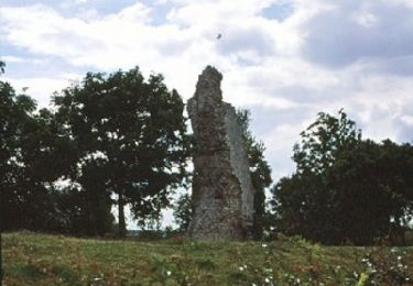
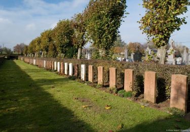
Circuit proposé par la Communauté de Communes des Vertes Vallées. Départ de l’église de Bavincourt. Retrouvez le circuit sur le site de la Communauté de Communes.
Plaatsbepaling
Land:
France
Regio :
Hauts-de-France
Departement/Provincie :
Pas-de-Calais
Gemeente :
Bavincourt
Locatie:
Unknown
Vertrek:(Dec)
Vertrek:(UTM)
469281 ; 5563920 (31U) N.
Opmerkingen
Wandeltochten in de omgeving
![Tocht Mountainbike Fosseux - Lucheux - Photo](https://media.geolcdn.com/t/375/260/ext.jpg?maxdim=2&url=https%3A%2F%2Fstatic1.geolcdn.com%2Fsiteimages%2Fupload%2Ffiles%2F1524743154velo.jpg)
![Mountainbike Mountainbike](https://static1.geolcdn.com/sitytour/trail-icons/202.png)
Lucheux
Mountainbike
Medium
(2)
Fosseux,
Hauts-de-France,
Pas-de-Calais,
France
![](/images/other/stat-length.png)
44 km | 50 km-effort
3h 0min
![](https://static1.geolcdn.com/siteimages/upload/files/16400158638029165_repeat_loop_refresh_sync_direction_icon.png)
Ja
![Tocht Stappen Berles-au-Bois - Berles Au Bois - La Cauchie - Bailleulmont - Bailleulval - Photo](https://media.geolcdn.com/t/375/260/ext.jpg?maxdim=2&url=https%3A%2F%2Fservices.sitytrail.com%2FGeolivesWS%2FDownloadMedia.ashx%3FTrailID%3D104671%26Media%3D8072_1.jpg)
![Stappen Stappen](https://static1.geolcdn.com/sitytour/trail-icons/101.png)
Berles Au Bois - La Cauchie - Bailleulmont - Bailleulval
Stappen
Medium
Berles-au-Bois,
Hauts-de-France,
Pas-de-Calais,
France
![](/images/other/stat-length.png)
9,6 km | 11,1 km-effort
2h 0min
![](https://static1.geolcdn.com/siteimages/upload/files/16400158638029165_repeat_loop_refresh_sync_direction_icon.png)
Ja
![Tocht Stappen Gouy-en-Artois - Le sentier des loups - Gouy en Artois - Photo](https://media.geolcdn.com/t/375/260/ext.jpg?maxdim=2&url=https%3A%2F%2Fservices.sitytrail.com%2FGeolivesWS%2FDownloadMedia.ashx%3FTrailID%3D104254%26Media%3D7449_2.jpg)
![Stappen Stappen](https://static1.geolcdn.com/sitytour/trail-icons/101.png)
Le sentier des loups - Gouy en Artois
Stappen
Moeilijk
Gouy-en-Artois,
Hauts-de-France,
Pas-de-Calais,
France
![](/images/other/stat-length.png)
14,2 km | 15,9 km-effort
3h 34min
![](https://static1.geolcdn.com/siteimages/upload/files/16400158638029165_repeat_loop_refresh_sync_direction_icon.png)
Ja
![Tocht Stappen Fosseux - Fosseux - Photo](https://media.geolcdn.com/t/375/260/ext.jpg?maxdim=2&url=https%3A%2F%2Fstatic1.geolcdn.com%2Fsiteimages%2Fupload%2Ffiles%2F1553511878bg_sport_marche.png)
![Stappen Stappen](https://static1.geolcdn.com/sitytour/trail-icons/101.png)
Fosseux
Stappen
Heel gemakkelijk
Fosseux,
Hauts-de-France,
Pas-de-Calais,
France
![](/images/other/stat-length.png)
23 km | 26 km-effort
5h 39min
![](https://static1.geolcdn.com/siteimages/upload/files/16400158638029165_repeat_loop_refresh_sync_direction_icon.png)
Ja