![](/images/other/stat-length.png)
![Tocht Mountainbike Bidart - Bidart Ascain - Photo](https://media.geolcdn.com/t/1900/400/ext.pjpeg?maxdim=2&url=https%3A%2F%2Fservices.sitytrail.com%2FGeolivesWS%2FDownloadMedia.ashx%3FTrailID%3D103645%26Media%3D6075_3.jpg)
Bidart Ascain
tracegps
Gebruiker
![Lengte](/images/other/stat-length.png)
Lengte
38 km
![Max. hoogte](https://static1.geolcdn.com/siteimages/upload/files/1508320355ic_sort_altitude_max_24dp.png)
Max. hoogte
138 m
![Positief hoogteverschil](https://static1.geolcdn.com/siteimages/upload/files/1508320355ic_sort_den_pos_24dp.png)
Positief hoogteverschil
671 m
![Km-Effort](/images/other/stat-length.png)
Km-Effort
47 km
![Min. hoogte](https://static1.geolcdn.com/siteimages/upload/files/1508320355ic_sort_altitude_min_24dp.png)
Min. hoogte
1 m
![Negatief hoogteverschil](https://static1.geolcdn.com/siteimages/upload/files/1508320355ic_sort_den_neg_24dp.png)
Negatief hoogteverschil
662 m
![Boucle](https://static1.geolcdn.com/siteimages/upload/files/16400158638029165_repeat_loop_refresh_sync_direction_icon.png)
Boucle
Ja
Datum van aanmaak :
2014-12-10 00:00:00.0
Laatste wijziging :
2014-12-10 00:00:00.0
![Mountainbike](https://static1.geolcdn.com/sitytour/trail-icons/202.png)
3h30
Moeilijkheid : Moeilijk
![Scan deze QR-code om de tocht te openen in de SityTrail-applicatie](https://capi.geolives.com/qq0zvz2zws4bq2lad0pu/sitytour/trails/103645/qr.png?size=200)
Gratisgps-wandelapplicatie
Over ons
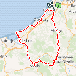
Tocht Mountainbike van 38 km beschikbaar op Nieuw-Aquitanië, Pyrénées-Atlantiques, Bidart. Deze tocht wordt voorgesteld door tracegps.
Beschrijving
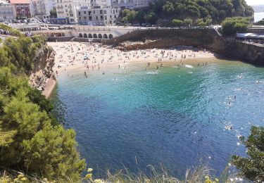
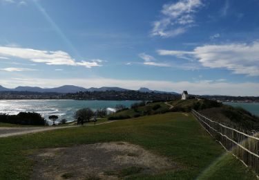
Balade vtt en Pays Basque. Bidart direction ahetze D655, Ibarron D855, Aroztegia suivre fléchage jaune sur sentier difficile (forte montée au départ), Aztarritzea, Ascain, Saint-Jean de Luz, Guéthary, Bidart. Bonne balade Michel
Plaatsbepaling
Land:
France
Regio :
Nieuw-Aquitanië
Departement/Provincie :
Pyrénées-Atlantiques
Gemeente :
Bidart
Locatie:
Unknown
Vertrek:(Dec)
Vertrek:(UTM)
615288 ; 4810228 (30T) N.
Opmerkingen
Wandeltochten in de omgeving
![Tocht Stappen Biarritz - Sentier du Littoral - De Bidart à St Jean de Luz - Photo](https://media.geolcdn.com/t/375/260/ext.jpg?maxdim=2&url=https%3A%2F%2Fservices.sitytrail.com%2FGeolivesWS%2FDownloadMedia.ashx%3FTrailID%3D109248%26Media%3D3350_3.jpg)
![Stappen Stappen](https://static1.geolcdn.com/sitytour/trail-icons/101.png)
Sentier du Littoral - De Bidart à St Jean de Luz
Stappen
Medium
(4)
Biarritz,
Nieuw-Aquitanië,
Pyrénées-Atlantiques,
France
![](/images/other/stat-length.png)
19 km | 24 km-effort
3h 30min
![](https://static1.geolcdn.com/siteimages/upload/files/16400158638029165_repeat_loop_refresh_sync_direction_icon.png)
Neen
![Tocht Stappen Bidart - Bidart -saint jean de Luz - Photo](https://media.geolcdn.com/t/375/260/59034fde-2620-4403-8359-52383f4a85b5.jpg&format=jpg&maxdim=2)
![Stappen Stappen](https://static1.geolcdn.com/sitytour/trail-icons/101.png)
Bidart -saint jean de Luz
Stappen
Heel gemakkelijk
Bidart,
Nieuw-Aquitanië,
Pyrénées-Atlantiques,
France
![](/images/other/stat-length.png)
9,1 km | 11,6 km-effort
2h 56min
![](https://static1.geolcdn.com/siteimages/upload/files/16400158638029165_repeat_loop_refresh_sync_direction_icon.png)
Ja
![Tocht Te voet Bidart - Voie Verte de l'Uhabia - Photo](https://media.geolcdn.com/t/375/260/789f3e81-aa4b-47c3-8d2c-4ffad9febd7a.jpeg&format=jpg&maxdim=2)
![Te voet Te voet](https://static1.geolcdn.com/sitytour/trail-icons/100.png)
Voie Verte de l'Uhabia
Te voet
Gemakkelijk
Bidart,
Nieuw-Aquitanië,
Pyrénées-Atlantiques,
France
![](/images/other/stat-length.png)
5,8 km | 6,9 km-effort
1h 34min
![](https://static1.geolcdn.com/siteimages/upload/files/16400158638029165_repeat_loop_refresh_sync_direction_icon.png)
Neen
![Tocht Stappen Biarritz - Biarritz la côte , le rocher de la vierge, le port - Photo](https://media.geolcdn.com/t/375/260/5dffcc0a-b3bd-48c3-aee4-20a60099537e.jpg&format=jpg&maxdim=2)
![Stappen Stappen](https://static1.geolcdn.com/sitytour/trail-icons/101.png)
Biarritz la côte , le rocher de la vierge, le port
Stappen
Gemakkelijk
Biarritz,
Nieuw-Aquitanië,
Pyrénées-Atlantiques,
France
![](/images/other/stat-length.png)
4,7 km | 6,4 km-effort
2h 16min
![](https://static1.geolcdn.com/siteimages/upload/files/16400158638029165_repeat_loop_refresh_sync_direction_icon.png)
Ja
![Tocht Stappen Bidart - Bidard St Jean de Luz par sentier côtier - Photo](https://media.geolcdn.com/t/375/260/14973de2-f099-4fda-8150-cd9c44165a9d.jpg&format=jpg&maxdim=2)
![Stappen Stappen](https://static1.geolcdn.com/sitytour/trail-icons/101.png)
Bidard St Jean de Luz par sentier côtier
Stappen
Gemakkelijk
Bidart,
Nieuw-Aquitanië,
Pyrénées-Atlantiques,
France
![](/images/other/stat-length.png)
18,7 km | 24 km-effort
5h 54min
![](https://static1.geolcdn.com/siteimages/upload/files/16400158638029165_repeat_loop_refresh_sync_direction_icon.png)
Ja
![Tocht Stappen Bidart - Bidart St Jean De Luz par le sentier de la côte - Photo](https://media.geolcdn.com/t/375/260/ext.jpg?maxdim=2&url=https%3A%2F%2Fservices.sitytrail.com%2FGeolivesWS%2FDownloadMedia.ashx%3FTrailID%3D274278%26Media%3D20120730154546.jpeg)
![Stappen Stappen](https://static1.geolcdn.com/sitytour/trail-icons/101.png)
Bidart St Jean De Luz par le sentier de la côte
Stappen
Gemakkelijk
(1)
Bidart,
Nieuw-Aquitanië,
Pyrénées-Atlantiques,
France
![](/images/other/stat-length.png)
15 km | 18,6 km-effort
3h 57min
![](https://static1.geolcdn.com/siteimages/upload/files/16400158638029165_repeat_loop_refresh_sync_direction_icon.png)
Neen
![Tocht Mountainbike Bidart - 05 - Bidart Ascain - Photo](https://media.geolcdn.com/t/375/260/ext.jpg?maxdim=2&url=https%3A%2F%2Fservices.sitytrail.com%2FGeolivesWS%2FDownloadMedia.ashx%3FTrailID%3D213296%26Media%3D6bb1549a-e52f-40f6-8671-3a0a4f192bce.jpg)
![Mountainbike Mountainbike](https://static1.geolcdn.com/sitytour/trail-icons/202.png)
05 - Bidart Ascain
Mountainbike
Moeilijk
Bidart,
Nieuw-Aquitanië,
Pyrénées-Atlantiques,
France
![](/images/other/stat-length.png)
38 km | 47 km-effort
3h 30min
![](https://static1.geolcdn.com/siteimages/upload/files/16400158638029165_repeat_loop_refresh_sync_direction_icon.png)
Ja
![Tocht Stappen Saint-Jean-de-Luz - Chibau Berria a Bidart - Photo](https://media.geolcdn.com/t/375/260/3d7c1e67-41cf-41fe-9123-72edf3c939f7.jpg&format=jpg&maxdim=2)
![Stappen Stappen](https://static1.geolcdn.com/sitytour/trail-icons/101.png)
Chibau Berria a Bidart
Stappen
Gemakkelijk
Saint-Jean-de-Luz,
Nieuw-Aquitanië,
Pyrénées-Atlantiques,
France
![](/images/other/stat-length.png)
10,3 km | 13,4 km-effort
2h 58min
![](https://static1.geolcdn.com/siteimages/upload/files/16400158638029165_repeat_loop_refresh_sync_direction_icon.png)
Neen
![Tocht Stappen Bidart - Littoran Bidart - Saint Jean de luz - Photo](https://media.geolcdn.com/t/375/260/3d8e4864-3ece-49f6-b603-f1e57c6ae9a6.jpg&format=jpg&maxdim=2)
![Stappen Stappen](https://static1.geolcdn.com/sitytour/trail-icons/101.png)
Littoran Bidart - Saint Jean de luz
Stappen
Bidart,
Nieuw-Aquitanië,
Pyrénées-Atlantiques,
France
![](/images/other/stat-length.png)
13,1 km | 16,8 km-effort
5h 31min
![](https://static1.geolcdn.com/siteimages/upload/files/16400158638029165_repeat_loop_refresh_sync_direction_icon.png)
Neen
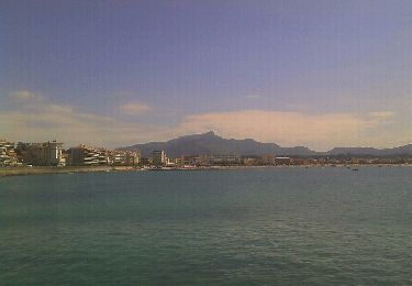
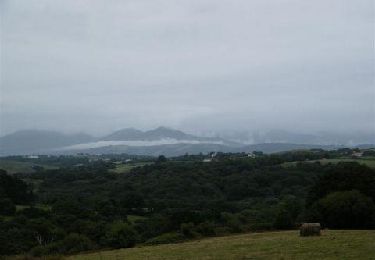
bcp de route et peu de vtt. mais beaux paysages