

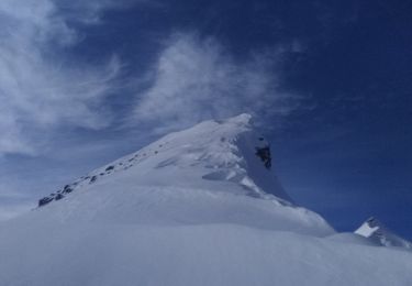
pic du Tourond depuis le col de la Vénasque

stavroguine
Gebruiker

Lengte
2,1 km

Max. hoogte
2709 m

Positief hoogteverschil
219 m

Km-Effort
5,1 km

Min. hoogte
2467 m

Negatief hoogteverschil
230 m
Boucle
Ja
Datum van aanmaak :
2019-01-15 15:55:26.787
Laatste wijziging :
2019-01-15 15:55:26.787
1h32
Moeilijkheid : Moeilijk

Gratisgps-wandelapplicatie
Over ons
Tocht Stappen van 2,1 km beschikbaar op Provence-Alpes-Côte d'Azur, Hautes-Alpes, Champoléon. Deze tocht wordt voorgesteld door stavroguine.
Beschrijving
Montée depuis le col de la Vénasque. Prendre juste en dessous du col côté Champoléon à gauche après les éboulis rejoindre l'arrêté au niveau d'un col (on voit un enclos) suivre l'arrête jusqu'au sommet.
Plaatsbepaling
Land:
France
Regio :
Provence-Alpes-Côte d'Azur
Departement/Provincie :
Hautes-Alpes
Gemeente :
Champoléon
Locatie:
Unknown
Vertrek:(Dec)
Vertrek:(UTM)
277492 ; 4954543 (32T) N.
Opmerkingen
Wandeltochten in de omgeving
Circuit de Costebelle


Stappen
Heel gemakkelijk
(2)
Saint-Jean-Saint-Nicolas,
Provence-Alpes-Côte d'Azur,
Hautes-Alpes,
France

7,4 km | 12,1 km-effort
2h 16min
Ja
Le Palastre


Stappen
Medium
Saint-Jean-Saint-Nicolas,
Provence-Alpes-Côte d'Azur,
Hautes-Alpes,
France

9,1 km | 17,9 km-effort
4h 4min
Ja
Col de l'Escalier


Stappen
Moeilijk
Saint-Michel-de-Chaillol,
Provence-Alpes-Côte d'Azur,
Hautes-Alpes,
France

16 km | 27 km-effort
6h 13min
Ja
Pic Queyrel


Stappen
Moeilijk
Saint-Michel-de-Chaillol,
Provence-Alpes-Côte d'Azur,
Hautes-Alpes,
France

10,4 km | 19,8 km-effort
4h 29min
Ja
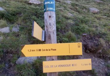
Pic du Tourond


Stappen
Zeer moeilijk
Saint-Michel-de-Chaillol,
Provence-Alpes-Côte d'Azur,
Hautes-Alpes,
France

13,7 km | 27 km-effort
6h 14min
Ja
Lac de Malcros


Stappen
Zeer moeilijk
Saint-Michel-de-Chaillol,
Provence-Alpes-Côte d'Azur,
Hautes-Alpes,
France

18,7 km | 34 km-effort
7h 43min
Ja
Soleil boeuf


Ski randonnée
Gemakkelijk
Saint-Jean-Saint-Nicolas,
Provence-Alpes-Côte d'Azur,
Hautes-Alpes,
France

10,9 km | 24 km-effort
4h 0min
Ja
Soleil boeuf et petite remontée à Prouveyrat


Ski randonnée
Medium
Saint-Jean-Saint-Nicolas,
Provence-Alpes-Côte d'Azur,
Hautes-Alpes,
France

12,2 km | 26 km-effort
5h 1min
Ja
Le Palastre . Pic clos Lamiante


Ski randonnée
Gemakkelijk
Saint-Jean-Saint-Nicolas,
Provence-Alpes-Côte d'Azur,
Hautes-Alpes,
France

10,4 km | 25 km-effort
5h 5min
Ja


 SityTrail


