![](/images/other/stat-length.png)
![Tocht Mountainbike Gravigny - Vallée de l'iton - Plateau du Neubourg - Photo](https://media.geolcdn.com/t/1900/400/ext.pjpeg?maxdim=2&url=https%3A%2F%2Fstatic1.geolcdn.com%2Fsiteimages%2Fupload%2Ffiles%2F1524743154velo.jpg)
Vallée de l'iton - Plateau du Neubourg
tracegps
Gebruiker
![Lengte](/images/other/stat-length.png)
Lengte
53 km
![Max. hoogte](https://static1.geolcdn.com/siteimages/upload/files/1508320355ic_sort_altitude_max_24dp.png)
Max. hoogte
156 m
![Positief hoogteverschil](https://static1.geolcdn.com/siteimages/upload/files/1508320355ic_sort_den_pos_24dp.png)
Positief hoogteverschil
706 m
![Km-Effort](/images/other/stat-length.png)
Km-Effort
62 km
![Min. hoogte](https://static1.geolcdn.com/siteimages/upload/files/1508320355ic_sort_altitude_min_24dp.png)
Min. hoogte
35 m
![Negatief hoogteverschil](https://static1.geolcdn.com/siteimages/upload/files/1508320355ic_sort_den_neg_24dp.png)
Negatief hoogteverschil
707 m
![Boucle](https://static1.geolcdn.com/siteimages/upload/files/16400158638029165_repeat_loop_refresh_sync_direction_icon.png)
Boucle
Ja
Datum van aanmaak :
2014-12-10 00:00:00.0
Laatste wijziging :
2014-12-10 00:00:00.0
![Mountainbike](https://static1.geolcdn.com/sitytour/trail-icons/202.png)
3h00
Moeilijkheid : Moeilijk
![Scan deze QR-code om de tocht te openen in de SityTrail-applicatie](https://capi.geolives.com/qq0zvz2zws4bq2lad0pu/sitytour/trails/103526/qr.png?size=200)
Gratisgps-wandelapplicatie
Over ons
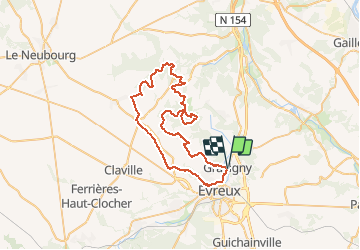
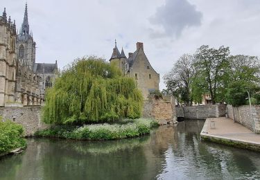
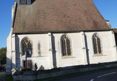
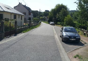
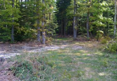
Tocht Mountainbike van 53 km beschikbaar op Normandië, Eure, Gravigny. Deze tocht wordt voorgesteld door tracegps.
Beschrijving
Magnifique parcours. * Roulant * Technique dans les montées comme pour les descentes. * relief très varié. Pour ce parcours, j'ai en partie utilisé un vieux fichier "Randonnée sacquenville".
Plaatsbepaling
Land:
France
Regio :
Normandië
Departement/Provincie :
Eure
Gemeente :
Gravigny
Locatie:
Unknown
Vertrek:(Dec)
Vertrek:(UTM)
365732 ; 5434317 (31U) N.
Opmerkingen
Wandeltochten in de omgeving
![Tocht Stappen Huest - les trois etangs - Photo](https://media.geolcdn.com/t/375/260/ext.jpg?maxdim=2&url=https%3A%2F%2Fstatic1.geolcdn.com%2Fsiteimages%2Fupload%2Ffiles%2F1553511878bg_sport_marche.png)
![Stappen Stappen](https://static1.geolcdn.com/sitytour/trail-icons/101.png)
les trois etangs
Stappen
Zeer moeilijk
(1)
Huest,
Normandië,
Eure,
France
![](/images/other/stat-length.png)
25 km | 28 km-effort
6h 25min
![](https://static1.geolcdn.com/siteimages/upload/files/16400158638029165_repeat_loop_refresh_sync_direction_icon.png)
Ja
![Tocht Stappen Évreux - Évreux PR1 - Photo](https://media.geolcdn.com/t/375/260/264dffb8-1158-4c64-8faa-da99acb4f66e.jpg&format=jpg&maxdim=2)
![Stappen Stappen](https://static1.geolcdn.com/sitytour/trail-icons/101.png)
![Te voet Te voet](https://static1.geolcdn.com/sitytour/trail-icons/100.png)
normanville
Te voet
Heel gemakkelijk
Normanville,
Normandië,
Eure,
France
![](/images/other/stat-length.png)
9,1 km | 10,9 km-effort
Onbekend
![](https://static1.geolcdn.com/siteimages/upload/files/16400158638029165_repeat_loop_refresh_sync_direction_icon.png)
Ja
![Tocht Stappen Tourneville - autrebocs - Photo](https://media.geolcdn.com/t/375/260/ext.jpg?maxdim=2&url=https%3A%2F%2Fstatic1.geolcdn.com%2Fsiteimages%2Fupload%2Ffiles%2F1553511878bg_sport_marche.png)
![Stappen Stappen](https://static1.geolcdn.com/sitytour/trail-icons/101.png)
autrebocs
Stappen
Heel gemakkelijk
(1)
Tourneville,
Normandië,
Eure,
France
![](/images/other/stat-length.png)
11,7 km | 14,7 km-effort
3h 26min
![](https://static1.geolcdn.com/siteimages/upload/files/16400158638029165_repeat_loop_refresh_sync_direction_icon.png)
Neen
![Tocht Stappen Gravigny - La Maladrerie (Gravigny) - Photo](https://media.geolcdn.com/t/375/260/ext.jpg?maxdim=2&url=https%3A%2F%2Fservices.sitytrail.com%2FGeolivesWS%2FDownloadMedia.ashx%3FTrailID%3D325516%26Media%3Dbb305735-0b2f-4c22-a378-39236568607d.jpg)
![Stappen Stappen](https://static1.geolcdn.com/sitytour/trail-icons/101.png)
La Maladrerie (Gravigny)
Stappen
Gemakkelijk
Gravigny,
Normandië,
Eure,
France
![](/images/other/stat-length.png)
5,5 km | 6,5 km-effort
1h 30min
![](https://static1.geolcdn.com/siteimages/upload/files/16400158638029165_repeat_loop_refresh_sync_direction_icon.png)
Ja
![Tocht Stappen Sacquenville - Autrebosc Brosville - Photo](https://media.geolcdn.com/t/375/260/ext.jpg?maxdim=2&url=https%3A%2F%2Fstatic1.geolcdn.com%2Fsiteimages%2Fupload%2Ffiles%2F1553511878bg_sport_marche.png)
![Stappen Stappen](https://static1.geolcdn.com/sitytour/trail-icons/101.png)
Autrebosc Brosville
Stappen
Heel gemakkelijk
(1)
Sacquenville,
Normandië,
Eure,
France
![](/images/other/stat-length.png)
9,1 km | 11,4 km-effort
1h 30min
![](https://static1.geolcdn.com/siteimages/upload/files/16400158638029165_repeat_loop_refresh_sync_direction_icon.png)
Neen
![Tocht Stappen Normanville - Circuit de Normanville - Photo](https://media.geolcdn.com/t/375/260/ext.jpg?maxdim=2&url=https%3A%2F%2Fstatic1.geolcdn.com%2Fsiteimages%2Fupload%2Ffiles%2F1553511878bg_sport_marche.png)
![Stappen Stappen](https://static1.geolcdn.com/sitytour/trail-icons/101.png)
Circuit de Normanville
Stappen
Medium
(4)
Normanville,
Normandië,
Eure,
France
![](/images/other/stat-length.png)
13 km | 16,5 km-effort
4h 26min
![](https://static1.geolcdn.com/siteimages/upload/files/16400158638029165_repeat_loop_refresh_sync_direction_icon.png)
Ja
![Tocht Mountainbike Gravigny - Balade dans la vallée d'iton - Photo](https://media.geolcdn.com/t/375/260/ext.jpg?maxdim=2&url=https%3A%2F%2Fservices.sitytrail.com%2FGeolivesWS%2FDownloadMedia.ashx%3FTrailID%3D105043%26Media%3D8613_5.jpg)
![Mountainbike Mountainbike](https://static1.geolcdn.com/sitytour/trail-icons/202.png)
Balade dans la vallée d'iton
Mountainbike
Zeer moeilijk
Gravigny,
Normandië,
Eure,
France
![](/images/other/stat-length.png)
63 km | 80 km-effort
3h 15min
![](https://static1.geolcdn.com/siteimages/upload/files/16400158638029165_repeat_loop_refresh_sync_direction_icon.png)
Ja
![Tocht Mountainbike Gravigny - Chemins et collines entre les deux vallées - Gravigny - Photo](https://media.geolcdn.com/t/375/260/ext.jpg?maxdim=2&url=https%3A%2F%2Fservices.sitytrail.com%2FGeolivesWS%2FDownloadMedia.ashx%3FTrailID%3D103553%26Media%3D5800_4.jpg)
![Mountainbike Mountainbike](https://static1.geolcdn.com/sitytour/trail-icons/202.png)
Chemins et collines entre les deux vallées - Gravigny
Mountainbike
Moeilijk
Gravigny,
Normandië,
Eure,
France
![](/images/other/stat-length.png)
49 km | 58 km-effort
2h 40min
![](https://static1.geolcdn.com/siteimages/upload/files/16400158638029165_repeat_loop_refresh_sync_direction_icon.png)
Ja