![](/images/other/stat-length.png)
![Tocht Mountainbike Soyans - Grand tour de Soyans - Photo](https://media.geolcdn.com/t/1900/400/ext.pjpeg?maxdim=2&url=https%3A%2F%2Fservices.sitytrail.com%2FGeolivesWS%2FDownloadMedia.ashx%3FTrailID%3D103168%26Media%3D4988_4.jpg)
Grand tour de Soyans
tracegps
Gebruiker
![Lengte](/images/other/stat-length.png)
![Max. hoogte](https://static1.geolcdn.com/siteimages/upload/files/1508320355ic_sort_altitude_max_24dp.png)
![Positief hoogteverschil](https://static1.geolcdn.com/siteimages/upload/files/1508320355ic_sort_den_pos_24dp.png)
![Km-Effort](/images/other/stat-length.png)
![Min. hoogte](https://static1.geolcdn.com/siteimages/upload/files/1508320355ic_sort_altitude_min_24dp.png)
![Negatief hoogteverschil](https://static1.geolcdn.com/siteimages/upload/files/1508320355ic_sort_den_neg_24dp.png)
![Boucle](https://static1.geolcdn.com/siteimages/upload/files/16400158638029165_repeat_loop_refresh_sync_direction_icon.png)
![Mountainbike](https://static1.geolcdn.com/sitytour/trail-icons/202.png)
2h30
Moeilijkheid : Moeilijk
![Scan deze QR-code om de tocht te openen in de SityTrail-applicatie](https://capi.geolives.com/qq0zvz2zws4bq2lad0pu/sitytour/trails/103168/qr.png?size=200)
Gratisgps-wandelapplicatie
Over ons
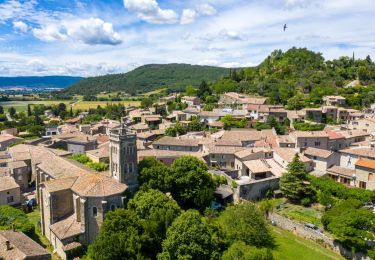
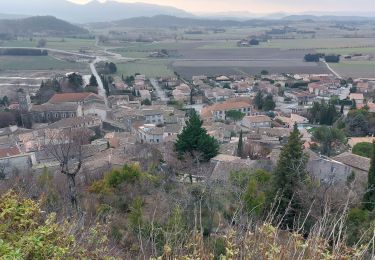
Tocht Mountainbike van 17,8 km beschikbaar op Auvergne-Rhône-Alpes, Drôme, Soyans. Deze tocht wordt voorgesteld door tracegps.
Beschrijving
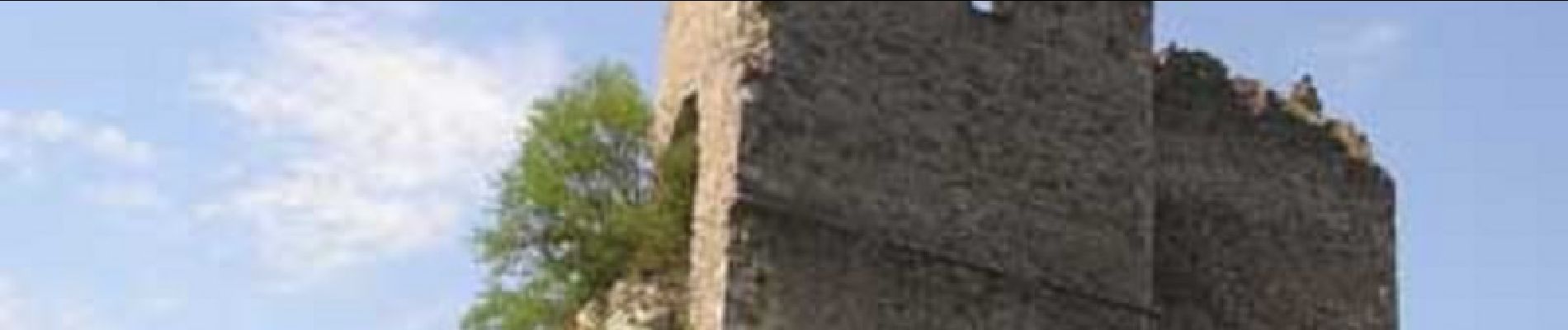
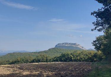
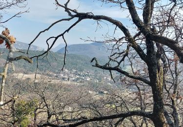
A la découverte des environs de Soyans avec toujours en ligne de mire les ruines du château médiéval du XIIème, contreforts du massif de Saoû, et la rivière Roubion qu'il faut traverser deux fois; à éviter en période de crue ! Beau parcours VTT ! C'est une rando casse-croûte, plus de détails au gîte du Pré bossu.
Plaatsbepaling
Opmerkingen
Wandeltochten in de omgeving
![Tocht Stappen Puy-Saint-Martin - 2022-09-27_14h04m59_10644793 - Photo](https://media.geolcdn.com/t/375/260/6480930c-30c1-44b7-a230-4fcbebdc50ce.jpg&format=jpg&maxdim=2)
![Stappen Stappen](https://static1.geolcdn.com/sitytour/trail-icons/101.png)
Stappen
![](/images/other/stat-length.png)
![](https://static1.geolcdn.com/siteimages/upload/files/16400158638029165_repeat_loop_refresh_sync_direction_icon.png)
![Tocht Stappen Pont-de-Barret - Pont-de-Barret 7km5 - Photo](https://media.geolcdn.com/t/375/260/bd4539ba-b505-451b-88b8-8a669ff8e607.jpg&format=jpg&maxdim=2)
![Stappen Stappen](https://static1.geolcdn.com/sitytour/trail-icons/101.png)
Stappen
![](/images/other/stat-length.png)
![](https://static1.geolcdn.com/siteimages/upload/files/16400158638029165_repeat_loop_refresh_sync_direction_icon.png)
![Tocht Stappen Puy-Saint-Martin - 2022-10-01_17h58m38_13274577 - Photo](https://media.geolcdn.com/t/375/260/248bb3c4-3f75-4f03-8f85-e68449b4e6e0.jpg&format=jpg&maxdim=2)
![Stappen Stappen](https://static1.geolcdn.com/sitytour/trail-icons/101.png)
Stappen
![](/images/other/stat-length.png)
![](https://static1.geolcdn.com/siteimages/upload/files/16400158638029165_repeat_loop_refresh_sync_direction_icon.png)
![Tocht Stappen Puy-Saint-Martin - Puy st Martin les Ours 8km - Photo](https://media.geolcdn.com/t/375/260/bf268e09-61bd-4eea-a081-31676e501b35.jpg&format=jpg&maxdim=2)
![Stappen Stappen](https://static1.geolcdn.com/sitytour/trail-icons/101.png)
Stappen
![](/images/other/stat-length.png)
![](https://static1.geolcdn.com/siteimages/upload/files/16400158638029165_repeat_loop_refresh_sync_direction_icon.png)
![Tocht Stappen Puy-Saint-Martin - Puy St Martin Chevriere-Saudon 16 km - Photo](https://media.geolcdn.com/t/375/260/69bb143d-562e-45de-9da3-14e8db74501d.jpg&format=jpg&maxdim=2)
![Stappen Stappen](https://static1.geolcdn.com/sitytour/trail-icons/101.png)
Stappen
![](/images/other/stat-length.png)
![](https://static1.geolcdn.com/siteimages/upload/files/16400158638029165_repeat_loop_refresh_sync_direction_icon.png)
![Tocht Stappen Soyans - Soyans- Rochecolombe 15 km - Photo](https://media.geolcdn.com/t/375/260/72e33805-cd1b-4df3-9acd-288f3ea7428d.jpg&format=jpg&maxdim=2)
![Stappen Stappen](https://static1.geolcdn.com/sitytour/trail-icons/101.png)
Stappen
![](/images/other/stat-length.png)
![](https://static1.geolcdn.com/siteimages/upload/files/16400158638029165_repeat_loop_refresh_sync_direction_icon.png)
![Tocht Stappen Saou - Saou Lestang 7 km. - Photo](https://media.geolcdn.com/t/375/260/d0ca71f6-795d-4c05-bf5c-fcab757b18ff.jpg&format=jpg&maxdim=2)
![Stappen Stappen](https://static1.geolcdn.com/sitytour/trail-icons/101.png)
Stappen
![](/images/other/stat-length.png)
![](https://static1.geolcdn.com/siteimages/upload/files/16400158638029165_repeat_loop_refresh_sync_direction_icon.png)
![Tocht Stappen Francillon-sur-Roubion - Balade à francillon sur roubion - description et photos - Photo](https://media.geolcdn.com/t/375/260/ext.jpg?maxdim=2&url=https%3A%2F%2Fservices.sitytrail.com%2FGeolivesWS%2FDownloadMedia.ashx%3FTrailID%3D656838%26Media%3Dfix__20161106144505.jpg)
![Stappen Stappen](https://static1.geolcdn.com/sitytour/trail-icons/101.png)
Stappen
![](/images/other/stat-length.png)
![](https://static1.geolcdn.com/siteimages/upload/files/16400158638029165_repeat_loop_refresh_sync_direction_icon.png)
![Tocht Stappen Saou - roche Colombe - Photo](https://media.geolcdn.com/t/375/260/ext.jpg?maxdim=2&url=https%3A%2F%2Fservices.sitytrail.com%2FGeolivesWS%2FDownloadMedia.ashx%3FTrailID%3D528694%26Media%3Dfix__20160221163100.jpg)
![Stappen Stappen](https://static1.geolcdn.com/sitytour/trail-icons/101.png)
Stappen
![](/images/other/stat-length.png)
![](https://static1.geolcdn.com/siteimages/upload/files/16400158638029165_repeat_loop_refresh_sync_direction_icon.png)