![](/images/other/stat-length.png)
![Tocht Stappen Loudenvielle - Les Gourgs Blancs - Photo](https://media.geolcdn.com/t/1900/400/ext.pjpeg?maxdim=2&url=https%3A%2F%2Fservices.sitytrail.com%2FGeolivesWS%2FDownloadMedia.ashx%3FTrailID%3D102944%26Media%3D4232_1.jpg)
Les Gourgs Blancs
tracegps
Gebruiker
![Lengte](/images/other/stat-length.png)
![Max. hoogte](https://static1.geolcdn.com/siteimages/upload/files/1508320355ic_sort_altitude_max_24dp.png)
![Positief hoogteverschil](https://static1.geolcdn.com/siteimages/upload/files/1508320355ic_sort_den_pos_24dp.png)
![Km-Effort](/images/other/stat-length.png)
![Min. hoogte](https://static1.geolcdn.com/siteimages/upload/files/1508320355ic_sort_altitude_min_24dp.png)
![Negatief hoogteverschil](https://static1.geolcdn.com/siteimages/upload/files/1508320355ic_sort_den_neg_24dp.png)
![Boucle](https://static1.geolcdn.com/siteimages/upload/files/16400158638029165_repeat_loop_refresh_sync_direction_icon.png)
![Stappen](https://static1.geolcdn.com/sitytour/trail-icons/101.png)
15h00
Moeilijkheid : Zeer moeilijk
![Scan deze QR-code om de tocht te openen in de SityTrail-applicatie](https://capi.geolives.com/qq0zvz2zws4bq2lad0pu/sitytour/trails/102944/qr.png?size=200)
Gratisgps-wandelapplicatie
Over ons
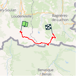
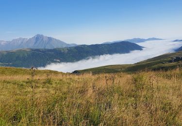
Tocht Stappen van 31 km beschikbaar op Occitanië, Hautes-Pyrénées, Loudenvielle. Deze tocht wordt voorgesteld door tracegps.
Beschrijving
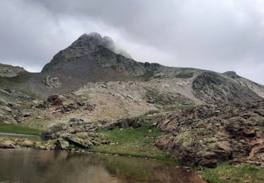
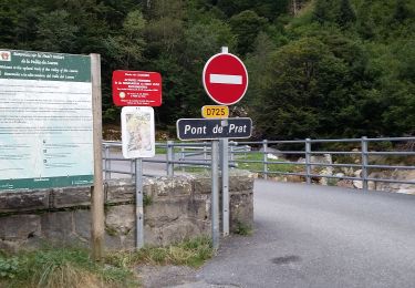
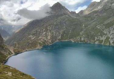
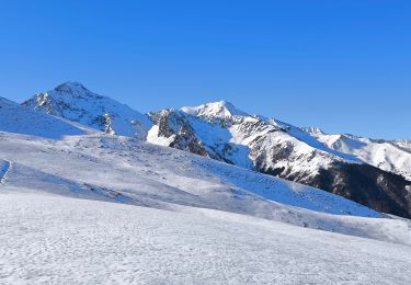
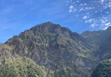
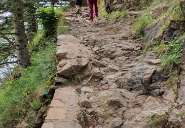
Les Gourgs Blancs Magnifique traversée de Pont du Prat, le lac de Caillauas, au pied des Gourgs Blancs, redescente vers le Lac du Portillon, son refuge. On peut couper la rando en y pasant la nuit. Puis remontée au col de Litérole pour redescendre et remonter au col des Crabioules et retour au pied du Maupas, son refuge et descente vers Luchon par la Vallée du Lys. Attention plusieurs passages délicats de haute montagne !
Plaatsbepaling
Opmerkingen
Wandeltochten in de omgeving
![Tocht Stappen Loudenvielle - Le refuge de la Soula - Photo](https://media.geolcdn.com/t/375/260/ext.jpg?maxdim=2&url=https%3A%2F%2Fservices.sitytrail.com%2FGeolivesWS%2FDownloadMedia.ashx%3FTrailID%3D343973%26Media%3Dfix__20140910123118.jpg)
![Stappen Stappen](https://static1.geolcdn.com/sitytour/trail-icons/101.png)
Stappen
![](/images/other/stat-length.png)
![](https://static1.geolcdn.com/siteimages/upload/files/16400158638029165_repeat_loop_refresh_sync_direction_icon.png)
![Tocht Stappen Azet - lacs des Miares depuis le col d'Azet - Photo](https://media.geolcdn.com/t/375/260/07c4b873-c4c9-49cc-a0ed-84c4945b022c.jpg&format=jpg&maxdim=2)
![Stappen Stappen](https://static1.geolcdn.com/sitytour/trail-icons/101.png)
Stappen
![](/images/other/stat-length.png)
![](https://static1.geolcdn.com/siteimages/upload/files/16400158638029165_repeat_loop_refresh_sync_direction_icon.png)
![Tocht Stappen Gouaux-de-Larboust - cap des Hittes & Pic Monségu depuis Gouaux de Larboust - Photo](https://media.geolcdn.com/t/375/260/19698674-5343-4ed7-a128-b1289b696bed.jpg&format=jpg&maxdim=2)
![Stappen Stappen](https://static1.geolcdn.com/sitytour/trail-icons/101.png)
Stappen
![](/images/other/stat-length.png)
![](https://static1.geolcdn.com/siteimages/upload/files/16400158638029165_repeat_loop_refresh_sync_direction_icon.png)
![Tocht Stappen Loudenvielle - pont de prat 20 lac Caillaouas par refuge de Soula - Photo](https://media.geolcdn.com/t/375/260/3ffa53ff-45ce-43f4-a349-48a3731ab3df.jpg&format=jpg&maxdim=2)
![Stappen Stappen](https://static1.geolcdn.com/sitytour/trail-icons/101.png)
Stappen
![](/images/other/stat-length.png)
![](https://static1.geolcdn.com/siteimages/upload/files/16400158638029165_repeat_loop_refresh_sync_direction_icon.png)
![Tocht Stappen Germ - Boucle Germ Astau Portillon Soula Germ - Photo](https://media.geolcdn.com/t/375/260/ext.jpg?maxdim=2&url=https%3A%2F%2Fservices.sitytrail.com%2FGeolivesWS%2FDownloadMedia.ashx%3FTrailID%3D332480%26Media%3Dfix__20140807143347.jpg)
![Stappen Stappen](https://static1.geolcdn.com/sitytour/trail-icons/101.png)
Stappen
![](/images/other/stat-length.png)
![](https://static1.geolcdn.com/siteimages/upload/files/16400158638029165_repeat_loop_refresh_sync_direction_icon.png)
![Tocht Sneeuwschoenen Germ - Pène de Magnéras - Peyragudes - Photo](https://media.geolcdn.com/t/375/260/1ceab0f9-185b-4a88-addc-237237ba7f9d.jpg&format=jpg&maxdim=2)
![Sneeuwschoenen Sneeuwschoenen](https://static1.geolcdn.com/sitytour/trail-icons/504.png)
Sneeuwschoenen
![](/images/other/stat-length.png)
![](https://static1.geolcdn.com/siteimages/upload/files/16400158638029165_repeat_loop_refresh_sync_direction_icon.png)
![Tocht Stappen Loudenvielle - Pont de Prat - Photo](https://media.geolcdn.com/t/375/260/37e45cc0-37c1-4ddb-89e7-9c0b365268ed.jpg&format=jpg&maxdim=2)
![Stappen Stappen](https://static1.geolcdn.com/sitytour/trail-icons/101.png)
Stappen
![](/images/other/stat-length.png)
![](https://static1.geolcdn.com/siteimages/upload/files/16400158638029165_repeat_loop_refresh_sync_direction_icon.png)
![Tocht Stappen Loudenvielle - La Clarabide et refuge de la soula - Photo](https://media.geolcdn.com/t/375/260/162505c0-cd78-4672-9751-51d705bf46b2.jpg&format=jpg&maxdim=2)
![Stappen Stappen](https://static1.geolcdn.com/sitytour/trail-icons/101.png)
Stappen
![](/images/other/stat-length.png)
![](https://static1.geolcdn.com/siteimages/upload/files/16400158638029165_repeat_loop_refresh_sync_direction_icon.png)
![Tocht Stappen Germ - etangs de Nere - Photo](https://media.geolcdn.com/t/375/260/3f1bd928-7a2c-42d0-a840-f69192ff15a5.jpg&format=jpg&maxdim=2)
![Stappen Stappen](https://static1.geolcdn.com/sitytour/trail-icons/101.png)
Stappen
![](/images/other/stat-length.png)
![](https://static1.geolcdn.com/siteimages/upload/files/16400158638029165_repeat_loop_refresh_sync_direction_icon.png)