![](/images/other/stat-length.png)
![Tocht Mountainbike Éclaron-Braucourt-Sainte-Livière - Espace VTT FFC Lac du Der en Champagne - Circuit n°08 - La Forêt du Der - Photo](https://media.geolcdn.com/t/1900/400/ext.pjpeg?maxdim=2&url=https%3A%2F%2Fservices.sitytrail.com%2FGeolivesWS%2FDownloadMedia.ashx%3FTrailID%3D102269%26Media%3D2730_1.jpg)
Espace VTT FFC Lac du Der en Champagne - Circuit n°08 - La Forêt du Der
tracegps
Gebruiker
![Lengte](/images/other/stat-length.png)
Lengte
19,5 km
![Max. hoogte](https://static1.geolcdn.com/siteimages/upload/files/1508320355ic_sort_altitude_max_24dp.png)
Max. hoogte
180 m
![Positief hoogteverschil](https://static1.geolcdn.com/siteimages/upload/files/1508320355ic_sort_den_pos_24dp.png)
Positief hoogteverschil
223 m
![Km-Effort](/images/other/stat-length.png)
Km-Effort
22 km
![Min. hoogte](https://static1.geolcdn.com/siteimages/upload/files/1508320355ic_sort_altitude_min_24dp.png)
Min. hoogte
139 m
![Negatief hoogteverschil](https://static1.geolcdn.com/siteimages/upload/files/1508320355ic_sort_den_neg_24dp.png)
Negatief hoogteverschil
223 m
![Boucle](https://static1.geolcdn.com/siteimages/upload/files/16400158638029165_repeat_loop_refresh_sync_direction_icon.png)
Boucle
Ja
Datum van aanmaak :
2014-12-10 00:00:00.0
Laatste wijziging :
2014-12-10 00:00:00.0
![Mountainbike](https://static1.geolcdn.com/sitytour/trail-icons/202.png)
1h30
Moeilijkheid : Medium
![Scan deze QR-code om de tocht te openen in de SityTrail-applicatie](https://capi.geolives.com/qq0zvz2zws4bq2lad0pu/sitytour/trails/102269/qr.png?size=200)
Gratisgps-wandelapplicatie
Over ons
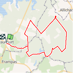
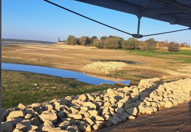
Tocht Mountainbike van 19,5 km beschikbaar op Grand Est, Haute-Marne, Éclaron-Braucourt-Sainte-Livière. Deze tocht wordt voorgesteld door tracegps.
Beschrijving
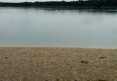
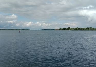
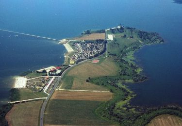
Espace VTT - FFC Lac du Der en Champagne Circuit officiel labellisé par la Fédération Française de Cyclisme. Idéal en VTT, ce circuit vous emmène dans la belle forêt du Der alternant grandes routes forestières et petits layons.
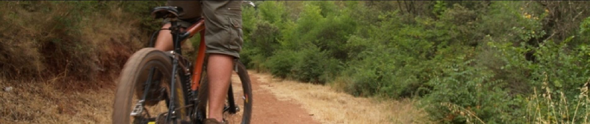
Plaatsbepaling
Land:
France
Regio :
Grand Est
Departement/Provincie :
Haute-Marne
Gemeente :
Éclaron-Braucourt-Sainte-Livière
Locatie:
Braucourt
Vertrek:(Dec)
Vertrek:(UTM)
634164 ; 5377249 (31U) N.
Opmerkingen
Wandeltochten in de omgeving
![Tocht Mountainbike Éclaron-Braucourt-Sainte-Livière - Tour du lac du Der - Photo](https://media.geolcdn.com/t/375/260/ext.jpg?maxdim=2&url=https%3A%2F%2Fstatic1.geolcdn.com%2Fsiteimages%2Fupload%2Ffiles%2F1524743154velo.jpg)
![Mountainbike Mountainbike](https://static1.geolcdn.com/sitytour/trail-icons/202.png)
Tour du lac du Der
Mountainbike
Medium
(1)
Éclaron-Braucourt-Sainte-Livière,
Grand Est,
Haute-Marne,
France
![](/images/other/stat-length.png)
36 km | 39 km-effort
2h 0min
![](https://static1.geolcdn.com/siteimages/upload/files/16400158638029165_repeat_loop_refresh_sync_direction_icon.png)
Ja
![Tocht Stappen Giffaumont-Champaubert - LAC dur DER ... la forêt, la terre et l'eau. - Photo](https://media.geolcdn.com/t/375/260/16ddca7d-e5a5-4726-a093-703886190c99.jpg&format=jpg&maxdim=2)
![Stappen Stappen](https://static1.geolcdn.com/sitytour/trail-icons/101.png)
LAC dur DER ... la forêt, la terre et l'eau.
Stappen
Heel gemakkelijk
Giffaumont-Champaubert,
Grand Est,
Marne,
France
![](/images/other/stat-length.png)
13,5 km | 14,9 km-effort
3h 32min
![](https://static1.geolcdn.com/siteimages/upload/files/16400158638029165_repeat_loop_refresh_sync_direction_icon.png)
Ja
![Tocht Mountainbike Éclaron-Braucourt-Sainte-Livière - Lac du DER - CHANTECOQ ... par St-Marie- Nuisement. - Photo](https://media.geolcdn.com/t/375/260/0f27a926-3a1d-4ecb-8e04-b7fa88246190.jpg&format=jpg&maxdim=2)
![Mountainbike Mountainbike](https://static1.geolcdn.com/sitytour/trail-icons/202.png)
Lac du DER - CHANTECOQ ... par St-Marie- Nuisement.
Mountainbike
Heel gemakkelijk
Éclaron-Braucourt-Sainte-Livière,
Grand Est,
Haute-Marne,
France
![](/images/other/stat-length.png)
37 km | 40 km-effort
3h 13min
![](https://static1.geolcdn.com/siteimages/upload/files/16400158638029165_repeat_loop_refresh_sync_direction_icon.png)
Ja
![Tocht Stappen Giffaumont-Champaubert - ghifaumont - Photo](https://media.geolcdn.com/t/375/260/2d20b284-5919-43bc-beca-9c34719666bc.jpg&format=jpg&maxdim=2)
![Stappen Stappen](https://static1.geolcdn.com/sitytour/trail-icons/101.png)
ghifaumont
Stappen
Heel gemakkelijk
Giffaumont-Champaubert,
Grand Est,
Marne,
France
![](/images/other/stat-length.png)
12,3 km | 13,8 km-effort
2h 48min
![](https://static1.geolcdn.com/siteimages/upload/files/16400158638029165_repeat_loop_refresh_sync_direction_icon.png)
Neen
![Tocht Stappen Giffaumont-Champaubert - Lac du Der 09-04-2014 - Photo](https://media.geolcdn.com/t/375/260/ext.jpg?maxdim=2&url=https%3A%2F%2Fstatic1.geolcdn.com%2Fsiteimages%2Fupload%2Ffiles%2F1553511878bg_sport_marche.png)
![Stappen Stappen](https://static1.geolcdn.com/sitytour/trail-icons/101.png)
Lac du Der 09-04-2014
Stappen
Heel gemakkelijk
(1)
Giffaumont-Champaubert,
Grand Est,
Marne,
France
![](/images/other/stat-length.png)
12,7 km | 14 km-effort
2h 59min
![](https://static1.geolcdn.com/siteimages/upload/files/16400158638029165_repeat_loop_refresh_sync_direction_icon.png)
Ja
![Tocht Stappen Giffaumont-Champaubert - lac du der - Photo](https://media.geolcdn.com/t/375/260/a2a32ad6-c50c-4066-848f-0c39f2554faa.jpg&format=jpg&maxdim=2)
![Stappen Stappen](https://static1.geolcdn.com/sitytour/trail-icons/101.png)
lac du der
Stappen
Gemakkelijk
Giffaumont-Champaubert,
Grand Est,
Marne,
France
![](/images/other/stat-length.png)
5 km | 5,5 km-effort
2h 7min
![](https://static1.geolcdn.com/siteimages/upload/files/16400158638029165_repeat_loop_refresh_sync_direction_icon.png)
Ja
![Tocht Stappen Éclaron-Braucourt-Sainte-Livière - Le Det - Photo](https://media.geolcdn.com/t/375/260/7940e994-1b3c-4570-948d-a615323b8e15.jpg&format=jpg&maxdim=2)
![Stappen Stappen](https://static1.geolcdn.com/sitytour/trail-icons/101.png)
Le Det
Stappen
Moeilijk
Éclaron-Braucourt-Sainte-Livière,
Grand Est,
Haute-Marne,
France
![](/images/other/stat-length.png)
12,4 km | 13,5 km-effort
2h 40min
![](https://static1.geolcdn.com/siteimages/upload/files/16400158638029165_repeat_loop_refresh_sync_direction_icon.png)
Ja
![Tocht Stappen Giffaumont-Champaubert - der - Photo](https://media.geolcdn.com/t/375/260/f606a1ab-40e5-4229-8eaa-6f24ec9a7d96.jpg&format=jpg&maxdim=2)
![Stappen Stappen](https://static1.geolcdn.com/sitytour/trail-icons/101.png)
der
Stappen
Gemakkelijk
Giffaumont-Champaubert,
Grand Est,
Marne,
France
![](/images/other/stat-length.png)
3,6 km | 4 km-effort
1h 26min
![](https://static1.geolcdn.com/siteimages/upload/files/16400158638029165_repeat_loop_refresh_sync_direction_icon.png)
Ja
![Tocht Mountainbike Giffaumont-Champaubert - Espace VTT FFC Lac du Der en Champagne - Circuit n°01 - Entre Dame et Chevalier - Photo](https://media.geolcdn.com/t/375/260/ext.jpg?maxdim=2&url=https%3A%2F%2Fservices.sitytrail.com%2FGeolivesWS%2FDownloadMedia.ashx%3FTrailID%3D102260%26Media%3D2721_1.jpg)
![Mountainbike Mountainbike](https://static1.geolcdn.com/sitytour/trail-icons/202.png)
Espace VTT FFC Lac du Der en Champagne - Circuit n°01 - Entre Dame et Chevalier
Mountainbike
Medium
Giffaumont-Champaubert,
Grand Est,
Marne,
France
![](/images/other/stat-length.png)
11,2 km | 12,3 km-effort
1h 0min
![](https://static1.geolcdn.com/siteimages/upload/files/16400158638029165_repeat_loop_refresh_sync_direction_icon.png)
Ja