


13,9 km | 19,1 km-effort

Gebruiker


Gratisgps-wandelapplicatie
 SityTrail
IGN / Geografische instituten
SityTrail World
De wereld gaat voor u open
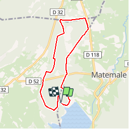
Tocht Mountainbike van 7,5 km beschikbaar op Occitanië, Pyrénées-Orientales, Matemale. Deze tocht wordt voorgesteld door tracegps.
Espace VTT - FFC Capcir – Haut Confluent Circuit officiel labellisé par la Fédération Française de Cyclisme. Un cadre magnifique, un parcours facile, un terrain varié, vous découvrirez une superbe forêt de pins sylvestres, hauts quelquefois d’une trentaine de mètres, qui recouvrent le plateau de Formiguères jusqu’au bord du Lac de Matemale. Lieu privilégié pour la pratique du VTT en famille, cet itinéraire devrait régaler les débutants comme les adeptes. Vous rencontrerez des piétons et des cavaliers, rappelez-vous qu’ils sont prioritaires.


Sneeuwschoenen

Stappen

Stappen

Stappen

Stappen

Sneeuwschoenen
Stappen


sport
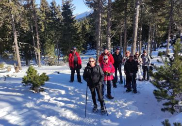
Sneeuwschoenen